UgCS
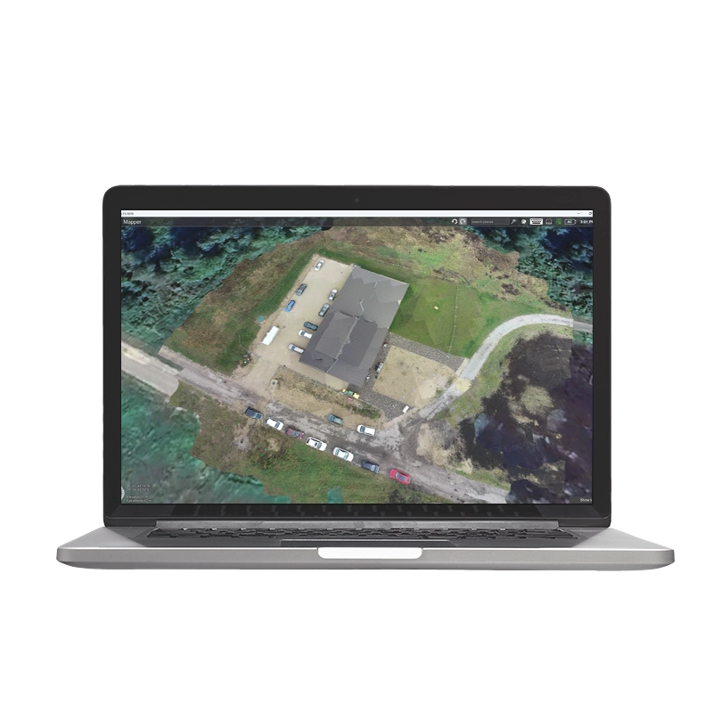
UgCS è un software avanzato per pianificazione e controllo di missioni con droni. Supporta fotogrammetria, LiDAR e scansioni aeree, ottimizzando operazioni professionali. Compatibile con vari payload, offre un’interfaccia intuitiva per missioni automatizzate.
Da 890,00 € IVA inclusa
Disponibilità Limitata - Spedito in 24-48 ore
UgCS
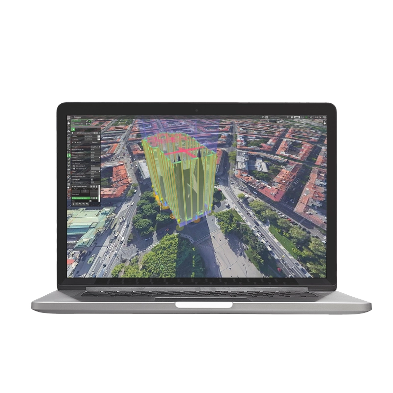
Un software tutto in uno per la pianificazione di volo automatica con funzioni avanzate per ogni campo di applicazione e compatibile con la maggior parte di drone e sensori sul mercato. Il software UgCS consente di pianificare le missioni di volo automatiche tramite un’ interfaccia grafica completa di funzioni per scansioni aeree di fotogrammetria e Lidar.
La licenza UgCS PRO è progettata per piloti di droni professionisti e fornitori di servizi. Presenta tutte le funzionalità principali di UgCS elencate di seguito ad eccezione degli strumenti di pianificazione del volo LiDAR (disponibili in UgCS EXPERT) e streaming video e distribuzione multi-nodo (disponibile in UgCS ENTERPRISE).
Scopri perché UgCS è la scelta migliore per i piloti professionisti di droni in tutto il mondo.
Choose the UgCS license that best suits your types of flights and tasks |  |  |  |
Route creation from KML / CSV files | |||
Exporting routes in KML | |||
Terrain following | |||
Customisable map | |||
Corridor inspections | |||
Vertical flight planning | |||
Go Offline | |||
Smart AGL | |||
LiDAR tool | |||
Live video streaming | |||
Up to 10 simultaneous drone connections | |||
Share your missions with the team | |||
UgCS SDK |
Droni Supportati
Supporta le piattaforme UAV più popolari tra cui DJI M300/350, M600, M2X0, Inspire, serie Phantom, serie Mavic; Droni compatibili con MAVLink (Pixhawk con ArduPilot/PX4).
Licenza Perpetua UgCS
Acquista una volta, possiedi per sempre Il primo anno di supporto e aggiornamenti è incluso. A partire dal secondo anno, è necessario acquistare un pacchetto annuale di assistenza e aggiornamenti per accedere all’assistenza e agli aggiornamenti più recenti.
System Requirements
| OS | Windows | macOS |
|---|---|---|
| Operating system | Windows 10; Windows 11* 64-bit | macOS: 10.13 High Sierra or later* 64 bit |
| CPU | Core 2 Duo or Athlon X2 at 2.4 GHz | Core 2 Duo or Athlon X2 at 2.4 GHz |
| Memory | Recommended: 8 GB of RAM | Recommended: 8 GB of RAM |
| Hard drive | 2 GB of free space | 2 GB of free space |
| Graphics hardware | Graphics card with DirectX 11 support (shader model 4.0). Any card made since 2004 should work | Graphics card with DirectX 11 support (shader model 4.0). Any card made since 2004 should work |
| Network | TCP/IPv4 network stack | TCP/IPv4 network stack |
| Screen resolution | Minimum supported screen resolution: 1920×1080 | Minimum supported screen resolution: 1920×1080 |
Fino al 40% di Sgravi Fiscali
L’obiettivo di Industria 4.0 e 5.0 è quello di incentivare le aziende italiane che investono in beni strumentali per migliorare, attraverso la digitalizzazione, i propri processi produttivi.
Questo si traduce in vantaggi Fiscali da una parte e Produttivi dall’altra soprattutto per:
• Startup
• Liberi professionisti
• PMI
• Pubblica Amministrazione
• Forze dell’Ordine
Noleggia il tuo drone da 150€/Mese
Paga in comode rate
• Zero anticipi, facile e rapido da richiedere
• Assicurazione casco All-Risk su drone ed accessori
• Piccole e comode rate da 24 a 60 mesi
• Costi più bassi di un finanziamento o leasing
• Bene subito disponibile
• 100% deducibile dalle tasse rata per rata
• Possibilità di riscatto finale del bene
• Possibilità di risoluzione anticipata del contratto
*Disponibile solo per titolari di partita iva con almeno 18mesi di attività
Chiamaci Ora
per una consulenza gratuita su Droni,Payload, Software ed ENAC.
Prenota Ora
la tua consulenza telefonica gratuita con i nostri Esperti.
| Licenza | Pro, Expert, Enterprise |
|---|---|
| Brands |
Fino al 40% di Sgravi Fiscali
L’obiettivo di Industria 4.0 e 5.0 è quello di incentivare le aziende italiane che investono in beni strumentali per migliorare, attraverso la digitalizzazione, i propri processi produttivi.
Questo si traduce in vantaggi Fiscali da una parte e Produttivi dall’altra soprattutto per:
• Startup
• Liberi professionisti
• PMI
• Pubblica Amministrazione
• Forze dell’Ordine
Noleggia il tuo drone da 150€/Mese
Paga in comode rate
• Zero anticipi, facile e rapido da richiedere
• Assicurazione casco All-Risk su drone ed accessori
• Piccole e comode rate da 24 a 60 mesi
• Costi più bassi di un finanziamento o leasing
• Bene subito disponibile
• 100% deducibile dalle tasse rata per rata
• Possibilità di riscatto finale del bene
• Possibilità di risoluzione anticipata del contratto
*Disponibile solo per titolari di partita iva con almeno 18mesi di attività
Chiamaci Ora
per una consulenza gratuita su Droni,Payload, Software ed ENAC.
Prenota Ora
la tua consulenza telefonica gratuita con i nostri Esperti.


There are no reviews yet.