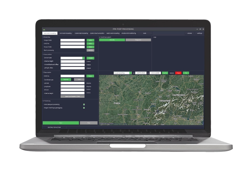
TOPODRONE LiDAR Post Processing License
Il TOPODRONE LiDAR Post-Processing License è un software per elaborazione dati LiDAR, ideale per trasformare nuvole di punti in modelli 3D dettagliati. Con strumenti per filtrazione e georeferenziazione, supporta applicazioni in topografia e ingegneria civile con risultati precisi.
Da 1.800,00 € IVA inclusa
Pre Ordine - Spedito in 6-8 giorni lavorativi
TOPODRONE Post Processing is the most powerful & affordable post processing software at the market.
It was designed for advanced GNSS data post processing, image geo-tagging and LIDAR points cloud generation, supports full range of TOPODRONE PPK & LIDAR systems, DJI Phantom 4RTK, DJI P1, AUTEL EVO II PRO RTK as well as any kind of coordinate systems and GEOIDs.


Software includes the following modules:
- PPK for GNSS data postprocessing & images geotagging for TOPODRONE PPK equipment
- RTK post processing & images geotagging for DJI Phantom 4 RTK drones, Autel Evo II Pro RTK, DJI Zenmuse P1 camera
- LIDAR Post Processing to calculate precise trajectory of LIDAR equipment based on GNSS and IMU data
- LIDAR Point Cloud Generation to create high precision georeferenced point cloud captured by VELODYNE PUCK, ULTRA PUCK, HDL 32, LIVOX AVIA sensors
- Static PP – for Static post processing, calculates precise coordinates of the point using base station Rinex file by one vector, and performs mutual alignment of wireframe network.
- PPP – Precise Point Positioning to calculate point coordinates in ITRF2014 or any coordinate system.
- GNSS data archive allows to download static rinex data from base stations all over the world
- Coordinates converter and more
Fino al 40% di Sgravi Fiscali
L’obiettivo di Industria 4.0 e 5.0 è quello di incentivare le aziende italiane che investono in beni strumentali per migliorare, attraverso la digitalizzazione, i propri processi produttivi.
Questo si traduce in vantaggi Fiscali da una parte e Produttivi dall’altra soprattutto per:
• Startup
• Liberi professionisti
• PMI
• Pubblica Amministrazione
• Forze dell’Ordine
Noleggia il tuo drone da 150€/Mese
Paga in comode rate
• Zero anticipi, facile e rapido da richiedere
• Assicurazione casco All-Risk su drone ed accessori
• Piccole e comode rate da 24 a 60 mesi
• Costi più bassi di un finanziamento o leasing
• Bene subito disponibile
• 100% deducibile dalle tasse rata per rata
• Possibilità di riscatto finale del bene
• Possibilità di risoluzione anticipata del contratto
*Disponibile solo per titolari di partita iva con almeno 18mesi di attività
| Brands | |
|---|---|
| License | Perpetual, 1-Anno |
Fino al 40% di Sgravi Fiscali
L’obiettivo di Industria 4.0 e 5.0 è quello di incentivare le aziende italiane che investono in beni strumentali per migliorare, attraverso la digitalizzazione, i propri processi produttivi.
Questo si traduce in vantaggi Fiscali da una parte e Produttivi dall’altra soprattutto per:
• Startup
• Liberi professionisti
• PMI
• Pubblica Amministrazione
• Forze dell’Ordine
Noleggia il tuo drone da 150€/Mese
Paga in comode rate
• Zero anticipi, facile e rapido da richiedere
• Assicurazione casco All-Risk su drone ed accessori
• Piccole e comode rate da 24 a 60 mesi
• Costi più bassi di un finanziamento o leasing
• Bene subito disponibile
• 100% deducibile dalle tasse rata per rata
• Possibilità di riscatto finale del bene
• Possibilità di risoluzione anticipata del contratto
*Disponibile solo per titolari di partita iva con almeno 18mesi di attività


Non ci sono ancora recensioni.