Drones for Photogrammetry
Drones for Photogrammetry and Topographic Surveying
Discover the best drones for photogrammetry with interchangeable payloads,
Precision RTK GPS systems and dedicated data processing software.
Professional Solutions for Photogrammetry
Topographers and GIS Experts are increasingly integrating the use of Professional Drones for their daily
work due to increasingly high-performance technology and increasingly affordable prices.
NOT JUST DRONES BUT INTEGRATED SOLUTIONS FOR PHOTOGRAMMETRY
Photogrammetric surveying is not just about the drone. It is about integrated UAV systems, with calibrated sensors,
high-precision GNSS RTK systems, software, workflow, training and support.
Our Mapper Packages include high-performance Drones with Calibrated Sensors and Advanced Software,
systems designed for quick learning and easy use,
so you can get your Drone services off the ground immediately for
Photogrammetry, Surveying, Mapping and GIS.
The advantages of drone photogrammetry
Photogrammetry with Professional Drones makes it possible to perform high-resolution aerial mapping
with high centimeter accuracy using integrated RTK and PPK systems, all within tight timeframes and at competitive costs!
Drones for Photogrammetry are mainly used for Orthophotos, DTMs and Point Cloud generation and
ideal for managing and planning urban interventions, structural interventions,
monitoring illegal construction, coastal erosion and land safety.
Using aero-photogrammetry drones, it is possible to determine features of an object
without coming into contact with it and to create information-rich point clouds (point-clouds).
Measurements are taken and saved locally (a posteriori, subsequent to the survey)
and thus can be repeated, modified and checked.
ROOM QUALITY
The fundamental datum of photogrammetry is the photographic shot, consequently the quality of the camera is obviously a key aspect to consider. Today on the market we find single-sensor cameras up to 61MP, or Oblique multi-sensor cameras up to 210MP
AUTOMATIC FLIGHTS
Another important feature to take into account, especially if the main subjects of our surveys are terrains, is the ability to conduct surveys with automatic flight. This feature makes it possible to survey even very large areas without having to worry firsthand about the drone’s flight and the acquisition of shots.
RTK
Real-Time Kinematics, or more commonly called RTK, allows us to take the accuracy of our surveys to the next level. But how? As mentioned earlier, flight stability and precise image placement are hugely important aspects of obtaining quality photogrammetric data, and drones equipped with the RTK module are unsurpassed in this to date.
Discover the Best Drones for Photogrammetry
We have created ready-to-use combos for our professional customers, expressly designed for drone photogrammetry,
all professional-range products, equipped with RTK systems and ultra-high resolution cameras with calibrated optics,
which guarantee maximum precision and accuracy, combined with ease of use and uncompromising safety.

Combo Mapper DJI Mavic 3 Enterprise
-
Scanning capacity: 200hA/hour
-
Accuracy: 1 cm + 1 ppm (without GCP)
-
Camera Resolution: 20mp (CMOS 4/3)
-
Interchangeable lenses: No
-
Flight Autonomy: 45 minutes
-
Operating radius: 8km
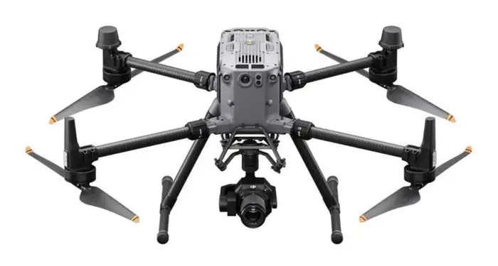
Combo Mapper DJI Matrice 350 RTK + P1
-
Scanning capacity: 300hA/hour
-
Accuracy: 1 cm + 1 ppm (without GCP)
-
Camera Resolution: 45mp (full-frame)
-
Interchangeable lenses: Yes
-
Flight Autonomy: 55 minutes
-
Operating radius: 8km
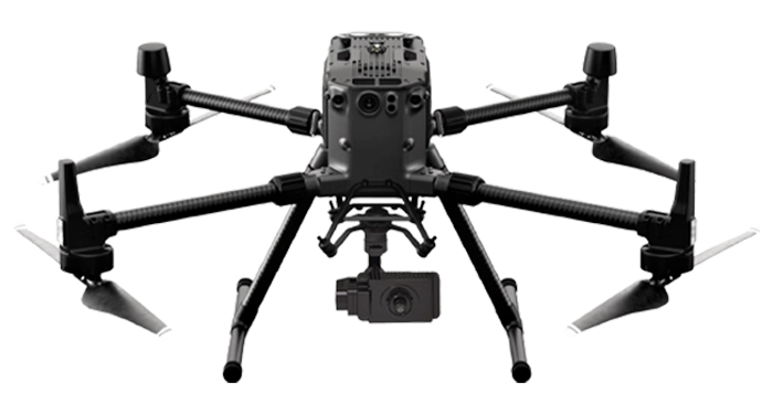
Combo Mapper DJI Matrice 350 RTK + BL6100 Pro
-
Scanning capacity: 100hA/hour
-
Accuracy: 3cm (without GCP)
-
Camera: 61mp
-
Interchangeable lenses: Yes
-
Flight Autonomy: 45 minutes
-
Operating radius: 8km
FOR FREE with all our "combos."
1 x Free membership to our Pilots Network*
1 x 2-hour preparatory course – At our office
1 x 2-hour Silver remote support (5 tickets) – Teleassistance
1 x Complete Enac Manuals
1 x Dronist’s Tariffs 2024
1 x Manual: How to fly in the red zone
1 x Shipping by express courier
*Becoming a part of our Pilots Network you will be able to receive Job Offers in Italy and Abroad
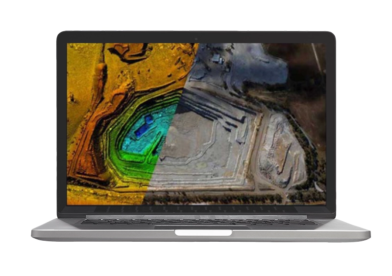
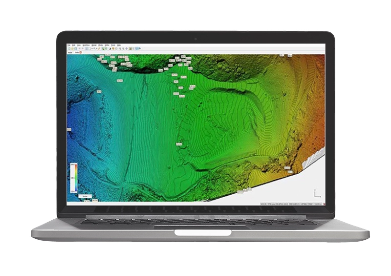
What results can I achieve?
- Digital terrain models (DTM)
- Digital surface models (DSM)
- Geotif .tiff, XYZ .xyz, ASCII GRID .asc, Autodesk .dwg/dxf
- Cartographic representation (georeferenced orthomosaics)
- Geotif .tiff
- Clouds of dots
- ASPRS .las, LAZ .laz, xyz point cloud .txt.
- 3D Models
- Wavefront .obj, 3ds models .3ds, Stanford .ply, Autodesk 3dface/polyline .dwf
Secondary Products
- Contour lines (contours)
- Area/volume calculation
- Digitization to CAD/GIS
- Acclivity analysis
- Point cloud classification
- Extraction of sections
- Spherical panoramic images
Flight Planning
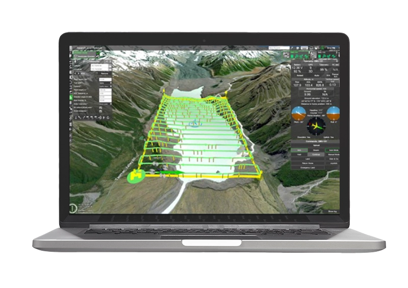
With advanced flight planning software such as UGCS or DJI Flight Hub you have the ability to manage every variable in your survey, including the ability to follow the terrain, on standard DEM or custom DEM, which can be imported directly into the program.

Processing and Post Processing
Agisoft Metashape e DJI Terra are professional-level photogrammetry software used worldwide by Technicians and Professionals. Metashape and DJI Terra allow you to Generate 3D Space Models from georeferenced photos.
Taking advantage of Structure for Motion’s proprietary algorithms, these powerful photogrammetry software enable all typical drone photogrammetric survey outputs, such as clouds, DSM\DTM, contour lines, and volume calculations.
Targeted Training Courses
DroneBase Academy in addition to providing courses for obtaining the Drone License offers Professional Training Courses aimed at enabling you to enter the world of drone work immediately that include Theoretical-Practical classes with experienced and qualified teachers in the various fields of application of these means.

Basic Photogrammetry Course
One-day (8-hour) introductory course aimed at those who are
entering the world of drones for the first time and have no
expertise in geographic/topographic data

Advanced Photogrammetry Course
Advanced 1-day (8-hour) course aimed at those who already have
technical skills in surveying such as surveyors,
engineers and want to use the Drone as a working tool.
Talk to our Expert
DroneBase provides you with Expert Consultants
who can recommend the most appropriate product for your needs
and meet all your needs
Hardware, Software and ENAC.
Call us NOW!
+39.0541.1790411
Request information
Please enter your details below, our consultant will
contact you back as soon as possible to provide you with a
Free Consultation
"*" indicates required fields


