
Thermal Imaging Drones: Advanced Technology for Precision Thermal Analysis
Thermal imaging drones are an innovative tool for conducting thermal analyses over large areas, such as buildings and industrial facilities, detecting heat loss, energy inefficiencies, and structural anomalies with precision. Equipped with thermal cameras, these drones provide fast and safe inspections of hard-to-reach areas, enhancing efficiency and reducing costs compared to traditional methods.Advantages of Thermal Imaging Drones
- Safe Access: Operate over roofs and hazardous areas without endangering personnel.
- High Precision: Deliver high-resolution thermal images, capturing even minor temperature variations.
- Efficiency: Cover large areas quickly, ideal for immediate interventions.
- Cost Savings: Reduce the need for lifting equipment and intervention times.
Applications of Thermal Imaging Drones
- Construction and Civil Engineering: Detect thermal bridges and energy losses.
- Industrial Systems: Monitor solar and electrical systems to identify overheating issues.
- Agriculture: Assess crop conditions to optimize water and fertilizer use.
- Photovoltaic Field Inspections: Identify defective panels to improve energy efficiency.
- Emergency Management: Detect fires or locate individuals in low-visibility situations.
Featured products
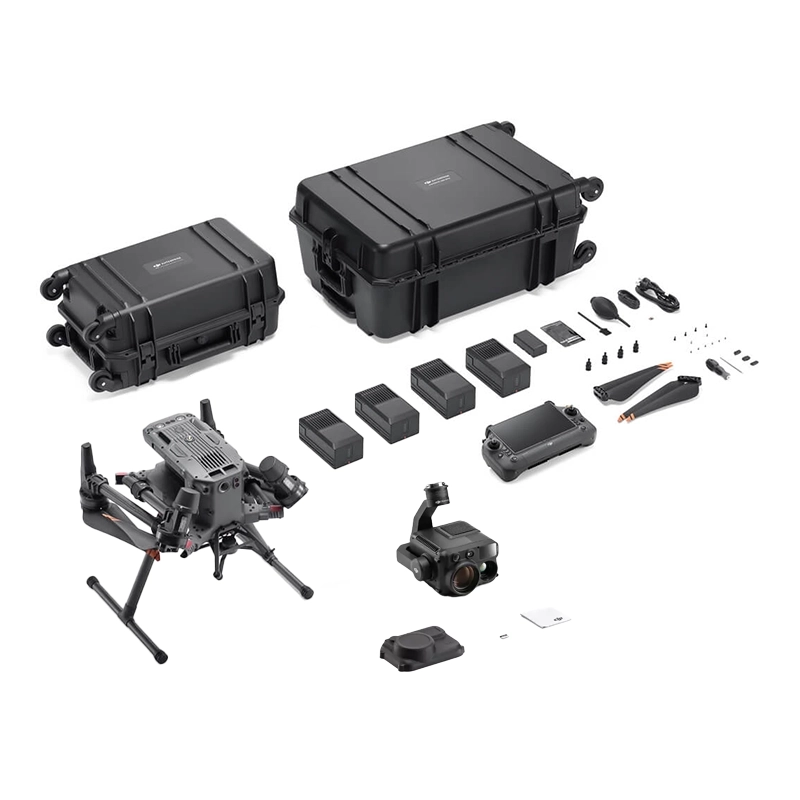
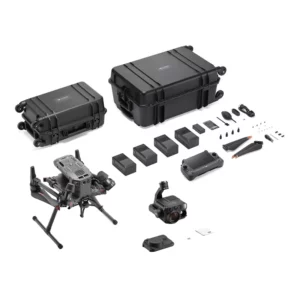
Combo Thermography & Inspection DJI Matrice 350 + Zenmuse H30T
Complete aerial thermal imaging system with Matrice 350 RTK and H30T sensor. Includes BS65 charging station and 4 batteries for continuous o
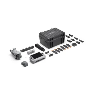
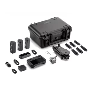
Combo Thermography & Inspection DJI Matrice 30T
Professional bundle with DJI Matrice 30T and 4 TB30 batteries for industrial thermography, photovoltaic inspection and energy efficiency. Co
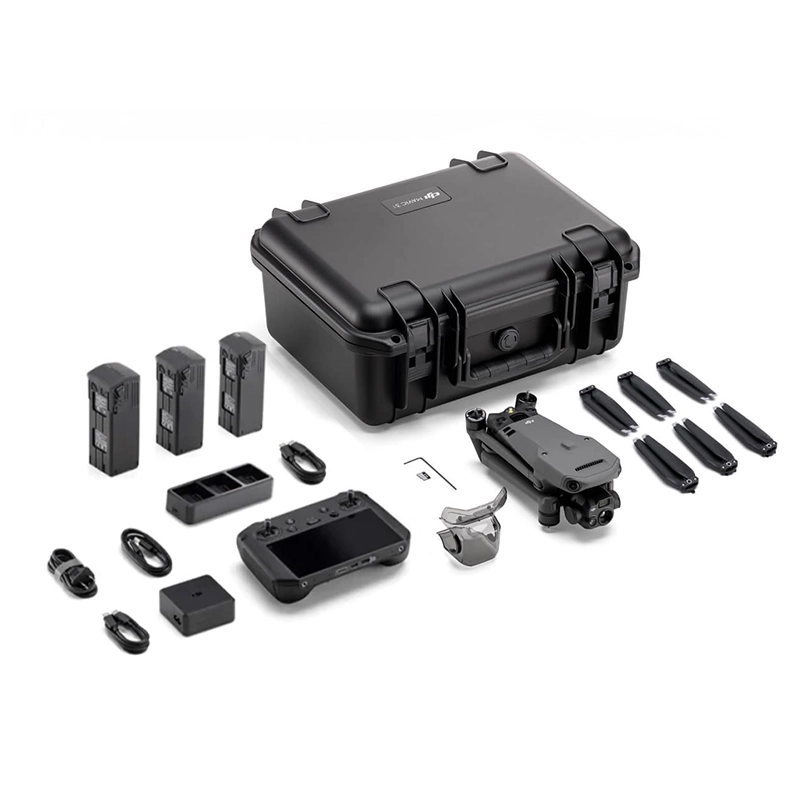
DJI Mavic 3 Thermal Thermography & Inspection Combo
Complete thermal imaging bundle for professional use with DJI Mavic 3 Thermal, calibrated sensors and specialised software for photovoltaic,
Combo Thermography & Inspection
Showing all 4 results
-
✓ Pronta consegnaCombo, Combo Thermography & Inspection
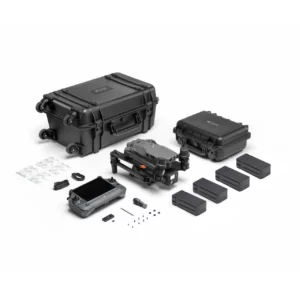
DJI Thermography & Inspection Combo Matrice 4T
Complete DJI Matrice 4T combo with calibrated thermal sensors, flight planning software and post-processing for professional thermography. Everything included for photovoltaic, wind and energy efficiency applications. Available at DroneBase, DJI Gold 5 Dealer.
SKU: n/a -
✓ Pronta consegnaCombo, Combo Thermography & Inspection
Combo Thermography & Inspection DJI Matrice 30T
Professional bundle with DJI Matrice 30T and 4 TB30 batteries for industrial thermography, photovoltaic inspection and energy efficiency. Complete system for continuous operations. Available at DroneBase, DJI Gold 5 Dealer.
SKU: DJM31T-CTI -
✓ Pronta consegnaCombo, Combo Thermography & Inspection
Combo Thermography & Inspection DJI Matrice 350 + Zenmuse H30T
 Combo, Combo Thermography & Inspection
Combo Thermography & Inspection DJI Matrice 350 + Zenmuse H30T
Complete aerial thermal imaging system with Matrice 350 RTK and H30T sensor. Includes BS65 charging station and 4 batteries for continuous operations. Available at DroneBase, DJI Gold 5 Dealer.
SKU: DJIM351-H30T -
✓ Pronta consegnaCombo, Combo Thermography & Inspection
DJI Mavic 3 Thermal Thermography & Inspection Combo
Complete thermal imaging bundle for professional use with DJI Mavic 3 Thermal, calibrated sensors and specialised software for photovoltaic, wind energy and energy efficiency applications. Available at DroneBase, DJI Gold 5 Dealer.
SKU: DJC2T1-CTI
Advanced Thermal Imaging Technology for Professional Inspections
Our thermography and inspection drone combos feature cutting-edge thermal sensors capable of detecting temperature variations with ±2°C accuracy. The 640×512 resolution thermal cameras provide detailed radiometric data essential for electrical infrastructure monitoring, building envelope analysis, and mechanical equipment diagnostics.
Each system includes specialized software for real-time temperature measurement and comprehensive reporting, enabling immediate identification of hotspots, energy losses, and potential equipment failures across industrial facilities.
Industrial Infrastructure Monitoring Solutions
These professional drone systems excel in power line inspection, solar panel diagnostics, and pipeline monitoring applications. The integrated thermal and visible light cameras provide comprehensive data collection, enabling detailed analysis of electrical components, mechanical systems, and structural integrity.
Advanced flight planning software ensures repeatable inspection routes and consistent data collection, critical for trending analysis and predictive maintenance programs in industrial environments.
Building Envelope and Energy Efficiency Analysis
Our thermography combos deliver precise building diagnostics, identifying thermal bridges, insulation defects, and air leakage in commercial and residential structures. The high-resolution thermal imaging reveals energy efficiency issues invisible to conventional inspection methods.
Integrated measurement tools and reporting software enable quantitative thermal analysis, providing detailed documentation for energy audits, building commissioning, and envelope performance verification required by building standards.
Emergency Response and Search Operations
These dual-sensor systems prove invaluable for emergency response scenarios, including search and rescue operations, fire monitoring, and disaster assessment. The thermal imaging capability enables detection of heat signatures through smoke and in low-visibility conditions.
Real-time video transmission and GPS coordinate logging facilitate immediate response coordination, while the robust flight platforms ensure reliable operation in challenging environmental conditions encountered during emergency missions.
Complete Professional Workflow Integration
Each combo includes comprehensive software packages for flight planning, data collection, and analysis. Professional reporting tools generate detailed inspection reports with thermal overlays, temperature measurements, and GPS-tagged findings for complete documentation.
Cloud-based data management enables team collaboration and historical trending, essential for maintenance scheduling and regulatory compliance in industrial inspection programs.
Why buy from DroneBase
DJI Gold 5 Dealer Excellence
Highest certification level ensuring expert technical support and genuine DJI products with full manufacturer warranties.
ISO 9001:2015 Quality Assurance
Certified quality management system guarantees consistent service delivery and professional standards in every transaction.
Professional Training Programs
Comprehensive pilot certification and thermal imaging analysis courses maximize your investment return and operational efficiency.
Complete After-Sales Support
Dedicated technical assistance, maintenance services, and spare parts availability ensure continuous operational readiness.
Frequently asked questions
In Italy, operators need an A2 Certificate of Competency for drones under 4kg in specific category, or Remote Pilot License for certified category operations. Professional inspection work typically requires additional operational authorizations from ENAC.
Professional thermal cameras on these platforms provide ±2°C accuracy or ±2% of reading, with measurement ranges from -20°C to +500°C. Radiometric data enables precise temperature analysis suitable for industrial inspection standards.
Complete thermography inspection combos range from €8,000 for Mavic 3 Thermal systems to €35,000+ for Matrice 350 configurations. Pricing includes drone, thermal payload, software licenses, and professional accessories.
Yes, these systems are specifically designed for electrical infrastructure inspection. The thermal cameras detect overheating components, while maintaining safe distances from power lines as required by utility inspection protocols.
Combos include DJI Pilot 2 for flight operations, DJI Thermal Analysis Tool for temperature measurement, and professional reporting software. Additional specialized analysis software may be included depending on the specific package configuration.
Complete training programs typically require 3-5 days, covering drone operations, thermal imaging principles, data analysis, and reporting procedures. Certification includes both theoretical knowledge and practical flight exercises.
Want a consultation or a demo?
Our DJI Enterprise certified technicians help you choose the right configuration. No commitment.
+39 0541 1790411


