
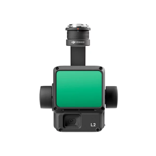
DJI Zenmuse L2 LiDAR — High-Density 3D Point Cloud with Precision IMU and Integrated 4/3" RGB Camera
The DJI Zenmuse L2 is DJI's reference LiDAR payload for 3D mapping, topographic surveys and infrastructure inspection: 5 simultaneous returns, range up to 240 m, ±4 cm vertical and ±5 cm horizontal accuracy, integrated 4/3" RGB CMOS camera for point cloud colouring and coverage up to 2.5 km² per single flight. Compatible with the DJI Matrice 350 RTK and Matrice 400, the Zenmuse L2 natively integrates the drone's RTK module for direct georeferencing without GCPs and is processed with DJI Terra to produce point clouds, DTMs, DSMs and 3D models ready for all major GIS and BIM software. Available for immediate delivery from DroneBase with technical support and DJI Care included.
Explore the available configurations
The Zenmuse L2 is available on its own or with DJI Care Enterprise coverage to protect your LiDAR investment.
DJI Zenmuse L2
5-return LiDAR, 240 m range, integrated 4/3" RGB camera and high-precision IMU. For 3D point clouds, DTMs, forest modelling, BIM and infrastructure inspection.
- 5 returns LiDAR
- 240 m range
- ±4 cm vertical
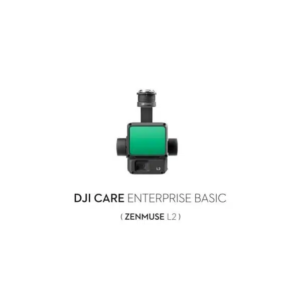
L2 + Care Enterprise Basic
DJI Care Enterprise Basic coverage for the Zenmuse L2: replacement in case of accidental damage, priority support and maintenance. Essential protection for a €13,199 payload.
- 1 year coverage
- Accidental damage
- Priority support

L2 + Care Enterprise Plus
DJI Care Enterprise Plus coverage for the Zenmuse L2: comprehensive protection including total loss, rapid replacement and guaranteed operational continuity for those working on tight-deadline contracts.
- Full coverage
- Loss included
- Rapid replacement
DJI Zenmuse L2 Lidar
Showing all 4 results
-
✓ Pronta consegna
-
✓ Pronta consegna
-
✓ Pronta consegna


What is the DJI Zenmuse L2 and when is it the right choice over photogrammetry
The DJI Zenmuse L2 is an airborne LiDAR (Light Detection and Ranging) system that measures distances by emitting laser pulses and calculating the return time of the signal reflected by objects. Unlike photogrammetry — which reconstructs 3D geometry from the correlation between overlapping images — LiDAR directly measures the 3D coordinates of each point independently of lighting conditions and, thanks to multiple returns, penetrates vegetation to reach the ground beneath. This makes the Zenmuse L2 indispensable for forest surveys, terrain modelling under tree canopy, power line inspection and any application where photogrammetry cannot produce reliable data. The integrated 4/3" RGB CMOS camera adds point cloud colouring in a single flight pass.
5 simultaneous returns — vegetation penetration and under-canopy modelling
The Zenmuse L2 records up to 5 returns per laser pulse. When the laser beam strikes a tree canopy, part of the signal is reflected by the upper leaves (first return), more by intermediate vegetation (returns 2–4) and a portion penetrates through to the ground (last return). This makes it possible to obtain simultaneously the surface model (DSM) including vegetation and the bare earth terrain model (DTM) beneath it — an operation impossible with RGB or multispectral photogrammetry. Typical point density is over 1,000 points/m² at 100 m altitude, sufficient for automatic classification of ground, low, medium and high vegetation, and man-made structures.
Integrated 4/3" RGB CMOS camera — coloured point cloud in a single flight
The Zenmuse L2 integrates a mapping RGB camera with a 4/3" CMOS sensor optically aligned with the LiDAR module. This enables simultaneous acquisition of the 3D point cloud and georeferenced RGB images for point cloud colouring in a single flight, eliminating the need for a second flight with a separate camera. The coloured point cloud is directly usable in analysis software such as CloudCompare, RealityCapture, Bentley ContextCapture and in BIM environments for structure visualisation and inspection.
High-precision IMU and direct georeferencing
The quality of a LiDAR point cloud depends critically on the precision with which the sensor's position and orientation are known at the moment of acquisition. The Zenmuse L2 integrates a high-precision IMU (Inertial Measurement Unit) that measures accelerations and angular velocities at high frequency, paired with the Matrice 350 RTK's RTK module for centimetre-level absolute positioning. The TimeSync system synchronises all sensors at microsecond level, ensuring that every point in the cloud is georeferenced with the highest available accuracy without ground control points.
2.5 km² per single flight — operational efficiency over large areas
At 150 m altitude with a cruise speed of 15 m/s, the Zenmuse L2 covers up to 2.5 km² (250 hectares) in a single flight with point density adequate for the majority of topographic applications. This operational efficiency is particularly relevant for large forest surveys, watershed studies, linear infrastructure inventories (roads, railways, power lines) and cadastral surveys over wide areas where field time is a critical cost factor.
Scanning modes — repetitive and non-repetitive
The Zenmuse L2 supports two complementary scanning modes. Repetitive mode produces regular parallel scan lines — optimal for linear surveys (roads, watercourses, power lines) and for applications that require a uniform and predictable point distribution. Non-repetitive mode generates a rosette scanning pattern that accumulates increasing density over time — optimal for area surveys where uniform ground coverage is to be maximised and shadow zones on complex structures minimised.
Compatibility and pairing with Zenmuse P1
The Zenmuse L2 is compatible with the DJI Matrice 350 RTK and Matrice 400. On the Matrice 350 RTK with the Dual Gimbal Connector, the Zenmuse L2 can be paired with the Zenmuse P1 on the dual lower connector to acquire both the LiDAR point cloud and 45 MP full-frame photogrammetric images in a single flight — the most comprehensive workflow for surveying, BIM and land management. This multi-payload configuration eliminates the need for separate flights for the two datasets, reducing operational time by 40–50% compared to sequential acquisition.
Processing with DJI Terra — from point cloud to GIS/BIM output
The native Zenmuse L2 processing workflow runs in DJI Terra: import of LiDAR data and RGB images, trajectory calculation with RTK + IMU fusion, generation of the georeferenced point cloud, automatic ground and vegetation classification, production of DTM, DSM and CHM (Canopy Height Model). Output files are in LAS/LAZ format compatible with QGIS, ArcGIS, AutoCAD Civil 3D, Trimble Business Center, Global Mapper and all major point cloud management software.
Main applications of the Zenmuse L2
Surveying and cadastre
Precision topographic surveys, cartographic updates, cadastral surveys in areas with vegetation or structures obstructing the line of sight, production of certified DTMs for building permits and planning applications.
Forest management and woodland inventories
Estimation of biomass volume, tree height, canopy density and vertical forest structure through multiple-return classification. Support for forest planning, fire risk assessment and post-harvest monitoring.
Linear infrastructure — roads, railways, power lines
Geometric survey of infrastructure corridors, power line clearance analysis, monitoring of landslides and slope instabilities near critical infrastructure, updating of BIM project models for maintenance purposes.
Hydrology and land management
Watershed modelling, reservoir volume calculation, flood risk analysis, survey of river banks and riverbeds with acquisition of the bed profile beneath riparian canopy cover.
DJI Care Enterprise — protection for a €13,199 payload
The Zenmuse L2 is the most expensive payload in the DJI range compatible with the M350 RTK: adequate protection is essential to guarantee operational continuity. DJI Care Enterprise Basic (€1,200/year) covers accidental damage with replacement or repair at fixed costs. DJI Care Enterprise Plus (€2,400/year) extends coverage to total payload loss, with rapid replacement that minimises operational downtime on tight-deadline contracts. Given the turnaround times and out-of-warranty repair costs for a professional LiDAR system, Care Enterprise pays for itself amply at the first avoided incident.
Why buy the DJI Zenmuse L2 from DroneBase
We are the only DJI Gold 5 Dealer in Italy with exclusive specialisation in the enterprise sector. The Zenmuse L2 is available for immediate delivery from our Rimini warehouse. Our technical team supports payload configuration on the Matrice 350 RTK, LiDAR system calibration, DJI Terra configuration for your processing workflow and verification of the accuracy of your first surveys. For surveyors and topographers we provide all the technical documentation required for LiDAR survey accuracy certification.
Frequently asked questions about the DJI Zenmuse L2
The Zenmuse P1 (photogrammetry) reconstructs 3D geometry from the correlation between overlapping images: it works on visible surfaces, requires good lighting conditions and does not penetrate vegetation. The Zenmuse L2 (LiDAR) directly measures distances with laser pulses: it works at night or in low-light conditions, penetrates vegetation thanks to 5 returns and produces dense point clouds even on non-textured surfaces. The two systems are complementary: where photogrammetry cannot penetrate vegetation or work in the dark, LiDAR is the solution. For the most complete dataset, the Matrice 350 RTK can carry both in a single flight.
Yes. Thanks to 5 simultaneous returns, the Zenmuse L2 captures both canopy returns (first and second return) and ground returns (fourth and fifth return) that filter through gaps in the foliage. Under dense canopy cover (high LAI) the density of ground-level points decreases, but remains sufficient for accurate DTM generation in most forest and agricultural scenarios. In forests with very dense understorey, DTM quality depends on the effective ground point density: contact us for an assessment of your specific case.
DJI's declared accuracy is ±4 cm vertical and ±5 cm horizontal under optimal conditions with active RTK and good satellite geometry. In real operational conditions — with partial GNSS coverage, non-optimal flight geometry or without a D-RTK 2 base station — typical accuracy settles at ±5–8 cm vertical. For topographic applications requiring accuracy certification, use of the D-RTK 2 base station and verification with at least 5 independent check points is recommended.
The DJI Zenmuse L2 is compatible with the DJI Matrice 350 RTK and DJI Matrice 400. It is not compatible with the Mavic 3 Enterprise, the Matrice 30 Series or consumer platforms. On both platforms it leverages the drone's integrated RTK module for direct georeferencing of every point in the cloud without ground control points.
The Zenmuse L2 improves on the previous L1 across all main parameters: 5 returns vs the L1's 3, 240 m range vs 190 m, a new-generation IMU with greater precision, a 4/3" camera vs the L1's 1", and higher scan frequency for greater point density at the same altitude and speed. If you already own an L1 and are satisfied with its results, the L1 remains a valid platform for many applications. If you are purchasing for the first time or need greater vegetation penetration and accuracy, the L2 is the correct choice.
The native processing workflow runs in DJI Terra (included with purchase), which handles LiDAR + IMU + RTK fusion and produces the classified point cloud in LAS/LAZ format. For advanced analysis, files are compatible with CloudCompare (free), LAStools, QGIS and ArcGIS for GIS, AutoCAD Civil 3D and Trimble Business Center for surveying, Bentley ContextCapture and Autodesk ReCap for BIM. For forest inventories, FUSION/LDV and lidR (R package) are the reference software.
Would you like to see the Zenmuse L2 in action with a LiDAR survey demo at your site?
Our DJI Enterprise certified technicians organise an operational demonstration with the Matrice 350 RTK + Zenmuse L2, from acquisition to classified point cloud output.
Book LiDAR Demo +39 0541 1790411


