DJI Mavic 3 Multispectral — Drone for Precision Agriculture with 4 Multispectral Sensors, 20 MP RGB and Integrated RTK
The DJI Mavic 3 Multispectral is the reference drone for precision agriculture and environmental monitoring: it combines a 20 MP RGB camera with 4 multispectral sensors at 5 MP each (Green, Red, Red Edge, NIR), a solar irradiance sensor for NDVI data normalisation and compatibility with the RTK module for centimetre-level mapping without ground control points. With 43 minutes of endurance, O3 Enterprise transmission up to 15 km and native integration with DJI Terra and DJI SmartFarm, it enables acquisition, processing and analysis of NDVI, GNDVI and NDRE maps directly in the field. At DroneBase you will find the drone, the RTK module, the tethered system and all accessories in stock, with ready shipment, GrenkeLeasing and technical support included.
Explore the main configurations
From basic crop monitoring to RTK centimetre mapping, through to continuous coverage with the tethered system.
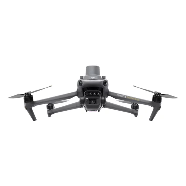
DJI Mavic 3 Multispectral
4 multispectral sensors (Green, Red, Red Edge, NIR) + 20 MP RGB + solar irradiance sensor. For NDVI, GNDVI, NDRE maps and precision crop monitoring.
- 4 spectral bands
- 20 MP RGB
- 43 min endurance
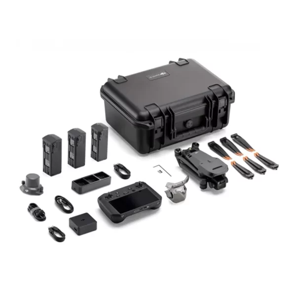
M3M + RTK Module
Add the RTK module for ±1 cm accuracy with no ground control points. For certified agronomic surveys, land registry and georeferenced multispectral maps with absolute accuracy.
- ±1 cm horizontal
- ±1.5 cm vertical
- No GCP required
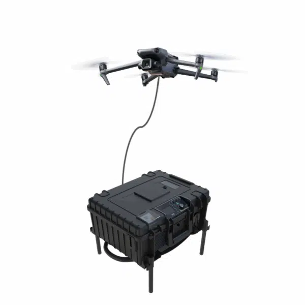
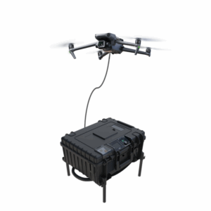
M3M + Tethered System
45 m tethered cable for continuous multispectral acquisition with no endurance constraints. For seasonal phenological monitoring, fixed sensing stations and long-duration missions.
- 45 m cable
- 24/7 operational
- No battery swaps
DJI Mavic 3 Multispectral
Showing all 15 results
-
✓ Ready to shipDJI Mavic 3 Multispectral, Drone DJI Mavic 3 Enterprise, Power Station, Public Security, Search & Rescue
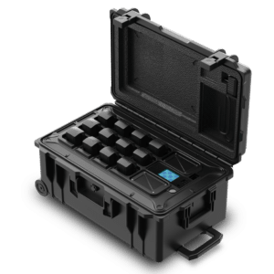
Battery Charging Box DJI Mavic 3
 DJI Mavic 3 Multispectral, Drone DJI Mavic 3 Enterprise, Power Station, Public Security, Search & Rescue
Battery Charging Box DJI Mavic 3
Professional all-in-one solution for DJI Mavic 3 Series operators. The BC-M3 simultaneously charges 12 flight batteries at 1200W rated power, monitors temperature and charge status in real time via built-in display and Zhifei Smart Charging app, and automatically suspends charging on any anomaly. Reverse Power Supply delivers USB emergency power off-grid. Trolley design with integrated wheels and telescopic handle, operational from -20°C to +60°C and compatible with any global power grid (180–264VAC).
SKU: BC-M3 -
✓ Ready to shipDJI Mavic 3 Multispectral, Professional Drones
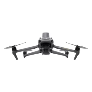
DJI Mavic 3 Multispectral
Dual imaging system with 20MP RGB and 4x5MP multispectral sensors for precise crop analysis. Up to 43 minutes autonomy and foldable design for precision agriculture operations anywhere. Available at DroneBase, DJI Gold 5 Dealer.
SKU: n/a -
✓ Ready to ship
-
Request availability
-
Request availability
-
Request availability
-
✓ Ready to ship
-
✓ Ready to shipDJI Mavic 3 Multispectral, Drone DJI Mavic 3 Enterprise
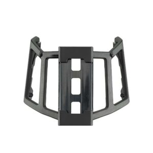
DJI Cellular Dongle Installation Kit
Mounting kit for rapid and secure installation of DJI Cellular Dongle on Mavic 3 Enterprise drones. Includes robust bracket and USB-C cable for stable 4G connections on remote missions. Available at DroneBase, DJI Gold 5 Dealer.
SKU: DJDONK -
Request availabilityDJI Mavic 3 Multispectral, Drone DJI Mavic 3 Enterprise
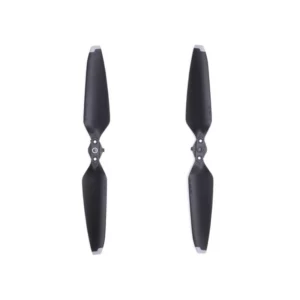
DJI Propellers M3 Enterprise CE EASA Low Noise
DJI Mavic 3 Multispectral, Drone DJI Mavic 3 EnterpriseDJI Propellers M3 Enterprise CE EASA Low Noise
Low-noise CE EASA certified propellers with optimised dynamic balancing, reducing noise pollution and impact damage. Compatible with Mavic 3 Enterprise. Available at DroneBase, DJI Gold 5 Dealer.
SKU: DJME43 -
Request availabilityDJI Mavic 3 Multispectral, Drone DJI Mavic 3 Enterprise
DJI Mavic 3 Enterprise Propellers
Balanced and tested propellers for Mavic 3 Enterprise with maximum efficiency and reduced noise. Weight 8.5g, diameter 9.4 inches for optimal professional performance. Available at DroneBase, DJI Gold 5 Dealer.
SKU: DJME38 -
✓ Ready to ship
-
✓ Ready to shipDJI Mavic 3 Multispectral
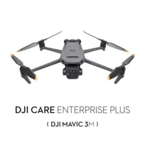
DJI Care Enterprise Plus renewed (Mavic 3M)
Renew your DJI Care Enterprise Plus coverage for an additional 12 months with unlimited free repairs and battery replacement. Complete professional protection for your Mavic 3M. Available at DroneBase, DJI Gold 5 Dealer.
SKU: DJEB16 -
✓ Ready to ship
-
✓ Ready to ship
-
✓ Ready to shipDJI Mavic 3 Multispectral, Tethered System
Tethered DJI Mavic 3 Enterprise – 45mt
Tethered system with 45m micro-cable for continuous power supply to the Mavic 3 Enterprise for up to 12 hours. Ideal for surveillance, emergencies and night-time operations with integrated 150W LED spotlight. Available at DroneBase, DJI Gold 5 Dealer.
SKU: n/a



What is the DJI Mavic 3 Multispectral and how it transforms crop monitoring
The DJI Mavic 3 Multispectral is a drone platform specialised for multispectral data acquisition in precision agriculture, viticulture, forestry and environmental monitoring. Unlike standard RGB drones that capture only visible light, the Mavic 3 Multispectral integrates 4 sensors at 5 MP each calibrated on specific spectral bands — Green (560 nm), Red (650 nm), Red Edge (730 nm) and Near Infrared (860 nm) — that detect crop reflectance at wavelengths invisible to the human eye. This enables the calculation of vegetation indices such as NDVI, GNDVI, NDRE and LCI that reveal plant health status, water stress, nutritional deficiencies and biomass distribution weeks before symptoms are visible — enabling targeted agronomic interventions that reduce input costs and increase yield.
4 multispectral sensors + 20 MP RGB — simultaneous acquisition in a single flight
The Mavic 3 Multispectral sensor system simultaneously captures 5 image streams in every flight: the 4 multispectral bands and the 20 MP RGB camera. The multispectral and RGB images are perfectly aligned — same spatial resolution, same acquisition angle, same georeferencing — eliminating the co-registration errors that affect separate multi-camera systems. The result is a multispectral map and an RGB orthophoto that are fully overlappable, usable together in DJI Terra or in GIS software such as QGIS, ArcGIS and Pix4Dfields for comprehensive agronomic analyses.
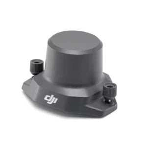
Solar irradiance sensor — accurate NDVI data regardless of light conditions
The quality of multispectral data depends critically on the lighting conditions at the time of flight. Clouds, changes in solar angle and shadows alter reflectance values, making data acquired in different sessions incomparable. The solar irradiance sensor integrated in the Mavic 3 Multispectral measures the incident solar radiation in real time throughout the entire mission and uses this data to automatically normalise the multispectral images. The result is continuous radiometric calibration that guarantees reliable and comparable absolute reflectance values between flights carried out on different days and under different light conditions — a prerequisite for seasonal phenological monitoring.
Optional RTK module — multispectral mapping with ±1 cm accuracy
The RTK Module for Mavic 3 attaches to the drone in seconds, bringing positioning accuracy to ±1 cm horizontal and ±1.5 cm vertical without ground control points (GCPs). For precision agriculture this means georeferenced multispectral maps with absolute accuracy, directly usable for variable-rate seeding, fertilisation and irrigation prescriptions linked to farm management software. It is compatible with the D-RTK 2 base station for operations in areas without NRTK coverage, or with CORS networks for real-time correction. The module is removable and interchangeable with the Mavic 3 Enterprise for those who use both drones.
Supported vegetation indices — NDVI, GNDVI, NDRE and beyond
Thanks to its 4 spectral bands, the Mavic 3 Multispectral supports the calculation of the main vegetation indices used in precision agronomy:
NDVI — Normalized Difference Vegetation Index
The most widely used index for assessing vegetation vitality and foliage density (LAI). Uses the Red and NIR bands to detect the quantity of active chlorophyll. Optimal for cereals, maize, soya and extensive crops.
GNDVI — Green NDVI
A variant of NDVI based on the Green band instead of Red, more sensitive to changes in chlorophyll content in the advanced stages of the crop cycle. Particularly effective on vineyards and orchard crops for monitoring canopy vigour.
NDRE — Normalized Difference Red Edge
Uses the Red Edge band (730 nm) to detect early plant stress before it is visible in NDVI, with high sensitivity to nitrogen deficiencies. Ideal for optimising nitrogen fertilisation on maize, wheat and vineyards with high intra-field variability.
DJI Terra and DJI SmartFarm — from acquisition to agronomic map in minutes
The Mavic 3 Multispectral workflow is integrated into the DJI software ecosystem. DJI Terra manages automatic mission planning (grid, overlap, altitude) and processing of multispectral images into orthophotos, DSMs and vegetation index maps on PC. DJI SmartFarm is the cloud platform dedicated to precision agriculture: it imports NDVI maps, automatically generates variable rate prescription maps in formats compatible with the main variable-rate agricultural machinery, and tracks crop evolution over time with multi-temporal comparisons. Both software packages are included with the drone purchase at no additional cost.
43-minute endurance and coverage up to 200 hectares per battery
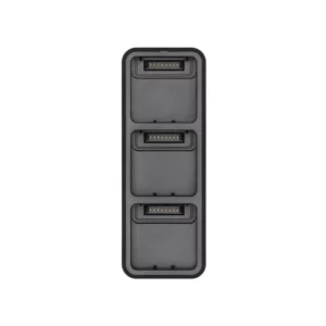
With the Mavic 3 Flight Battery endurance reaches 43 minutes under standard conditions. On mapping missions at 120 m altitude with 75/75% overlap, a single battery typically covers 150–200 hectares, sufficient for the majority of Italian agricultural plots in a single session. The Battery Kit (2 batteries + 100W charging hub) is the recommended configuration for those working on areas larger than 300 hectares or managing multiple plots in the same day.
Tethered system — continuous multispectral monitoring with no endurance constraints
The 45 m tethered system for the Mavic 3 Multispectral transforms the drone into a continuously powered aerial monitoring station, eliminating the battery constraint. It is the solution for continuous phenological monitoring at agrometeorological stations, hourly multispectral acquisitions during critical crop stages (flowering, fruit set, ripening), rapid response analysis to water stress or phytosanitary treatments, and fixed coverage of experimental plots. The ground power supply ensures full operability of the drone, multispectral sensors and data transmission for the entire duration of the session.
Application scenarios — from viticulture to environmental monitoring
The Mavic 3 Multispectral is adopted across a wide range of sectors that require georeferenced spectral reflectance data:
Precision viticulture
Inter- and intra-row vigour mapping with NDVI and GNDVI for differentiated harvesting by homogeneous zones, optimisation of foliar nutrition, early detection of Flavescence dorée and other vine diseases before visible symptoms appear.
Cereals and extensive crops
Generation of NDRE maps for variable nitrogen fertilisation prescriptions, monitoring of crop emergence and plant population, early yield estimation per crop and plot through correlation with historical NDVI indices.
Olive groves and orchard crops
Assessment of canopy phytosanitary status, chlorophyll distribution mapping to optimise differentiated pruning, post-treatment monitoring to verify the effectiveness of interventions.
Environmental and forest monitoring
Vegetation biomass mapping, assessment of woodland health status, detection of invasive species through spectral signature analysis, monitoring of wetlands and protected areas for biodiversity studies and environmental compliance.
Industry 4.0 and 5.0 incentives — Hyper-Amortization + Nuova Sabatini
The DJI Mavic 3 Multispectral qualifies as an eligible capital good under the Italian Industry 4.0 / 5.0 plan. Agricultural companies, cooperatives and professionals in the agronomic sector who purchase the drone interconnected with their farm management system (via DJI SmartFarm or DJI Terra) can access a tax credit of up to 40% on the investment, with full combination of Hyper-Amortization and Nuova Sabatini. The scheme also applies to self-employed professionals, agronomists, agricultural assessors and VAT-registered entities under the standard regime. Learn how it works. DroneBase provides all the technical documentation for reporting.
Grenke Operational Leasing — custom monthly rate on request
For those who prefer a predictable monthly instalment instead of an upfront investment, GrenkeLeasing operational leasing is available from 36 to 60 months: zero deposit, response within 48 hours, available to VAT-registered entities with at least 18 months of activity. The monthly payment is 100% tax-deductible as an operating cost. Request a personalised quote specifying the configuration with or without the RTK module.
Why buy the DJI Mavic 3 Multispectral from DroneBase
We are the only DJI Gold 5 Dealer in Italy with exclusive specialisation in the enterprise sector. What this means for you:
Ready-to-ship and complete configuration
Mavic 3 Multispectral, RTK module, Battery Kit, tethered system and all accessories in stock at our Rimini warehouse. Shipping within 24–48h. The drone is delivered already configured and calibrated for its first flight.
Demo on a real field with NDVI processing included
We carry out a demonstration flight on one of your plots, process the NDVI and NDRE maps in real time with DJI Terra and show you the complete workflow from acquisition to variable rate prescription map. No purchase commitment required.
Operational training and agronomic support
Training courses on the operational use of the Mavic 3 Multispectral, interpretation of vegetation indices, and configuration of DJI Terra and DJI SmartFarm for prescription map generation. Direct technical support for the first field missions.
MEPA code for public bodies and universities
The Mavic 3 Multispectral is available on the Electronic Marketplace for Public Administration (MEPA) for universities, agronomic research centres, rural development agencies and regional authorities. Find out how to purchase via MEPA.
Frequently asked questions about the DJI Mavic 3 Multispectral
The drone captures images in 4 spectral bands — Green (560 nm), Red (650 nm), Red Edge (730 nm) and Near Infrared (860 nm) — which measure plant reflectance at wavelengths invisible to the human eye. From these images, vegetation indices are calculated: NDVI (overall vitality), GNDVI (chlorophyll content), NDRE (early stress and nitrogen deficiencies) and others. The end result is a georeferenced colour map showing the distribution of crop health status across the entire plot, usable to guide targeted agronomic interventions.
No, the RTK module is optional and sold separately at €659.00. Without RTK the drone uses standard GPS with positioning accuracy of a few metres, sufficient for field-scale vegetation maps. With the RTK module, accuracy rises to ±1 cm without GCPs — necessary for certified topographic surveys, land registry work and prescription maps that must be compared with absolute precision over time. The module is also compatible with the Mavic 3 Enterprise, interchangeable between the two drones.
DJI provides DJI Terra (PC-based processing, included) and DJI SmartFarm (cloud platform for prescription maps, included) as native solutions. For more advanced analyses, the images are compatible with Pix4Dfields, Agisoft Metashape, QGIS, ArcGIS and any GIS software that supports georeferenced multi-band images in GeoTIFF format. The solar irradiance sensor automatically generates the radiometric calibration data required for all processing workflows.
With a single battery (43-minute nominal endurance) the drone typically covers 150–200 hectares under standard conditions: flight at 120 m altitude, 75% frontal and 75% lateral overlap, no wind. In real-world conditions (moderate wind, low temperatures, RTK active) typical coverage is 100–150 hectares per battery. The Battery Kit with 2 batteries is recommended for operational sessions covering more than 200 hectares.
They are complementary tools with different functions. The Mavic 3 Multispectral is a data acquisition drone: it flies, photographs and generates vegetation maps to support agronomic decisions. The DJI Agras T40 is an intervention drone: it distributes fertilisers, pesticides or water via a nozzle spraying system. The ideal workflow is: use the Mavic 3 Multispectral to generate the variable rate prescription map, then transfer it to the T40 for differentiated treatment by homogeneous zones — reducing product consumption by 20–40% compared to uniform application.
Yes, thanks to the integrated solar irradiance sensor that normalises images based on instantaneous light conditions. In uniformly overcast conditions the drone operates correctly with good-quality data. What should be avoided are conditions of mixed light (rapid alternation of sun and shadow during the flight) that create discontinuities in radiometric calibration. To maximise data quality, it is recommended to fly during the central 2–3 hours of the day with clear or uniformly overcast skies.
The Mavic 3 Multispectral weighs under 1 kg. For flights over agricultural land in rural areas away from people and infrastructure, it is often sufficient to operate in open category A1/A3 with ENAC operator registration and completion of the online theory module. For structured professional operations, BVLOS or in areas near populated centres, at least the STS-01 EU certificate is required. Our team supports you in identifying the correct authorisation pathway for your operational scenario.
Yes, via GrenkeLeasing operational leasing from 36 to 60 months: fixed monthly instalment, zero deposit, 100% tax-deductible, response within 48h. Available to VAT-registered entities with at least 18 months of activity — including agricultural companies, cooperatives and freelance agronomists. Request a personalised quote specifying the configuration with or without the RTK module.
Would you like to see the DJI Mavic 3 Multispectral in action on your own field?
Our technicians carry out a demonstration flight with real-time NDVI and NDRE processing on your land. Discover what the drone sees that the eye cannot.
Book Field Demo +39 0541 1790411