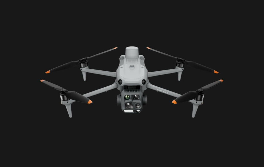
DJI Matrice 4 Series
Introducing the DJI Matrice 4 series, a new series of compact and intelligent multi-sensor drones for the enterprise sector. The series includes Matrice 4T and Matrice 4E, each equipped with advanced features such as intelligent sensing and laser rangefinder measurement. Flight operations are now safer, more reliable and supported by artificial intelligence, with greatly enhanced sensing capabilities. The accessories of the Matrice 4 series have also been significantly improved. The Matrice 4T is suitable for a wide range of sectors, including energy, emergency response, public safety and forest protection. The Matrice 4E is designed for geospatial applications such as surveying and mapping, the construction and mining industries. It is the beginning of a new era in the field of intelligent aerial operations.
Two models, countless
applications
Wide-angle camera
CMOS 1/1.3″, 48 MP effective pixels, f/1.7, equivalent format: 24 mm
Media camera
CMOS 1/1.3″, 48 MP effective pixels, f/2.8, equivalent format: 70 mm
Camera
CMOS 1/1.5″, 48 MP effective pixels, f/2.8, equivalent format: 168 mm
Laser rangefinder
Measurement range: 1800 m (1 Hz); oblique incidence range (1:5 oblique distance): 600 m (1 Hz) Blind zone: 1 m; Accuracy (m): ± (0.2 + 0.0015 × D) [1]
Infrared thermal imaging camera [2]
Resolution 640 × 512, f/1.0, equivalent focal length: 53 mm, uncooled VOx microbolometer, supports high resolution mode
Auxiliary light at NIR [3]
FOV: 6°, Lighting distance: 100 m
Wide-angle camera
CMOS 4/3, 20 MP effective pixels, f/2.8-f/11, equivalent format: 24 mm, mechanical shutter
Media camera
CMOS 1/1.3″, 48 MP effective pixels, f/2.8, equivalent format: 70 mm
Camera
CMOS 1/1.5″, 48 MP effective pixels, f/2.8, equivalent format: 168 mm
Laser rangefinder
Measurement range: 1800 m (1 Hz); oblique incidence range (1:5 oblique distance): 600 m (1 Hz) Blind zone: 1 m; Accuracy (m): ± (0.2 + 0.0015 × D) [1]
Smart features
Excellent performance in low-light environments
Clear vision and stable images
High-efficiency precision mapping
Comprehensive accessory upgrade
More safety in flight
DJI Care Enterprise
Intelligent features with artificial intelligence
The power of artificial intelligence in the service of smarter
operations
The integrated AI model can detect vehicles, vessels and subjects during search and rescue operations or routine flights. It also supports switching to other models, thus allowing for expanded AI application scenarios. In addition, it supports HR photo grids and has powerful tracking capabilities.
Laser rangefinder, precise measurements
The integrated AI model can detect vehicles, vessels and subjects during search and rescue operations or routine flights. It also supports switching to other models, thus allowing for expanded AI application scenarios. In addition, it supports HR photo grids and has powerful tracking capabilities.
Recording the field of observation
DJI Pilot 2 can highlight the central position of the camera frame and the observed terrain area. It can provide visualization of the surveyed area on the map, simplifying patrol and rescue operations in mountainous areas without clear landmarks.
Efficient flight, smart features
Cruise
FlyTo
SmartTrack
POI
By activating the Cruise control mode, it is possible to fly the drone in a specific direction without continuously pressing the control sticks, making long-distance flights smoother.
In case of emergencies or disasters, the drone can automatically adjust its trajectory and flight speed according to its surroundings, being able to reach a predetermined position without manual adjustments.
The Smart Track function allows the camera to precisely locate a subject and automatically adjust the zoom, making it easy to switch between subjects. It can automatically reacquire a subject even if obscured for a short interval of time.
The POI function enables constant 3D observation and modeling of buildings while flying over a predetermined area, thus significantly improving the efficiency of fixed point observation and modeling tasks.
Excellent performance in dimly lit environments
Crystal-clear vision: Highlights the
details
Efficient flight, smart features
Enhanced medium telephoto lens
The Matrice 4 series is equipped with a medium camera that extends its performance for medium-range inspection tasks. When inspecting power lines or bridges, it can identify screws and cracks at a distance of 10 meters and clearly read instrument data in substations. [6]
Super resolution telephoto lens
The Matrice 4 series camera boasts significantly higher sharpness, with a resolution of 48 MP, and is capable of detecting extraordinary details from signals up to 250 meters away. [7] In addition, the Matrice 4T is equipped with an IR-Cut filter that ensures uninterrupted operation day and night.
Close-up stabilization for telephoto images
Advanced telephoto stabilization makes foreground subjects stable and clear during telephoto shooting at 10x zoom or higher. In scenarios such as public safety and inspection activities, details of subjects are clearly visible.
Electronic haze removal for unprecedented sharpness
In smoggy or humid atmospheric conditions, electronic dehazing provides three modes (low, medium, and high) to improve the image sharpness of Matrice 4 series devices according to different operating environments and requirements.
Precision mapping, to
save time and energy
Quick shots with intervals of
0.5 seconds
The wide-angle camera of the Matrice 4E can take quick shots at 0.5-second intervals in both orthogonal and oblique photography modes, enabling high-speed aerial surveys from multiple angles. In addition, the mapping flight speed can reach up to 21 meters per second, [8] significantly improving operational efficiency.
Multidirectional acquisition, multiplied efficiency
Oblique acquisition in 5 directions
The Matrice 4 series devices now feature the ability to capture images in 5 directions in oblique mode. The stabilizer can rotate and shoot intelligently from multiple angles depending on the shooting area, resulting in more shots in a single flight than previous models [9] and significantly improving the efficiency of oblique photography with small drones.
Orthogonal acquisition in 3 directions [10]
The DJI Matrice 4E enables tri-directional orthographic acquisition and allows lateral acquisition during orthogonal shooting operations, thus reducing lateral overlap. Mapping operations for an area of 2.8 square kilometers can be accomplished in a single flight. [11] No additional elevation optimization flights are required to achieve better elevation accuracy. Combined with the new DJI Terra features, the efficiency of reconstruction is further improved without compromising quality.
Smart 3D images,
precision modeling
The DJI Matrice 4E supports the intelligent 3D capture function, which allows it to shoot and create an approximate model via radio control. Based on the approximate model, it can quickly generate accurate mapping paths near the surface of a structure, take detailed measurements and model irregular buildings. It also enables visualization of virtual paths in space and waypoint photos for intelligent 3D acquisition, so that flight safety and coverage area of specific paths can be assessed.
Distortion correction 2.0 enables in-camera distortion correction with high accuracy and residual distortion of less than 2 pixels. [12] In all Matrice 4E devices, the wide-angle camera is calibrated at the factory and, when used in combination with DJI Terra, significantly improves reconstruction accuracy.
At the end of an operation, DJI Pilot 2 allows you to automatically generate a reconnaissance quality report. The report contains all key information, such as shooting points, RTK status, and photo parameters. In case of anomalies, additional photos can be taken directly on the spot to avoid repeating the trip.
Flight safety, smooth operation
Integrated positioning,
safe return to
initial position
The Matrice 4 series devices have a built-in DJI RTK module that supports the extended L5 frequency band and features GNSS + Visual Positioning and navigation system. Initial position can be updated by visual positioning for rapid takeoff within 15 seconds. Even in the absence of GNSS signals, these devices are able to complete the process of returning to the initial point, effectively overcoming signal interruptions and interference that commonly occur in urban environments.
Smart driving, obstacle-free flying
When the DJI RC Plus 2 Enterprise radio controller is connected to the Internet, the system can upload terrain elevation maps and preload detailed maps. Thus, it becomes possible to automatically plan the route to avoid obstacles, effectively handling scenarios such as flying at night or through mountainous areas and ensuring safe flight operations. The drone is equipped with a 5-way and downward vision-assisted system, which helps provide full visibility for enhanced safety.
A new standard of
videotransmission
The O4 Enterprise video transmission system represents a new industry standard for the most critical environments. With the 8-antenna system included in the Matrice 4 series and the high-gain antenna of the radio control, a transmission range of up to 25 kilometers can be achieved. [13] In addition, the system improves image transmission with a download bandwidth of 20MB/s, more than double that of the Mavic 3 Enterprise series, and thus ensures more accurate and stable images with regard to upload paths and download materials. [13]
The Matrice 4 series supports the optional use of a DJI Cellular Dongle 2 adapter. [14] Signal stability is further improved by the combined use of 4G image transmission and aircraft antennas.
Accessories upgrades, a
jump in performance [15]
Beacon with stabilized tracking
Real-time speaker
Integrated broadcasting and lighting
The DJI AL1 headlamp is capable of illuminating subjects up to 100 meters away [16] and has two modes, always-on and strobe. Thanks to the stabilizer, it is able to connect and follow the camera's movements to ensure that the illuminated area is aligned with the camera's view. In addition, the spotlight is able to focus on a single subject and provide a wide field of view (FOV) by illuminating large areas.
The DJI AS1 speaker features outstanding sound power and a wide range. It has a transmission range of up to 300 meters and can output a volume of up to 114 decibels at a distance of 1 meter. [17] Supports recorded messages, multimedia import, and text-to-voice conversion. [18] It is also equipped with a real-time transmission system and echo suppression, [19] which improves the efficiency and flexibility of emergency search and rescue operations.
The beacon and speaker can operate independently or together to respond to different operational scenarios.
D-
RTK 3 high-precision multifunction station
The multifunction D-RTK 3 station can act as a base station to provide centimeter-level positioning for multiple drones simultaneously or extend the operational range of drones in relay station mode. In addition, the new Rover Station mode, combined with the DJI Enterprise app and DJI Terra, provides a complete solution for high-precision aerial survey applications to ensure safe and accurate operations.
DJI RC Plus Enterprise
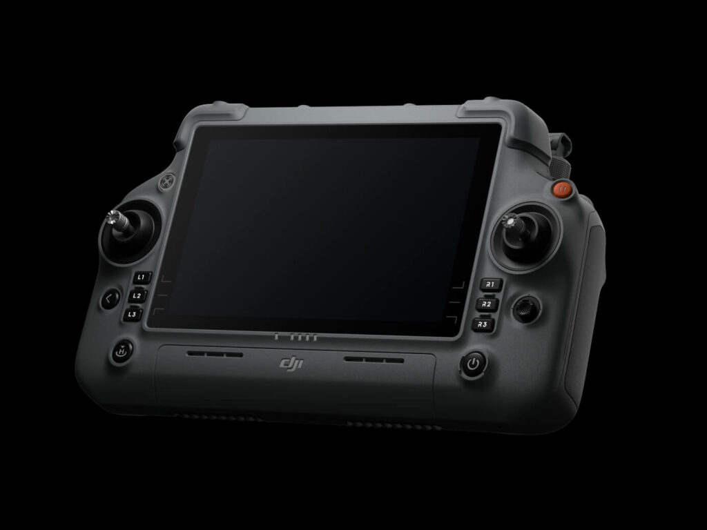
The radio control of the DJI RC Plus 2 Enterprise features a new high-brightness display, providing clear visibility even in direct sunlight. The radio control has an IP54 rating and operates in temperatures between -20°C and 50°C. It uses the O4 Enterprise video transmission system and features a series of integrated high-gain attennas, which enable high performance. It also supports O4 Enterprise and 4G hybrid transmission solutions, ensuring stable and smooth video transmission in urban and mountainous environments.
DJI Cellular Dongle 2 [14]
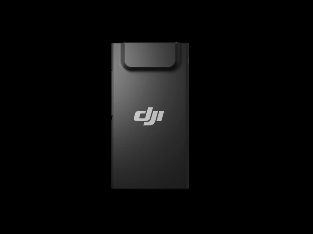
The DJI Cellular Dongle 2 enables video transmission over 4G network and is able to work in synergy with the O4 Enterprise video transmission system, thus ensuring safe flights even in complex environments. It also provides connectivity to the mobile network for radio control.
DJI Power 1000
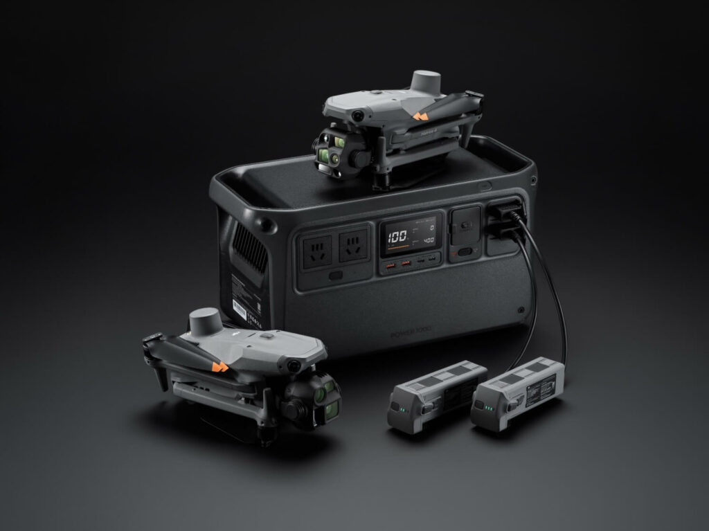
DJI Power 1000 can provide 200W fast charging for the smart batteries of the Matrix 4 series devices [20], which are fully recharged in 48 minutes. [21] It also has a 2200W AC output, providing reliability and power stability for outdoor operations. It can also be paired with the DJI Power 1kW car charger, which enables 1kW fast charging, supporting outdoor operations with continuous power and allowing uninterrupted travel.
D-RTK 3 high-precision multifunction station
DJI RC Plus 2 Enterprise
DJI Cellular Dongle 2 [14]
DJI Power 1000
The DJI AL1 headlamp is capable of illuminating subjects up to 100 meters away [16] and has two modes, always-on and strobe. Thanks to the stabilizer, it is able to connect and follow the camera's movements to ensure that the illuminated area is aligned with the camera's view. In addition, the spotlight is able to focus on a single subject and provide a wide field of view (FOV) by illuminating large areas.
The DJI AS1 speaker features outstanding sound power and a wide range. It has a transmission range of up to 300 meters and can output a volume of up to 114 decibels at a distance of 1 meter. [17] Supports recorded messages, multimedia import, and text-to-voice conversion. [18] It is also equipped with a real-time transmission system and echo suppression, [19] which improves the efficiency and flexibility of emergency search and rescue operations.
The beacon and speaker can operate independently or together to respond to different operational scenarios.
Software designed for
the industry
DJI Pilot 2
DJI Pilot 2’s interface has been completely updated, with a smart and customizable toolbar and support for various types of flight routes. It also includes virtual space templates and route preview functions, [22] to make operations more convenient and efficient. It can connect with FlightHub 2 to improve drone control operations and facilitate information sharing in the cloud, thus reducing the workload of frontline operators.
DJI Flighthub 2
Specially for the Matrix 4 series aircraft, DJI FlightHub 2 has been upgraded for radio control to enable a range of flight route planning functions, including remote takeoff and landing, 3D Smart image routes, geometric and slope routes. Operators can simultaneously control the payload and the aircraft through real-time flight control functions. During multiple drone operations, operators can synchronize multiple live streams on a single screen, creating a new and efficient air-to-ground operational experience.
* Users who purchase Matrix 4 series aircraft and initially connect to FlightHub 2 will receive live streaming minutes, map image shares and dedicated storage space.
DJI Terra
DJI Terra enables high-precision camera distortion correction for the 4E Matrix aircraft. It supports free offline PPK processing of visible light images and allows import of D-RTK 3 data, resulting in improved reconstruction accuracy. The software provides numerous 2D, 3D data and point cloud models suitable for various applications such as geographic information, emergency response and construction planning.
* One-year DJI Terra license provided with the purchase of Matrix 4E.
DJI Modify
DJI Modify enables intelligent editing of 3D mesh and point cloud models. When combined with the Matrix 4 series and DJI Terra, it can create an integrated solution for aerial surveying, modeling, model repair, and sharing.
DTAT 3.0
Once the thermography operations[2] with Matrix 4T are completed, the DTAT 3.0 thermal analysis tool can be used to mark, analyze and process the images, identifying abnormal temperature points.
DJI Pilot 2
DJI Flighthub 2
DJI Terra
DJI Modify
DTAT 3.0
The DJI AL1 headlamp is capable of illuminating subjects up to 100 meters away [16] and has two modes, always-on and strobe. Thanks to the stabilizer, it is able to connect and follow the camera's movements to ensure that the illuminated area is aligned with the camera's view. In addition, the spotlight is able to focus on a single subject and provide a wide field of view (FOV) by illuminating large areas.
The DJI AS1 speaker features outstanding sound power and a wide range. It has a transmission range of up to 300 meters and can output a volume of up to 114 decibels at a distance of 1 meter. [17] Supports recorded messages, multimedia import, and text-to-voice conversion. [18] It is also equipped with a real-time transmission system and echo suppression, [19] which improves the efficiency and flexibility of emergency search and rescue operations.
The beacon and speaker can operate independently or together to respond to different operational scenarios.
Open ecosystem for
developers
AI Developer
It provides the necessary tools for model training and certification process for third-party developers with access to on-board processing, contributing to the expansion of new fields of application for drone artificial intelligence.
PSDK
E-Port and E-Port Lite encryption authentication provides payload security, enabling the Matrice 4 series aircraft to have broader application scenarios.
MSDK
Mobile SDK 5 simplifies app development to control Matrice 4 Series. Mobile SDK 5 is completely open source and comes with production code samples of DJI Pilot 2 core modules, ensuring reliability.
Cloud API
With DJI Pilot 2’s built-in Cloud API (MQTT-based protocol), you can directly connect your Matrice 4 aircraft to third-party cloud platforms. You have access to the drone’s hardware, video streaming, and photo data without having to develop an app.
DJI Terra API
With the DJI Terra API, users can integrate the powerful mapping capabilities into their platforms, resulting in automated 2D and 3D reconstructions. In addition, users can customize photogrammetry operation flows as needed, enabling the operational results of Matrice 4E to better meet the needs of various industrial applications.
Security of user data
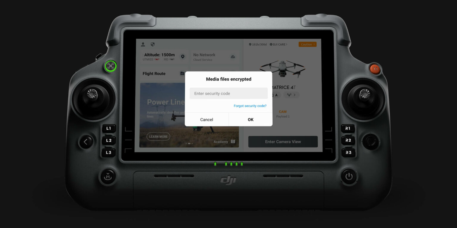
Local Data Mode
Erase all device data with one tap
AES-256 video transmission encryption
Cloud API
DJI Care Enterprise Plus and
extended warranty service
official for the first year[23]
DJI Care Enterprise Plus[24]
Comprehensive protection | Professional quality assurance | Exclusive service | Service starts with activation
Free repairs
Unlimited free repairs within the coverage limit.
Flyaway Coverage
1 time per year, smooth operation
Coverage for the entire fleet
Shared coverage for maximum protection
Free Shipping
Repairs with free postal shipment, extreme ease of service
Extended warranty service
During the service period, major parts [25] remain covered by the warranty
official, for extended product protection.
Applicable scenarios
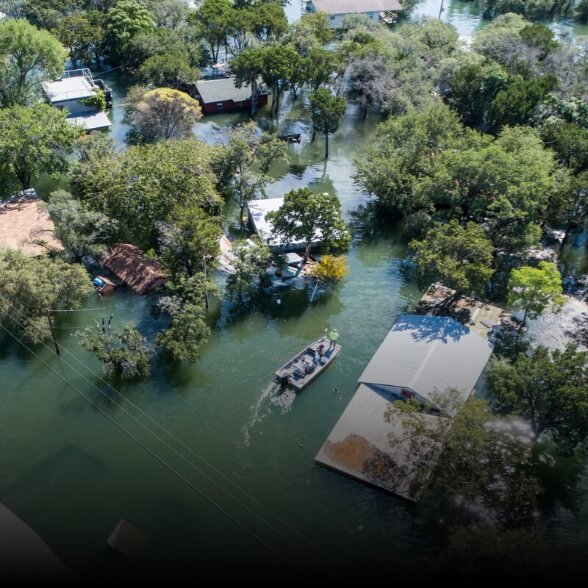
Public Safety

Inspection of power lines
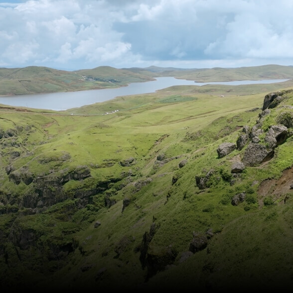
Information
geographic

Gas and Oil

Renewable energy
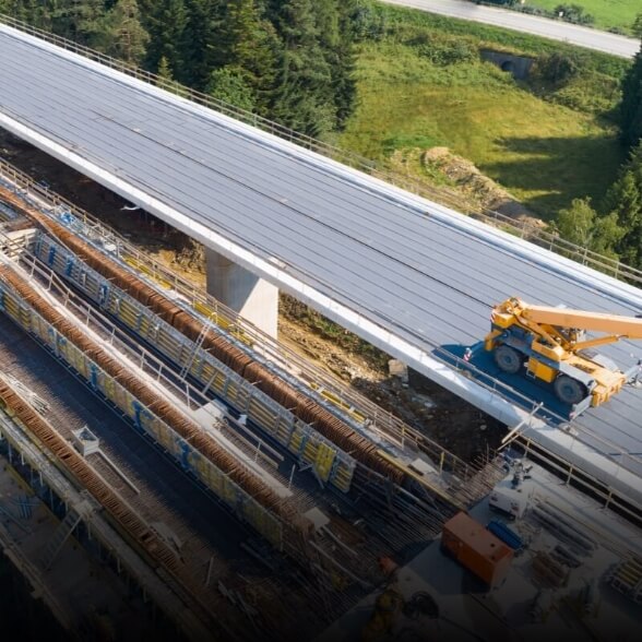
Roads and bridges

Maritime sector

Water saving
The era of intelligent flights
Call Us Now
for a free consultation on Hardware,
Software and ENAC.
Book Now
your free phone consultation with our Experts.
* Tested with a production model of the DJI Matrice 4 series in an enclosed environment under favorable conditions and an unobstructed wireless signal. Actual results may vary depending on environment, usage and firmware version.
** All videos and photos on this page were taken in strict compliance with local laws and regulations. Demonstrations, including wildlife, were taken and filmed from a safe distance and are used for reference only. Please observe local laws and regulations and ensure that the aircraft has obtained relevant certifications prior to flight.
1. D indicates the measurement distance.
2. Only available with 4T Matrice . DO NOT expose the infrared camera lenses to a strong energy source such as sun, lava or laser beams. Otherwise, the camera sensor may burn out and be permanently damaged.
3. Available only with 4T Matrice . NIR auxiliary light is suitable for camera illumination needs.
4. Measured when the drone is flying 100 meters above the ground, with the camera effectively capturing images.
5. Without installing speaker or beacon accessories, visual obstacle avoidance remains active in urban night lighting scenarios. Compared with the Mavic 3 Enterprise, it offers a longer operational lifetime.
6. Measured under standard lighting conditions from a horizontal position 10 meters away from the subject, with direct line of sight.
7. Shooting with the camera facing directly toward the subject.
8. Adjust the maximum horizontal speed to this value in Gain and Exposure Adjustment; this value was measured without any load, in a windless environment near sea level.
9. Data are strongly influenced by the environment and performance may vary under different scenarios. Actual performance will vary depending on the actual product delivered.
10. Current capabilities are insufficient to meet the mapping needs of urban areas. Future updates will continue to optimize flight paths and mapping solutions for urban areas.
11. At a GSD of 5 cm, with a frontal overlap rate of 80%, a lateral overlap rate of 70% and a flight speed of 15 m/s.
12. Between individual drones, margins of production tolerance are provided. Data are provided for reference purposes only. Please refer to the actual product supplied for specific information.
13. Data measured in an open, interference-free environment.
14. Purchasable separately. DJI Cellular Dongle 2 is not available in some countries and geographical areas. Please consult your local retailer for more details.
15. Purchasable separately. Installation of accessories may affect the safety performance of obstacle avoidance by the aircraft. Follow the instructions for use.
16. For reference only, this result obtained at a distance of one hundred meters from the subject is presented.
17. The data were collected in the experimental environment with an ambient temperature of 25 °C and are for reference only. Actual conditions may vary slightly depending on differences in software versions, audio source, specific environment and other factors. The final result depends on actual usage.
18. The current text-to-voice feature supports only Mandarin Chinese and English.
19. You need to upgrade to the latest firmware version.
20. The data are affected by the ambient temperature, and in case of overheating there may be a lowering of power.
21. Measured at 25 °C room temperature, with 0% to 100% charge.
22. Flight routes with Smart 3D images support this feature, but it is currently only available on Matrice 4E.
23. The service plan offered may vary by country or region. Please consult your local authorized dealer for more information.
24. Unlimited free repairs: Free repairs within the scope and amount of coverage; Free shipping: Available in geographic areas covered by DJI Care Enterprise. Additional costs, including logistics and customs costs, incurred outside the scope of coverage are the responsibility of the user; Flyaway coverage: Ability to take advantage of flyaway coverage service after associating the account and radio control via DJI Pilot 2; Fleet-wide coverage: Shared coverage can be extended to other DJI Enterprise devices associated with DJI Care Enterprise Plus within the same time period (30 calendar days) from initial activation and association.
25. For specific parts, see the DJI website – Service – After-Sales Service Policy.
