
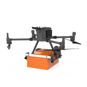
- DJI drone compatibility: Designed to integrate seamlessly with models such as DJI Matrice 300 and 350, facilitating implementation in aerial operations.
- Ultralight design: Minimizes the impact on the drone, allowing longer flights and agile maneuvers during survey operations.
- Advanced performance: Provide high-resolution data for detailed subsurface analysis, improving survey accuracy.
- Geophysical Surveys: Mapping of underground structures for environmental and engineering studies.
- Archaeological surveys: Identification of buried sites and artifacts without invasive excavation.
- Environmental monitoring: Subsurface analysis for geological hazard prevention and land management.
Featured products

Georadar Drone - Zond Aero 1000 NG GPR
Ultra-lightweight GPR system for geophysical and archaeological surveying on DJI Matrice 300/350. Single unit with Ethernet and WiFi connect
Georadar Drone - Zond Aero 500 NG
Ultralight single-unit GPR for advanced geophysical surveying on DJI Matrice 300/350. Real-time profile visualisation and WiFi/Ethernet conn
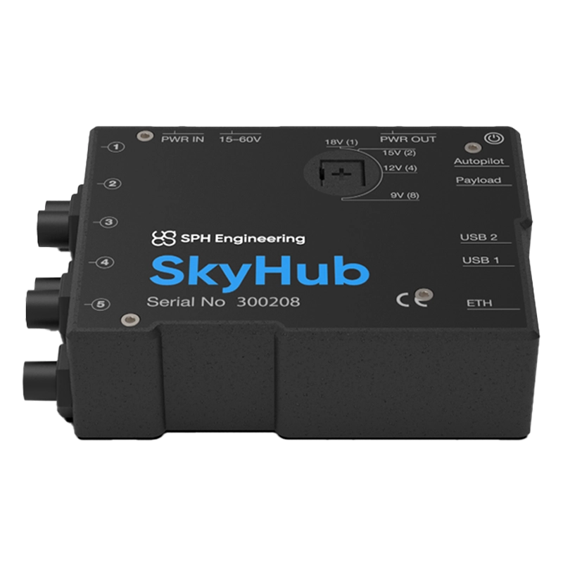
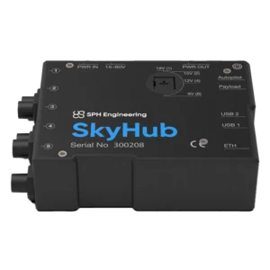
Skyhub
Advanced onboard computer for DJI drones that integrates specialised sensors (magnetometers, georadar, echosounder) and automates complex mi
Georadar
Showing all 3 results
-
✓ Pronta consegnaGeoradar, Georadar & Magnetometer Combo, UgCS - SPH
Georadar Drone – Zond Aero 1000 NG GPR
Ultra-lightweight GPR system for geophysical and archaeological surveying on DJI Matrice 300/350. Single unit with Ethernet and WiFi connectivity for real-time analysis. Available at DroneBase, DJI Gold 5 Dealer.
SKU: n/a -
✓ Pronta consegna
-
✓ Pronta consegna
Advanced Ground Penetrating Radar Technology
Our georadar drone systems integrate state-of-the-art GPR technology with professional drone platforms to deliver unmatched subsurface mapping capabilities. The Zond Aero series combines high-frequency radar sensors with advanced signal processing algorithms, enabling precise detection of buried utilities, archaeological artifacts, and geological features from aerial platforms.
These systems offer significant advantages over traditional ground-based GPR methods, including rapid area coverage, access to difficult terrain, and consistent survey altitude for uniform data quality across large survey areas.
Archaeological and Cultural Heritage Applications
Georadar drones revolutionize archaeological surveying by providing non-invasive subsurface investigation capabilities across extensive sites. Our GPR-equipped drones can detect buried structures, foundations, and artifacts while preserving site integrity and reducing excavation costs.
The high-resolution imaging capabilities enable archaeologists to map complex subsurface features with precision, supporting heritage preservation projects and research initiatives throughout Italy and Europe.
Infrastructure and Utility Mapping Solutions
Professional georadar drone systems excel in infrastructure inspection and utility mapping applications, providing accurate subsurface data for construction planning and maintenance operations. These systems can detect underground pipes, cables, and structural foundations with exceptional accuracy.
Real-time data processing capabilities enable immediate analysis and decision-making in the field, reducing project timelines and improving safety protocols for excavation and construction activities.
Geological Survey and Environmental Monitoring
Our georadar drone technology supports comprehensive geological surveys and environmental monitoring programs, offering detailed subsurface analysis for research and commercial applications. The systems provide valuable data for groundwater studies, soil analysis, and geological mapping projects.
Advanced penetration capabilities and multi-frequency analysis enable detection of various subsurface conditions, supporting environmental consulting, mining exploration, and geotechnical engineering applications across diverse geological settings.
Why buy from DroneBase
DJI Gold 5 Partnership
Exclusive access to latest georadar drone technology with comprehensive manufacturer support and warranty coverage.
ISO 9001:2015 Certified
Quality-assured service delivery with certified processes ensuring consistent professional standards and reliability.
Italian Technical Expertise
Local engineering support and training programs delivered by certified specialists based in Rimini.
Enterprise-Grade Solutions
Professional-only product portfolio designed specifically for demanding commercial and research applications.
Frequently asked questions
Penetration depth varies by frequency and soil conditions. The Zond Aero 500 NG achieves up to 15 meters depth in optimal conditions, while the 1000 NG provides approximately 10 meters with higher resolution for detailed subsurface analysis.
Yes, commercial georadar drone operations require appropriate ENAC drone pilot certification and operational authorizations. DroneBase provides guidance on regulatory compliance and training requirements for professional GPR drone operations.
Professional georadar drone system pricing varies based on specifications and configuration requirements. Contact our specialists for detailed quotations including hardware, software licensing, and training packages tailored to your specific applications.
Georadar drones effectively detect metallic and non-metallic utilities including pipes, cables, and conduits. Detection capability depends on material contrast, depth, and soil conditions. Our systems excel at mapping complex utility networks in urban environments.
Effective georadar drone operation requires both drone piloting certification and specialized GPR data interpretation training. DroneBase offers comprehensive training programs covering flight operations, data acquisition protocols, and analysis software utilization.
Soil moisture significantly impacts GPR penetration and resolution. Recent rainfall can reduce penetration depth but may improve target contrast. Our systems include environmental compensation features and our specialists provide optimal survey timing recommendations.
Want a consultation or a demo?
Our DJI Enterprise certified technicians help you choose the right configuration. No commitment.
+39 0541 1790411


