
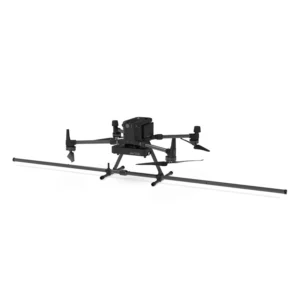
- DJI drone compatibility: Designed to integrate seamlessly with models such as DJI M300 and M350 RTK, facilitating implementation in aerial operations.
- Portable design: Lightweight and compact structure, ideal for operations in hard-to-reach environments.
- Integrated GPS: Ensures precise geotagging of collected data, improving the accuracy of surveys.
- Geophysical surveys: Mapping of magnetic anomalies for geological and mining studies.
- Archaeological surveys: Identification of buried structures and artifacts without invasive excavation.
- Metal object detection: Locating pipes, cables and other underground metal objects.
Featured products

Drone magnetometer - Sensys MagDrone R4
Ultra-portable magnetometer for DJI M300/M350 RTK drones with integrated GPS for surveying large inaccessible areas. Ideal for mineral explo
Drone magnetometer - Sensys MagDrone R3
Ultra-portable magnetometer with integrated GPS for DJI M300/M350 RTK drones, perfect for surveys across vast inaccessible areas. Ideal for
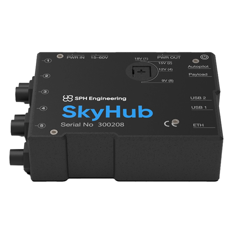
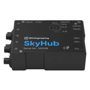
Skyhub
Advanced onboard computer for DJI drones that integrates specialised sensors (magnetometers, georadar, echosounder) and automates complex mi
Magnetometer
Showing all 6 results
-
✓ Pronta consegnaMagnetometer
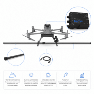
Magnetometer Integration Kit DJI Matrice 350/400
The Magnetometer Integration Kit DJI Matrice 350/400 is the complete solution for professional use of SENSYS MagDrone magnetometers on latest generation DJI Matrice. Includes the SPH Engineering SkyHub 3 onboard computer, radar altimeter, Smart Cable v3 and software packages for True Terrain Following and payload management. Plug & play installation for geophysical, archaeological, environmental and UXO surveys. Distributed by DroneBase.
SKU: DB-SPHICM -
✓ Pronta consegnaMagnetometer, UgCS - SPH
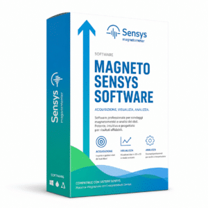
SENSYS MAGNETO® Desktop | Magnetic Data Analysis Software
The SENSYS MAGNETO® Desktop is the professional SENSYS GmbH software for the comprehensive analysis of magnetic and electromagnetic data from area and borehole surveys. Automatic calculation of position and size of suspicious objects, color-coded maps, multi-dataset management, integrated text editor for reporting. Standard for UXO, archaeology, geophysics and offshore investigations. Compatible with the entire SENSYS ecosystem (MagDrone, MagWalk, MX, BM2). DroneBase is official reseller.
SKU: IS-SENSYS-MAGNETO -
✓ Pronta consegnaGeoradar & Magnetometer Combo, Magnetometer
Drone magnetometer – Sensys MagDrone R3
Ultra-portable magnetometer with integrated GPS for DJI M300/M350 RTK drones, perfect for surveys across vast inaccessible areas. Ideal for mining exploration, archaeology and security. Available at DroneBase, DJI Gold 5 Dealer.
SKU: n/a -
✓ Pronta consegnaGeoradar & Magnetometer Combo, Magnetometer
Drone magnetometer – Sensys MagDrone R4
Ultra-portable magnetometer for DJI M300/M350 RTK drones with integrated GPS for surveying large inaccessible areas. Ideal for mineral exploration, archaeology and security applications. Available at DroneBase, DJI Gold 5 Dealer.
SKU: n/a -
✓ Pronta consegna
Cesium Vapor Magnetometer Technology
Our Sensys MagDrone systems utilize state-of-the-art cesium vapor sensors that deliver unmatched sensitivity and accuracy in airborne magnetic surveys. These professional-grade instruments detect magnetic field variations as small as 10 picotesla, enabling precise detection of subsurface geological features and mineral deposits.
The advanced sensor arrays provide superior signal-to-noise ratios compared to traditional fluxgate magnetometers, ensuring reliable data collection even in challenging environmental conditions. Each system incorporates sophisticated compensation algorithms to minimize platform interference and deliver research-quality magnetic field measurements.
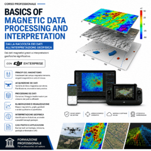
High-Resolution Geological Surveys
DroneBase magnetometer systems excel in detailed geological mapping applications, providing surveyors with unprecedented spatial resolution and coverage efficiency. The multi-sensor configurations enable rapid data collection over large areas while maintaining the precision required for commercial exploration projects.
Professional survey teams utilize our magnetometer solutions for mineral exploration, oil and gas prospecting, archaeological investigations, and environmental assessments. The combination of drone mobility and high-sensitivity sensors delivers comprehensive magnetic anomaly maps that guide critical exploration decisions.
Integrated Data Processing Solutions
The Skyhub platform transforms raw magnetometer data into actionable insights through advanced processing algorithms and visualization tools. Real-time data transmission capabilities allow survey teams to monitor data quality during flight operations, ensuring optimal survey efficiency and reducing the need for repeat flights.
Comprehensive post-processing features include gradient calculations, filtering options, and anomaly detection algorithms specifically designed for geological applications. The platform supports multiple data export formats for seamless integration with existing geological interpretation software and workflows.
Professional Survey Applications
Commercial operators rely on our magnetometer systems for diverse applications including mineral exploration, archaeological surveys, utility detection, and environmental monitoring. The systems excel in detecting ferrous objects, mapping geological structures, and identifying subsurface anomalies that indicate valuable mineral deposits.
Key applications include: iron ore exploration, archaeological site mapping, unexploded ordnance detection, geothermal resource assessment, and hydrocarbon microseepage surveys. Each application benefits from the superior sensitivity and spatial resolution that only professional-grade cesium vapor magnetometers can provide.
Enterprise-Grade System Reliability
Our magnetometer systems are engineered for demanding commercial operations with robust construction and reliable performance in challenging field conditions. Each system undergoes rigorous quality control testing and calibration procedures to ensure consistent accuracy across multiple survey campaigns.
Professional-grade components and redundant safety systems minimize operational downtime while maximizing data collection efficiency. The modular design facilitates rapid deployment and maintenance, ensuring your survey operations maintain peak productivity throughout extended field campaigns.
Why buy from DroneBase
DJI Gold 5 Partnership
Authorized premium dealer status ensures genuine products, comprehensive warranties, and priority technical support for all magnetometer systems.
ISO 9001:2015 Certified
Quality management certification guarantees consistent service standards and reliable delivery of professional magnetometer solutions.
Expert Technical Consultation
Specialized knowledge in geological surveying applications helps optimize magnetometer configurations for your specific project requirements.
Comprehensive Training Programs
Professional operator training ensures maximum efficiency and accuracy in magnetometer data collection and processing workflows.
Frequently asked questions
Professional drone magnetometer systems typically range from €150,000 to €300,000 depending on sensor configuration, processing software, and support packages. Contact our sales team for detailed quotations based on your specific surveying requirements and operational needs.
Yes, commercial magnetometer operations require appropriate drone pilot certifications, flight permissions from aviation authorities, and may require additional permits for geological surveying activities. We provide guidance on regulatory compliance for magnetometer operations in Italy and EU markets.
Professional cesium vapor magnetometers deliver sensitivity levels of 10-15 picotesla with absolute accuracy better than 0.1 nanotesla. This precision enables detection of subtle magnetic anomalies associated with mineral deposits, archaeological features, and geological structures.
Drone magnetometry provides 10-50 times faster data collection rates compared to ground surveys while maintaining comparable accuracy. Aerial platforms also access difficult terrain and provide consistent sensor elevation, resulting in higher quality magnetic gradient measurements.
Operators need commercial drone pilot certification, specialized magnetometer system training, and geological survey methodology knowledge. We offer comprehensive training programs covering flight operations, data collection procedures, and processing software utilization.
While magnetometers primarily detect ferrous materials, they can identify geological structures and alteration zones associated with non-ferrous mineral deposits. Combined with other geophysical methods, magnetometry provides valuable exploration data for diverse mineral targets.
Want a consultation or a demo?
Our DJI Enterprise certified technicians help you choose the right configuration. No commitment.
+39 0541 1790411


