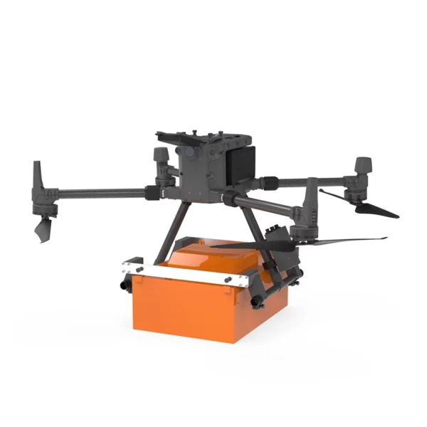

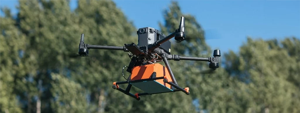
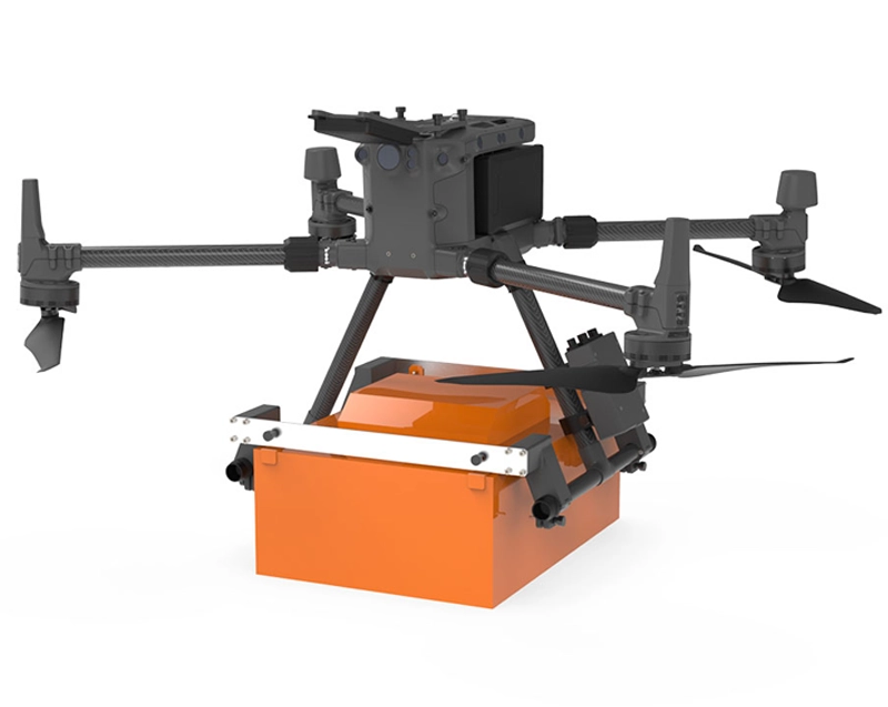
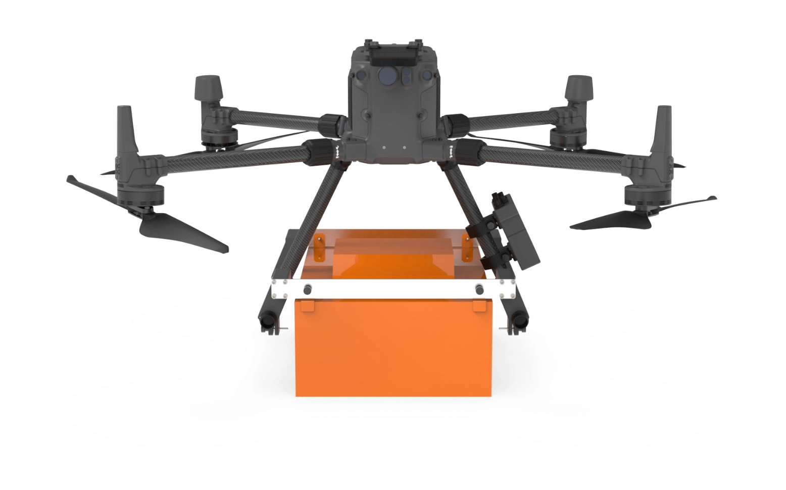
Georadar Drone – Zond Aero 500 NG
GPR georadar system for drone compatible with DJI Matrice 300/350.
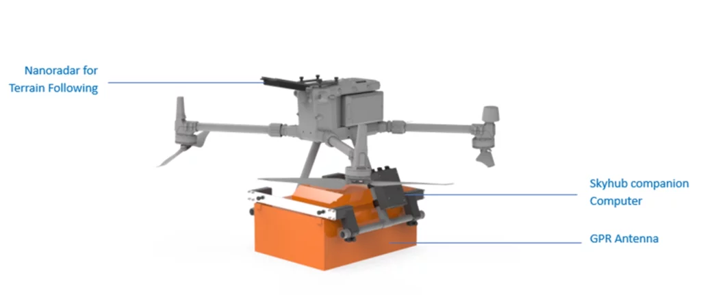
Zond Aero 500 is an ultralight single-unit GPR specially designed for portable solutions. The device can be used as stand-alone on-board equipment with power supply from external source and Ethernet cable connection or inside the fully protective waterproof case with its own built-in lithium-ion battery and WiFi.
The user receives real-time information in the form of a radiolocation profile (sometimes also referred to as a radargram). The data is recorded on a hard disk for further use(processing, printing, interpretation, etc.) at the same time.
Here you will see examples of radiolocation profiles…
Zond Aero 500 has a built-in 500 MHzshielded antenna for
single-channel operation over different time intervals.
Zond Aero 500 can be optionally equipped with the shockproof trolley.
Key Features of the Zond Aero 500
- GPR system for DJI M300/350 RTK.
- Includes carrying kit and stands for DJI M300 RTK.
- Type Single-channel with shielded antenna
- Central frequency 500 MHz
- Operating bandwidth 200-900 MHz (-12 dB)
- 512 samples per track
- Sampling frequency 25600 samples/second
- Scanning speed 50 scan/s
- Example of 16-bit digital raw data output
- Time interval Selectable time interval 50, 100, 200 or 300ns
- Depth Up to 4 meters in average normal soil with time interval of 100 ns
- Data format Standard geophysical SEGY data format (.sgy) with track geotagging
Zond Aero 500 has a built-in 500 A antenna for single-channel operation on different time intervals. Zond Aero 500 can be optionally equipped with the cart for ground use equipped with Odometer (requires topographic antenna for GPR data log). All georadar parameters are computer-controlled, so many hardware features are described here…
Georadar Drone Applications
- Ground Mine Search, UXO (Unexploded Ordnance)
- Archaeology
- Search for any metal objects weighing a few hundred grams or more lying underground
- Perform geological mapping in the exploration of extractable minerals and other extractable resources
- Identify the spatial distribution of ore bodies by looking for regional variations in the magnetic field
- Conduct geological investigations to discover anomalies
- Monitor tailings storage facility (TSF) facilities to prevent potential accidents
- Perform moisture analysis of TSFs to minimize hazardous leakage
- Conducting stratigraphic horizon modeling.
GPR Zond Aero 500 Standard Kit:
What the Kit Includes:
1 x Zond Aero 500 NGGPR system with 500 MHz center frequency
1 x Prism 2 Data Acquisition/Processing software
1 x NANUK protectivecase (also used for ground surveys)
1 x 99 W/h Li-Ion battery integrated into the case
1 x Wi-Fi router integrated into the case
1 x Charger
1 x Tow rope for terrestrial surveys
1 x Mounting kit to fix GPR system on the DJI M300/M350 RTK drone
Drone combo kit:
What the kit includes:
1 x Zond Aero 500 NGGPR system with 500 MHz center frequency
1 x Prism 2 Data Acquisition/Processing software
1 x NANUK protectivecase (also used for ground surveys)
1 x 99 W/h Li-Ion battery integrated into the case
1 x Wi-Fi router integrated into the case
1 x Charger
1 x Tow rope for terrestrial surveys
1 x Mounting kit to fix GPR system on the DJI M300/M350 RTK drone
1 x Drone Matrice 350 RTK
4 x Batteries TB 65
1 x BS65 Charging Station for Drone Batteries
1 x SkyHub Kit with Terrain Following Nanoradar
1 x UGCS Pro mission planning software
1 x Skyhub Software Pakage for GPR
Technical Data GPR Zond Aero 500
Type | Single-channel with shielded antenna |
Center frequency | 500 MHz |
Operating bandwidth | 200-900 MHz (-12 dB) |
Sampling | Real Time Sampling (RTS) with high hardware stacking |
Samples per scan | 512 per trace |
Samples rate | 25600 samples/second |
Scan rate | 50 scans/s |
Sample output | 16-bit digital raw data |
Time range per sample | Selectable time range 50, 100, 200 or 300ns |
Depth | Up to 4 meters in average normal soil with 100ns time range |
Data format | Standard Geophysical SEGY Data Format (.sgy) with traces geotagging |
DOCUMENTATION & DATA SETS | |
Data Sheet | |
User Manual | |
Data Samples | |
ENVIRONMENTAL | |
Temperature | -20°C to 60°C internal temperature |
Humidity | 96% non-condensing |
Ingress protection | IP68 in a protective box (used for transportation and for ground surveys) IP52 in airborne variant |
MECHANICAL | |
Size (L x W x H) | • 41 x 31 x 16 cm – airborne configuration |
Weight | • 2.1 kg – airborne configuration without mounting kit for the drone |
BATTERY | |
Airborne variant | Drone main battery is used to provide power to the GPR using standard power socket of the drone intended for payload |
Ground surveys | The battery is integrated into a protective box, operating time up to 12 hours 99 W/h Li-Ion |


There are no reviews yet.