Sniffer4D 1ppm TDLAS CH4 Sensing
Sniffer4D Multi-pass TDLAS Hyper-local Methane Detection & Mapping Products
Methane detection sensor for drones with a resolution of 1 ppm,
offering intuitively displayed data to decision makers.
Traditional Solutions
Poor Flexibility in Deployment
Scenarios in energy, agriculture, solid waste treatment and scientific research include various sources of methane emissions, requiring a new device to reduce costs and improve efficiency.
Difficulty in Detecting Low Concentrations
Stationary monitoring equipment has limitations in detecting methane leaks at low concentrations.
Limited Work Scenario and Long Response Time
Laser scanning can be easily affected by object surfaces or obstacles.

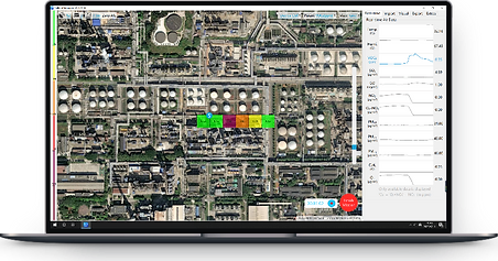

Sniffer4D 1ppm TDLAS Methane Sensing
& Mapping System
Compatible with a variety of UAVs, supports up to 3 external modules for customized tasks with different configurations.

Advanced real-time data visualization and analytical software – Sniffer4D Mapper
Intuitive and insightful real-time information for decision making.

Sniffer 4D 1ppm TDLAS
Methane Sensing Module
Sniffer4D Mini2 base unit or Sniffer4D 1ppm NDIR CO2 Sensing & Mapping System required.

Tunable Diode Laser Absorption Spectroscopy (TDLAS)
Detection Method: Tunable Diode Laser Absorption Spectroscopy (TDLAS)
Methane detection sensor for drones
Superior Gas Selectivity
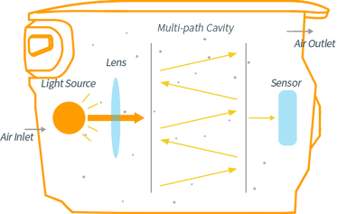
Sensitive only to methane, with quantitative detection based on TDLAS closed-path and contact.
Short Response Time
The built-in air pump and ultra-compact cabin enable a response to changes in concentration in seconds or less.
Internal Vibration ReductionMechanism
Ultra-compact and lightweight structural design with an internal vibration reduction mechanism significantly reduces the effects of vibration from moving platforms, ensuring the best data quality.
Range
0~10000ppm
Resolution
1ppm(Static Noise Level <300ppb)
Detection Limit
1~1.5ppm
ldeal Operating Temperature
15~25℃ (Built-in 2-stage temp.control)
Conforming to
USEPA Method 21


Appropriate choice for your operation
Gas from the air

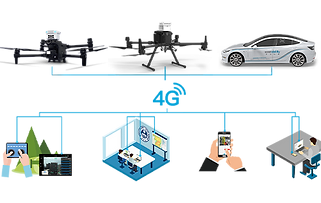
Built-in 4G connectivity for real-time data transmission to one or more points. Supports cluster communication.
Smart LEDs
Sniffer4D’s front and rear high-brightness warning LEDs automatically change color based on different gas concentrations, alerting on-site personnel to hazards.

Real-Time Data Analysis and Visualization
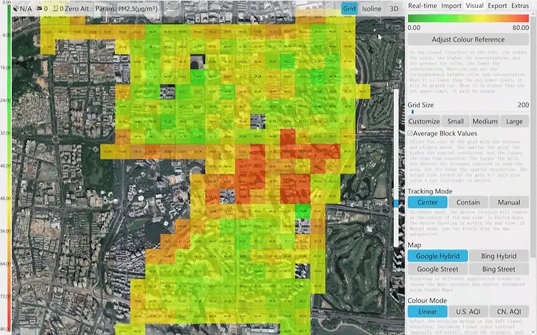
Sniffer4D Mapper software visualizes and analyzes data from one or more Sniffer4Ds in real time. Three types of visualization (2D grid map/ 2D isoline map/ 3D point cloud map) provide intuitive and detailed information for decision makers.


Delivering Results with One Click
After a mission, just click a button to generate a PDF report containing the main results, or a CSV file with all the raw data.
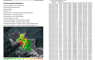
Post-Mission Analysis
Historical missions can be downloaded and uploaded to Sniffer4D Mapper for post-mission analysis, taking full advantage of the data for GHG analysis.


Complete Workflow
The complete workflow allows users to easily complete data collection and report work in one mission.

Talk to our Expert
DroneBase provides you with Expert Consultants
who can recommend the most appropriate product for your needs
and meet all your needs
Hardware, Software and ENAC.
Call us NOW!
+39.0541.1790411
Request information
Please enter your details below, our consultant will
contact you back as soon as possible to provide you with a
Free Consultation
"*" indicates required fields


