
- Real-time monitoring: Allows you to observe the status of crops and intervene promptly in case of abnormalities.
- Resource optimization: Helps to use fertilizer and water more efficiently, reducing waste and costs.
- Yield increase: Provides accurate information to improve agricultural productivity.
- Crop management: Monitoring plant health, growth and stress.
- Soil mapping: Analysis of soil composition and moisture for optimal seeding.
- Agricultural planning: Support in crop rotation and integrated pest management.
Featured products
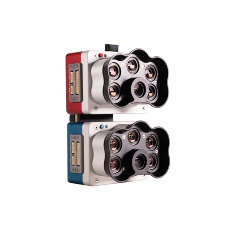
RedEdge-P Dual
Dual multispectral sensor with 10 spectral bands for advanced vegetation analysis and precision agriculture. Resolution exceeding Landsat an

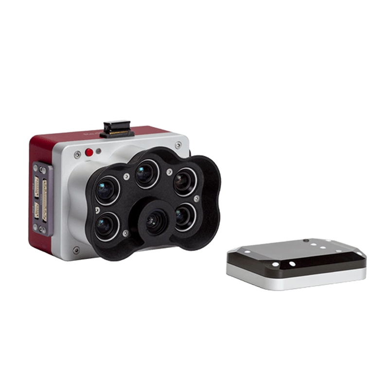
Micasense Altum-Pt.
Multispectral and thermal camera with ultra-high resolution panchromatic imaging for precision agriculture. Dual spatial resolution and CFex
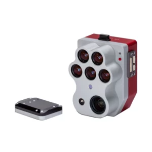
Micasense RedEdge-P
Multispectral camera with 6 simultaneous bands and CFexpress memory for high-speed acquisition. Double resolution and advanced analysis for
Sensors for agriculture
Showing all 3 results
-
✓ Pronta consegnaMultispectral, Sensors for agriculture, Thermography with Drones
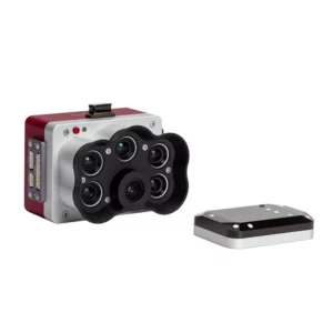
Micasense Altum-Pt.
Multispectral and thermal camera with ultra-high resolution panchromatic imaging for precision agriculture. Dual spatial resolution and CFexpress storage for rapid acquisition and efficient data management. Available at DroneBase, DJI Gold 5 Dealer.
SKU: n/a -
✓ Pronta consegna
-
✓ Pronta consegna

Multispectral Imaging Technology for Modern Agriculture
Professional agricultural sensors capture invisible light spectra that reveal critical crop health information invisible to the human eye. Our Micasense sensors utilize precisely calibrated narrow-band filters to measure plant reflectance across red, green, blue, red edge, and near-infrared wavelengths.
These specialized sensors enable calculation of vegetation indices like NDVI, NDRE, and GNDVI, providing quantifiable metrics for crop vigor, nitrogen levels, and stress detection across entire fields with centimeter-level accuracy.
Thermal and RGB Integration for Comprehensive Field Analysis
The Altum-Pt combines multispectral capabilities with radiometric thermal imaging and high-resolution RGB capture in a single integrated system. This tri-sensor approach eliminates the need for multiple flights while providing comprehensive data for irrigation management, pest detection, and yield prediction.
Thermal data reveals water stress patterns and irrigation inefficiencies, while RGB imagery provides visual context and enables accurate plant counting and field boundary mapping for complete agricultural intelligence.
Precision Calibration and Data Accuracy Standards
All Micasense sensors feature factory radiometric calibration and include Downwelling Light Sensor (DLS) technology for real-time illumination compensation. This ensures consistent, repeatable measurements across different flight conditions and seasons.
The integrated GPS and IMU systems provide precise geolocation data for each captured pixel, enabling accurate temporal comparisons and integration with existing farm management systems and GIS workflows.
Professional Software Integration and Analysis Workflows
Agricultural sensors seamlessly integrate with industry-standard processing software including Pix4Dfields, Agisoft Metashape, and Atlas by Micasense. These platforms automatically generate vegetation index maps, prescription maps, and detailed analytics reports.
Advanced features include automated anomaly detection, variable rate application mapping, and historical trend analysis that transforms raw sensor data into actionable insights for precision agriculture decision-making.
Enterprise-Grade Durability and Flight Performance
Designed for demanding agricultural environments, these sensors feature ruggedized construction with vibration isolation and weather-resistant housing. Global shutter technology eliminates rolling shutter distortion during high-speed flights and windy conditions.
Optimized power consumption and lightweight design ensure extended flight times while maintaining payload capacity for additional equipment like RTK GPS modules or spray systems on professional drone platforms.
Why buy from DroneBase
DJI Gold Partner Excellence
Highest certification level ensures expert technical support and authentic professional equipment.
ISO 9001:2015 Quality Assurance
Certified quality management guarantees reliable service and professional-grade solutions.
Agricultural Expertise
Specialized knowledge in precision farming applications and sensor integration requirements.
Enterprise Support Network
Dedicated technical assistance and training programs for professional agricultural operations.
Frequently asked questions
Professional agricultural sensors typically range from €5,000 to €15,000 depending on specifications and capabilities. Contact our team for detailed quotations including sensor, software licensing, and support packages tailored to your specific agricultural requirements.
Yes, most professional agricultural analysis requires specialized software like Pix4Dfields or Atlas by Micasense. We provide guidance on software selection and can arrange licensing packages that complement your sensor investment for complete workflow solutions.
All crops benefit from multispectral monitoring, with particular advantages for corn, soybeans, wheat, vineyards, and specialty crops. High-value crops like almonds, citrus, and vegetables show excellent ROI through early stress detection and precision input management.
Most agricultural sensors perform optimally at 80-120 meters altitude, providing 2-4cm ground sampling distance. This altitude balances area coverage efficiency with detail resolution needed for accurate vegetation index calculations and anomaly detection.
Multispectral sensors require consistent lighting conditions for accurate results. Light overcast can work with DLS compensation, but heavy clouds affect data quality. Thermal sensors in the Altum-Pt can operate in varied conditions for irrigation and stress monitoring.
Collection frequency depends on crop type and growth stage. Generally, bi-weekly flights during critical growth periods provide optimal monitoring, with increased frequency during stress periods or before major management decisions like fertilizer or irrigation adjustments.
Want a consultation or a demo?
Our DJI Enterprise certified technicians help you choose the right configuration. No commitment.
+39 0541 1790411


