Drones for Photogrammetry and Topographic Surveying
Discover the best drones for photogrammetry with interchangeable payloads,
Precision RTK GPS systems and dedicated data processing software.
Millimeter Accuracy in Surveys
Get extremely accurate data with high-precision photogrammetry drones.
Saving Time and Costs
Reduce operational time and costs with fast and efficient aerial surveys for every project.
Access to Advanced 3D Maps
Create detailed orthophotos and three-dimensional models with integrated and intuitive software.
Versatility in Every Scenario
Perfect for topographic surveys in hard-to-reach urban and natural areas.
Professional Solutions for Photogrammetry
Leverage advanced technologies to achieve accurate, fast and efficient surveys. Our professional photogrammetry drones are designed to deliver millimeter results, ideal for 3D mapping, detailed orthophotos, and topographic analysis.
With a combination of state-of-the-art sensors and integrated software, our solutions turn every project into a success, ensuring accuracy and saving time
Learn more and revolutionize the way you work!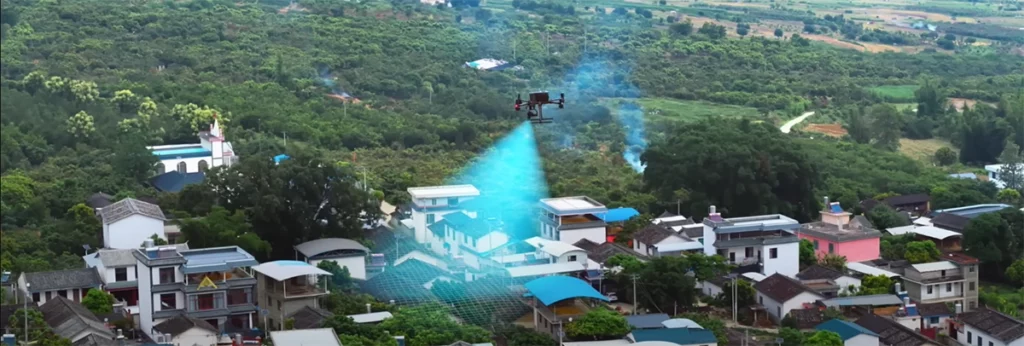
Not Just Drones: Integrated Solutions for Photogrammetry
Photogrammetry is not just about drones, but about tools and processes working in synergy. We offer comprehensive solutions that combine:
- Professional drones with high-precision sensors.
- Advanced software for data processing, 3D mapping and creation of detailed orthophotos.
- Assistance and training to maximize the efficiency of your workflow.
With our integrated solutions, you will have everything you need to tackle your projects with precision and ease. Discover the future of photogrammetry!
Do you have questions? We have the answers!The advantages of drone photogrammetry
Traditional photogrammetry is often complex, slow and expensive. The need for heavy instruments and extensive field experience makes surveying a laborious process, prone to errors and difficulties, especially in hard-to-reach areas.
Have you ever found yourself having to repeat a survey because of inaccurate data? Have you ever lost valuable time due to ineffective tools?
Any mistake or delay in surveying can compromise the quality of your project, increase costs and leave your clients dissatisfied. The risk of relying on old techniques puts you at a disadvantage compared to your competitors, who use innovative tools to achieve fast and accurate results.
Staying tied to the past is not an option. Change is needed.
Click now and start the change!Millimeter Accuracy
Acquire highly accurate data essential for topographic surveys, 3D mapping, and detailed analysis. Drones provide accuracy that eliminates errors and improves the quality of work.
Efficiency and Time Saving
Forget long days in the field. Photogrammetry drones dramatically reduce operational time, allowing you to complete complex projects in a fraction of the time compared to traditional methods.
Access to Difficult Terrain
Drones allow you to reach inaccessible or dangerous areas without risk to personnel. Mountainous areas, deep gorges or complex industrial sites will no longer be a problem.
Reducing Operating Costs
With the speed and efficiency of drone photogrammetry, you lower operational expenses, reducing the need for large teams and heavy equipment.
Happy Customer 0 K+ Marketing Expert 0 + Leads Generated 0 M+ Reveneu Driven 0 B+What results can I achieve?
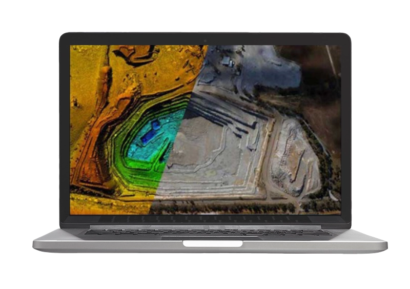
- Digital terrain models (DTM)
- Digital surface models (DSM)
- Geotif .tiff, XYZ .xyz, ASCII GRID .asc, Autodesk .dwg/dxf
- Cartographic representation (georeferenced orthomosaics)
- Geotif .tiff
- Clouds of dots
- ASPRS .las, LAZ .laz, xyz point cloud .txt.
- 3D Models
- Wavefront .obj, 3ds models .3ds, Stanford .ply, Autodesk 3dface/polyline .dwf
Secondary Products
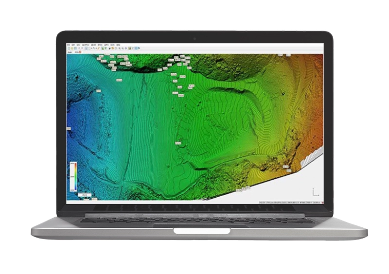
- Contour lines (contours)
- Area/volume calculation
- Digitization to CAD/GIS
- Acclivity analysis
- Point cloud classification
- Extraction of sections
- Spherical panoramic images
Flight Planning
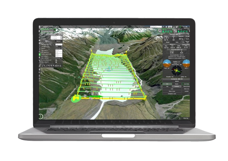
With advanced flight planning software such as UGCS or DJI Flight Hub you have the ability to manage every variable in your survey, including the ability to follow the terrain, on standard DEM or custom DEM, which can be imported directly into the program.
More DetailsProcessing and Post Processing

Agisoft Metashape e DJI Terra are professional-level photogrammetry software used worldwide by Technicians and Professionals. Metashape and DJI Terra allow you to Generate 3D Space Models from georeferenced photos.
Taking advantage of Structure for Motion’s proprietary algorithms, these powerful photogrammetry software enable all typical drone photogrammetric survey outputs, such as clouds, DSMDTM, contour lines, and volume calculations.
More DetailsTargeted Training Courses
DroneBase Academy in addition to providing courses for obtaining the Drone License offers Professional Training Courses aimed at enabling you to enter the world of drone work immediately that include Theoretical-Practical classes with experienced and qualified teachers in the various fields of application of these means.
Basic Photogrammetry Course
One-day (8-hour) introductory course aimed at those who are new to the world of drones and have no expertise in geographic/topographic data
Download ElaborateAdvanced Photogrammetry Course
Advanced 1-day (8-hour) course aimed at those who already have technical skills in surveying such as surveyors, engineers and want to use the Drone as a working tool.
Download ElaborateWhat They Say About Us
Lorem ipsum dolor sit amet, consectetur adipiscing elit.
[trustindex no-registration=”google”]
FOR FREE with all our “combos.”1 x Free membership to our Pilots Network*
1 x 2-hour Introductory Course – At our office
1 x 2-hour Silver Remote Support (5 tickets) – Teleassistance
1 x Complete Enac Manuals
1 x Dronist’s Rate Book 2024
1 x Manual: How to Fly in the Red Zone
1 x Express Shipping
*Becoming a part of our Pilots Network you will be able to receive Job Offers in Italy and Abroad
Discover the Best Drones for Photogrammetry
We have created ready-to-use combos for our professional customers, expressly designed for drone photogrammetry,
all professional-range products, equipped with RTK systems and ultra-high resolution cameras with calibrated optics,
which guarantee maximum precision and accuracy, combined with ease of use and uncompromising safety.
DJI Mavic 3 Enterprise Combo Mapper
 € 2,89
per day
- Scanning capacity: 200hA/hour
- Accuracy: 1 cm + 1 ppm (without GCP)
- Camera Resolution: 20mp (CMOS 4/3)
- Interchangeable lenses: No
- Flight Autonomy: 45 minutes
- Operating radius: 8km

Discover the benefits of Operational Rental
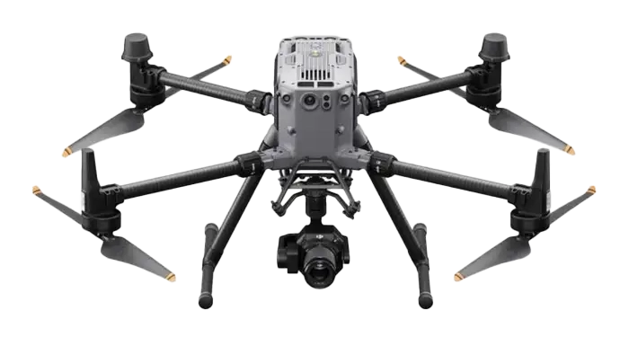
DJI Matrice 350 RTK + P1 Mapper Combo
 € 2,99
per day
- Scanning capacity: 300hA/hour
- Accuracy: 1 cm + 1 ppm (without GCP)
- Camera Resolution: 45mp (full-frame)
- Interchangeable lenses: Yes
- Flight Autonomy: 55 minutes
- Operating radius: 8km
Discover the benefits of Operational Rental
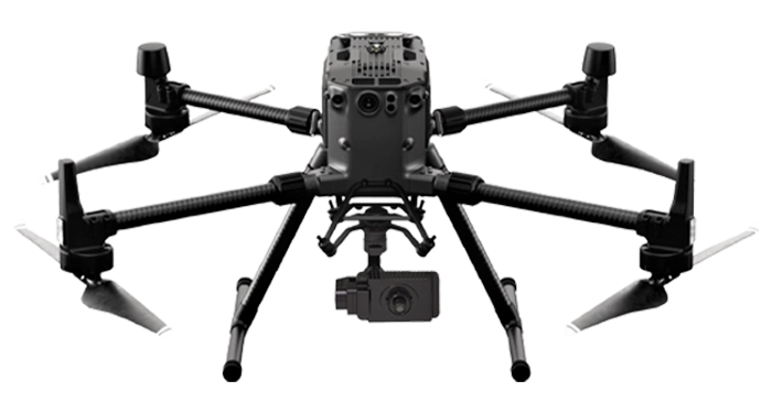
DJI Matrice 350 RTK + BL6100 Pro Mapper Combo
 € 2,89
per day
- Scanning capacity: 100hA/hour
- Accuracy: 3cm (without GCP)
- Camera Resolution: 61mp (full-frame)
- Interchangeable lenses: Yes
- Flight Autonomy:45 minutes
- Operating radius: 8km
Discover the benefits of Operational Rental