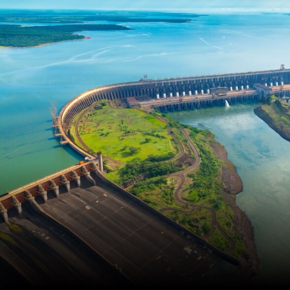
Long-range drone platform with power line-level obstacle detection

Designed for excellence, designed for versatility
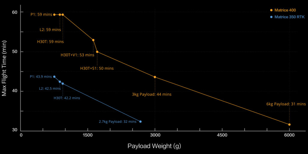
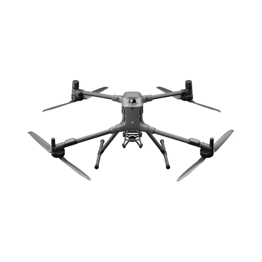
DJI Matrice 400, DJI Enterprise’s flagship drone platform, boasts an impressive flight time of 59 minutes [1], a payload capacity of up to 6 kg [2], and integrated rotating LiDAR and mmWave radar for powerline obstacle detection [3]. It also supports the O4 Enterprise optimized video transmission system and Airborne Relay video transmission [4], providing enhanced safety and ease of operations. Combining intelligent sensing with visible and thermal imagery, AR projection, ship takeoff/landing, and advanced automation, Matrice 400 excels in emergency response, electrical inspections, mapping, and AEC constructions.
Extended flight autonomy high-speed performance
Updated payload capacity of 6kg [2] with versatile compatibility
Safe and reliable flights
Improved intelligence and efficiency
Operations
automated
easier
Update
complete with
accessories
DJI Care Enterprise
Extended flight autonomy,
high-speed performance
The flight capabilities of the Matrice 400 are outstanding: it offers up to 59 minutes of forward flight time even with a payload, and up to 53 minutes of hover duration [6]. These capabilities make it a reliable tool for long-duration, continuous operations such as search and rescue, firefighting, and large-scale mapping. It can also avoid large obstacles [3] such as buildings and mountains at flight speeds of up to 25 m/s.
Up to 59 minutes
Forward flight time
Up to 25 m/s
Flight speed
Multi-load, multi-scene
The high payload capacity of Matrice 400 enables it to easily meet the needs of a wide range of applications. With a maximum payload capacity of 6 kg [2], Matrice 400 supports seamless switching between a single bottom [8] and double bottom [8] connector. It also features a third stabilizer connector on the underside for added flexibility. The aircraft is equipped with 4 external E-Port V2 ports [7], allowing simultaneous mounting of up to 7 payloads.
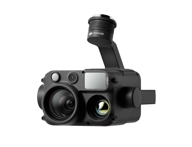
Zenmuse H30 series [8]
The Zenmuse H30 series integrates 5 main modules: wide-angle camera, zoom camera, infrared thermal imaging camera, laser rangefinder and NIR auxiliary light. Using intelligent, state-of-the-art algorithms, it revolutionizes the standards of perception and imaging, pushing the limits of day and night vision.
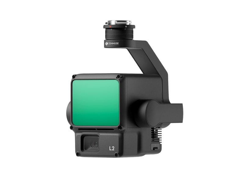
Zenmuse L2 [8]
Zenmuse L2 integrates a frame-based LiDAR, an independently developed high-precision IMU system, and an RGB mapping camera with a 4/3 CMOS sensor, providing DJI’s multi-payload drone platform with more accurate, efficient, and reliable geospatial data acquisition.
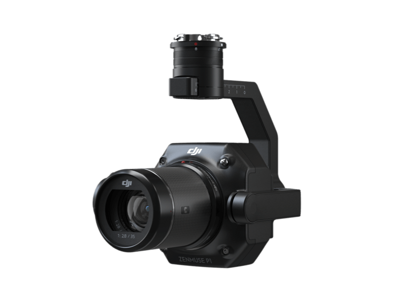
Zenmuse P1 [8]
Zenmuse P1 integrates a full frame sensor with fixed focus interchangeable lenses on a 3-axis stabilizer. Designed for photogrammetry flight missions, it takes efficiency and precision to a whole new level.

Zenmuse S1 [8]
Zenmuse S1 is DJI’s first reflector designed for multi-load drone platforms. Using LEP (Laser Excited Phosphor) technology, it offers high brightness and long illumination distance and supports multiple illumination modes. This makes it ideal for public safety, emergency rescue, inspection and other night operations.
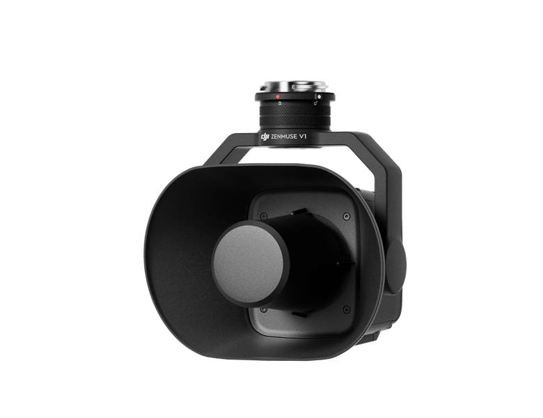
Zenmuse V1 [8]
Zenmuse V1 is DJI’s first speaker designed for multi-load drone platforms. It boasts high volume and long transmission distance, supporting multiple transmission modes, making it ideal for scenarios such as public safety, emergency rescue and more.
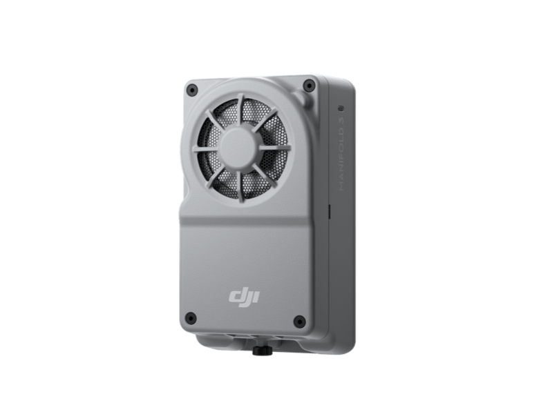
Manifold 3 [8]
Manifold 3 packs an impressive computing power of 100 TOPS into a compact unit that weighs about 120 g. It can be mounted on the Matrice 400 drone platform, optimizing efficiency in various operational missions due to its robust processing capability.
Flight autonomy [1]
Calculates the flight range of Matrice 400 based on the configured load.
Safe and reliable flights
Designed for harsh conditions
Matrice 400 has an IP55 [9] degree of protection, enabling it to operate reliably in harsh conditions, such as heavy dust or rain. It also maintains stable performance at temperatures between -20 °C and 50 °C, ensuring consistent results in both hot and cold conditions.
IP55
IP rating
Between -20 °C and 50 °C
Operating temperature
Designed for harsh conditions
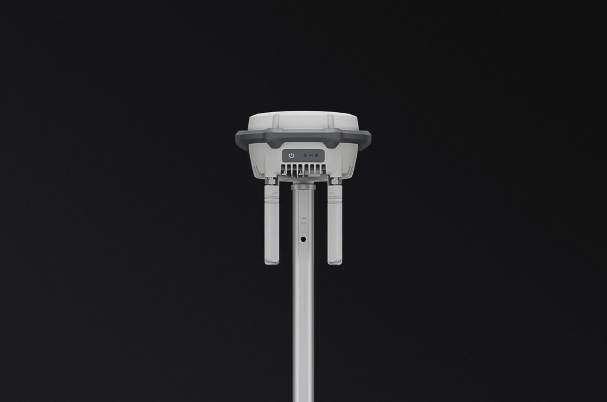
The Matrice 400’s advanced obstacle detection system integrates rotating LiDAR, high-precision mmWave radar and color fish-eye vision sensors for low-light conditions [13], taking detection capabilities to unprecedented levels. The system also detects small obstacles such as high-voltage power lines in mountainous terrain, even in the dark [3]. It can penetrate rain and fog to sense its surroundings, providing enhanced safety in harsh weather conditions.
https://www-cdn.djiits.com/reactor/assets/_next/static/videos/3a3a7b89-5c1f-4299-90fc-0f24771ae2f5.mp4
Robust video transmission
https://www-cdn.djiits.com/reactor/assets/_next/static/videos/d1058ca1-76d0-4a47-8824-f00e3afe4859.mp4?w=1184&h=800
Optimized O4 Enterprise video transmission system
With the ten-antenna system on the aircraft and the high-gain array antenna system on the radio control, the DJI O4 Enterprise Optimized Video Transmission System can achieve image transmission up to 40 km [10].
Matrice 400 also supports the sub2G frequency band [5], and when equipped with two DJI Cellular Dongle 2s [11], it can automatically switch to the network of the best available carrier, providing a more stable signal even in urban environments with interference or in remote regions
https://www-cdn.djiits.com/reactor/assets/_next/static/videos/545eee21-bbca-4960-8e1b-87d332b4ca46.mp4?w=1184&h=800
Airbridge video transmission[5]
Matrice 400 has a built-in video signal repeater module. With this configuration, one Matrice 400 can serve as a repeater drone, flying overhead to relay the signal to another Matrice 400 operating at a greater distance. This capability significantly extends the transmission distance, making the system suitable for search and rescue missions and inspections in mountainous areas.
Fusion positioning of the aircraft
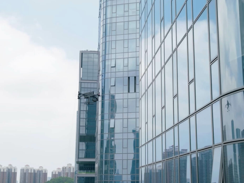
Omnidirectional sensing performance [12] achieved by rotating LiDAR, high-precision mmWave radar and low-light color fish-eye vision sensors provide Matrice 400 with strong positioning capabilities. It can fly stably near glass building facades or wind turbine blades and re-enter safely from building edges, mountain bases or bridge sides even when the return point has not been updated.
https://www-cdn.djiits.com/reactor/assets/_next/static/videos/fada17e0-cde5-4622-8599-a54f96324692.mp4?w=1386&h=1040
Full-Color Vision Assist
The four low-light color fisheye vision sensors on the aircraft provide full-color vision assist (Full-Color Vision Assist) to ensure a safer flight.
Intelligence and efficiency
improved
Detection
intelligent [14]
With the in-visible and thermal imaging offered by the Zenmuse H30 series, Matrice 400 can detect vehicles, boats and people during search and rescue operations or routine flights. It also supports switching to other models, allowing for expanded application scenarios. It also supports photos with high-resolution grids and has powerful tracking capabilities.
https://www-cdn.djiits.com/reactor/assets/_next/static/videos/1b04fc04-059c-4f44-9060-d2074aead6ba.mp4?w=2400&h=1200
Intelligent AR projection
https://www-cdn.djiits.com/reactor/assets/_next/static/videos/f2483627-3f94-410d-9c16-ebb572aa5fbe.mp4?w=2400&h=1200https://www-cdn.djiits.com/reactor/assets/_next/static/videos/a91e15e5-bb8f-48b8-93ca-7abc9973e195.mp4?w=2400&h=1200https://www-cdn.djiits.com/reactor/assets/_next/static/videos/1479ae1e-2904-4180-88bf-b9d4b4bf2d1a.mp4?w=2400&h=1200https://www-cdn.djiits.com/reactor/assets/_next/static/videos/d4532cb4-1e59-447d-910c-e38d1e8092d2.mp4?w=2400&h=1200
AR power lines
AR map visualization
Flight Waypoint AR
Live annotations
During tasks such as power grid inspection, the obstacle detection system automatically detects frontal obstacles at cable level [3] and displays them as easily recognizable AR lines on the radio control screen, making the surroundings clear at a glance and ensuring safer flight.
When operating during the day or night in urban areas, the radio control can display the names of buildings and landmarks in real time, marking major roads with prominent lines.
A real-time path preview is available for the drone during RTH, obstacle detection and FlyTo operations. During landing, the AR Aircraft Shadow can be displayed to help operators confirm the landing position.
Without modeling, you can mark points on the radio control screen to obtain object positions, draw lines to measure distances between multiple points, and delineate areas to calculate their size. Measurement results can be synchronized with DJI FlightHub 2 to improve team efficiency.
Terrain Follow in real time
Matrice 400 supports flight with real-time Terrain Follow in any horizontal direction [15]. This function can be enabled during both manual flight and automated flight routes, ensuring a stable relative height above the ground.
During large-scale search and rescue operations, the size of ground objects can be kept constant on the radio control screen, reducing the need for frequent zoom adjustments and improving efficiency. During mapping missions, a constant ground sampling distance (GSD) can be maintained to obtain high-precision mapping data.
https://www-cdn.djiits.com/reactor/assets/_next/static/videos/81881541-21fb-458e-bd76-c83cee8da212.mp4?w=1386&h=1040https://www-cdn.djiits.com/reactor/assets/_next/static/videos/08ee70a3-08ea-4230-83a8-b191bd54acad.mp4?w=1386&h=1040
Takeoff and landing on ships [16]
To meet the needs of offshore operations such as maritime patrol and wind turbine inspection, Matrice 400 is equipped with the ability to take off and land on ships, supporting takeoff from stationary ships and landing on moving ships. By detecting landing point patterns on deck, it can achieve safe and accurate landings.
Intelligent AR projection
https://www-cdn.djiits.com/reactor/assets/_next/static/videos/d1a3ce2c-8611-4f9e-b711-f08911bae0d0.mp4?w=2400&h=1200https://www-cdn.djiits.com/reactor/assets/_next/static/videos/bd0f54ca-613b-426e-80e7-c6ca2b80e2eb.mp4?w=2400&h=1200https://www-cdn.djiits.com/reactor/assets/_next/static/videos/11d61ea0-58d7-47fc-8fd6-c5fcd213e590.mp4?w=2400&h=1200https://www-cdn.djiits.com/reactor/assets/_next/static/videos/4d461574-0834-464e-a757-4be5799bc845.mp4?w=2400&h=1200
Cruise
FlyTo
SmartTrack
POI
By activating the Cruise control mode, it is possible to fly the drone in a specific direction without continuously pressing the control sticks, making long-distance flights or linear inspections easier.
In case of emergencies or disasters, the drone can automatically adjust its trajectory and flight speed according to its surroundings, being able to reach a predetermined position without manual adjustments.
The Smart Track function allows the camera to precisely locate a subject and automatically adjust the zoom, making it easy to switch between subjects. It can automatically reacquire a subject even if obscured for a short interval of time.
The POI function enables constant 3D observation and modeling of buildings while flying over a predetermined area, thus significantly improving the efficiency of fixed point observation and modeling tasks.
Intelligent AR projection
https://www-cdn.djiits.com/reactor/assets/_next/static/videos/f8be1662-f83e-4021-94e3-8c2bca87b148.mp4?w=2400&h=1200https://www-cdn.djiits.com/reactor/assets/_next/static/videos/6f454ded-1816-40f8-9bb9-b9289eceb433.mp4?w=2400&h=1200
Follow power lines with Zenmuse L2
Slope path & Geometric path
When equipped with the L2 laser radar, Matrice 400 can perform automated tracking flights of power transmission and distribution lines. It uses rotating LiDAR to detect obstacles in real time and automatically bypasses power lines that cross the drone’s route.
Matrice 400 supports the planning and execution of sloped and geometric routes via DJI Pilot 2 or DJI FlightHub 2. Whether conducting detailed aerial surveys of building facades, slopes or other inclined surfaces, or collecting mapping data of individual buildings or structures, Matrice 400 can quickly plan sloped or geometric routes to effectively capture high-precision data.
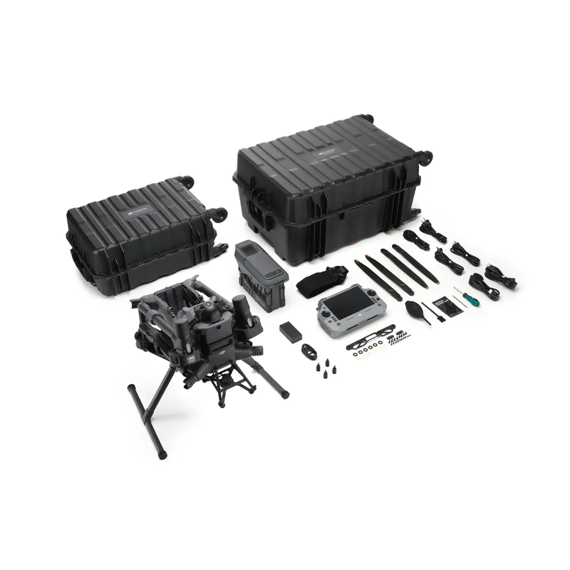
Comprehensive accessories update [17]
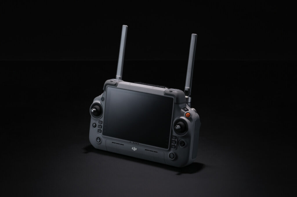
DJI RC Plus 2 Enterprise Enhanced
The radio control of the DJI RC Plus 2 Enterprise Enhanced features a new high-brightness display, providing clear visibility even in direct sunlight. The radio control has an IP54 rating and operates in temperatures between -20°C and 50°C. It uses the O4 Enterprise optimized video transmission system and has a set of integrated high-gain antennas, which enable high performance. It also supports sub2G module and 4G hybrid transmission solutions, ensuring stable and smooth video feeds in both high-altitude urban and mountainous environments.
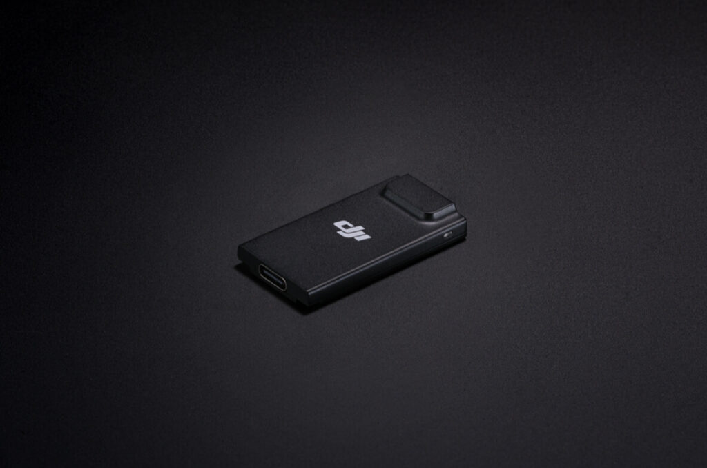
DJI Cellular Dongle 2 [11].
The DJI Cellular Dongle 2 enables video transmission over 4G network and is able to work in synergy with the O4 Enterprise Enhanced video transmission system, thus ensuring safe flights even in complex environments. It also provides connectivity to the mobile network for radio control.
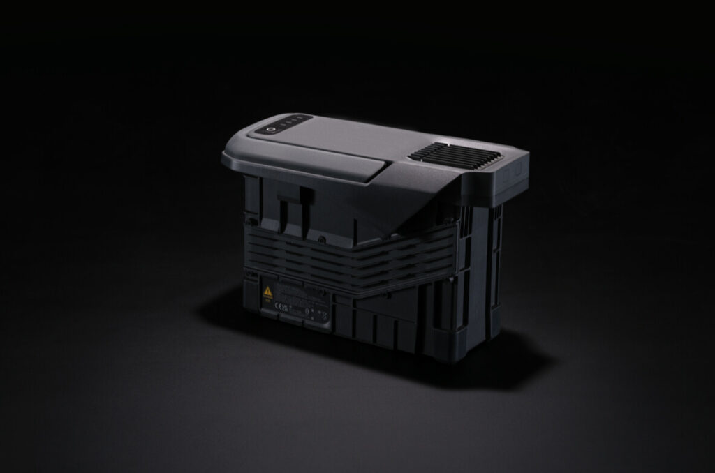
TB100 battery
The TB100 smart flight battery uses high-performance, high-energy cells and can be charged up to 400 cycles, reducing the cost for a single flight. It also features improved heat dissipation and is equipped with a self-heating system for increased reliability.
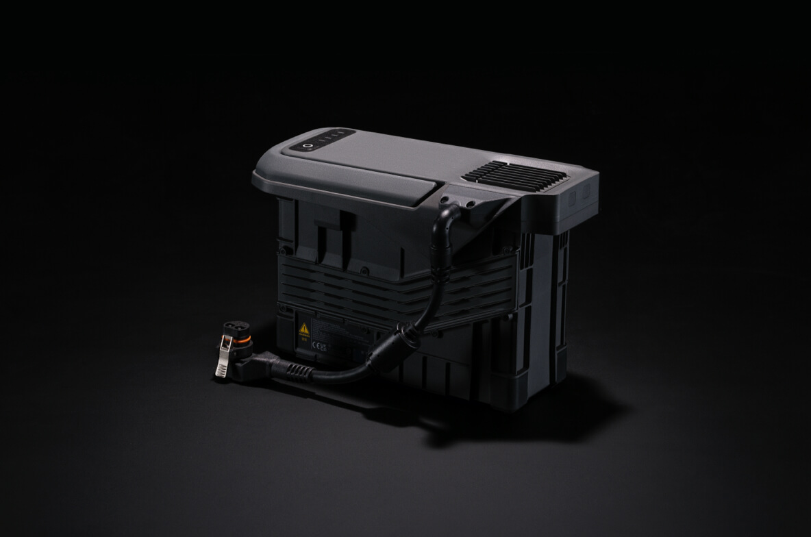
Battery with cable TB100C
The TB100C Corded Battery is compatible with third-party corded lighting and communication products, enabling long-lasting aerial lighting functions and corded communication base station.
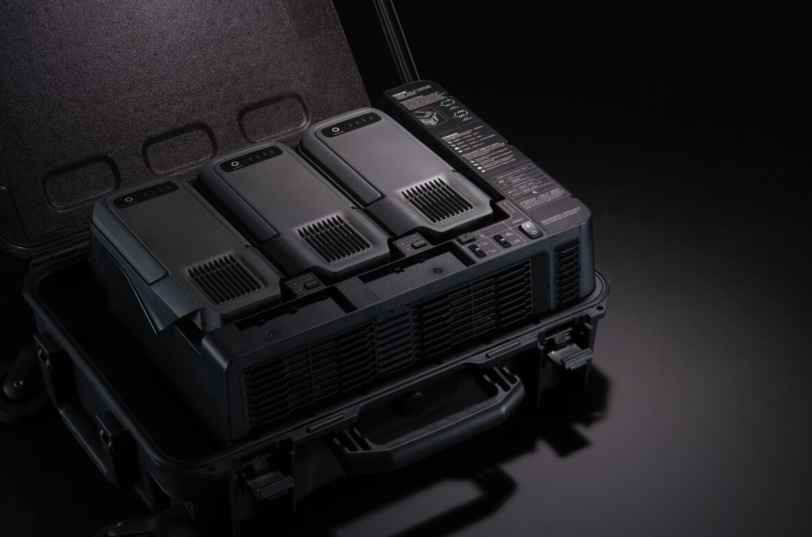
BS100 smart battery charging station
The smart battery station is a one-stop solution for charging, storing and transporting batteries. It can sequentially recharge up to three TB100 batteries and two WB37 batteries. With a fast charging time of only 45 minutes [18] per TB100 battery, it ensures uninterrupted flight operations. In Silent Mode, noise levels are limited to 36 dB [19].
Multifunction station D-RTK 3
The multifunctional D-RTK 3 Station can serve as a base station to provide centimeter-level positioning to multiple drones simultaneously. In addition, the new Rover Station mode, combined with the DJI Enterprise app and DJI Terra, provides a complete solution for high-precision aerial survey applications to ensure safe and accurate operations.
Software designed for industry
https://www-cdn.djiits.com/reactor/assets/_next/static/videos/9abe5b24-0583-414b-87ee-5e4f06dbed1a.mp4?w=2400&h=1200https://www-cdn.djiits.com/reactor/assets/_next/static/videos/d190484a-d482-4363-98d6-36e13f05ea69.mp4?w=2400&h=1200https://www-cdn.djiits.com/reactor/assets/_next/static/videos/3be5b3bb-c8bb-42f1-a81e-4fe5a91ed4f8.mp4?w=2400&h=1200
DJI FlightHub 2
DJI Terra
DJI Modify
Specifically for the Matrice 400, DJI FlightHub 2 has been upgraded to enable cloud-based remote control, allowing operators to control the aircraft’s flight attitude and official payloads, as well as perform live remote takeoff, landing and flight checks. In addition, it supports a wide range of flight path planning functions, including slope paths, geometric paths and other types of advanced paths. During multiple drone operations, operators can synchronize and remotely view multiple live streams on different screens, creating a new and efficient integrated air-ground operational experience.
* Users who purchase the Matrice 400 and connect it to FlightHub 2 upon activation will receive live streaming minutes, map image shares and dedicated cloud storage space.
DJI Terra is a 3D model reconstruction software that has photogrammetry as its core technology . It supports accurate and efficient 2D and 3D reconstruction using visible light data, as well as reconstruction and processing of point cloud data with DJI Zenmuse L2. DJI Terra is an ideal combination for DJI Matrice 400 and its payloads. Together they form a complete application solution that is suitable for vertical scenarios such as land surveying and mapping, power line inspection, emergency response, construction, and forestry.
DJI Modify enables intelligent editing of 3D mesh and point cloud models. When combined with Matrice 400 and DJI Terra, it can create an integrated solution for aerial surveying, modeling, model repair and sharing.
Software designed for industry
Intelligent Algorithm Developer Program
It provides the necessary tools for model training and certification process for third-party developers with access to on-board processing, contributing to the expansion of new fields of application for drone artificial intelligence.
PSDK
The new E-Port V2 supports high USB 3.0 communication payload speed and provides up to 120 watts of power per port. The E-Port V2’s E4 port can be expanded into four payload ports via the E-Port Hub expansion plate, expanding the application scenarios and potential of the Matrice 400.
MSDK
Mobile SDK 5 simplifies app development to control the Matrice 400. It comes with fully open-source production-level code samples with core modules adapted from DJI Pilot 2, ensuring high reliability.
Cloud API
With DJI Pilot 2’s built-in Cloud API (MQTT-based protocol), you can directly connect the Matrice 400 aircraft to third-party cloud platforms. You have access to the drone’s hardware, video streaming and photo data without having to develop an app.
Free access to data
Developers can leverage the data interfaces of loads, LiDAR, mmWave radar, and vision sensors to create innovative applications and expand the DJI ecosystem.
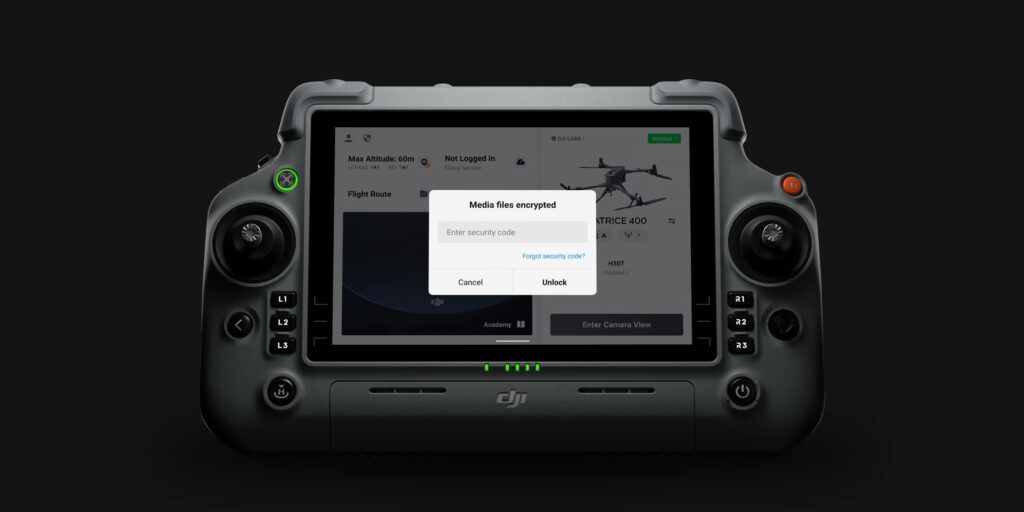
Security of user data
![]()
Encryption of multimedia data
![]()
Local data mode
![]()
One-touch log deletion
![]()
AES-256 video transmission encryption
![]()
Cloud API
Get 1 year of DJI Care Enterprise Plus or 1 year of official extended warranty service for free [20].
DJI Care Enterprise Plus
Comprehensive protection | Professional quality assurance | Exclusive service | Service starts with activation

Free repairs
Unlimited free repairs within the coverage limit.

Replacement of batteries
1 battery per year, long life

Coverage for the entire fleet
Shared limit for maximum protection

Free two-way shipping
Repairs with free postal shipment, extreme ease of service

Expert assistance
Quick response from DJI product experts

Full device coverage
Worry-free support for every mission
Extended warranty service
In addition to the official warranty, an additional 1-year extended warranty is provided. Major parts are covered by the official warranty, with support provided by our professional engineers.

Official Service
Supported by professional engineers

Quality repairs
Original parts, quality guaranteed
Applicable scenarios
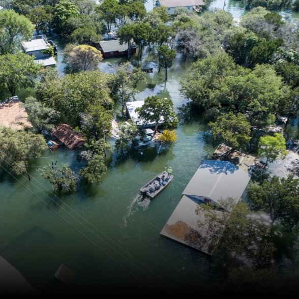
Public Safety

Inspection of lines
electrical
Information
geographic
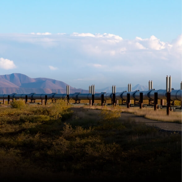
Oil and Natural Gas
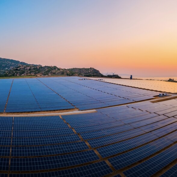
Renewable energy
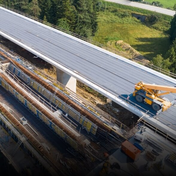
Roads and bridges
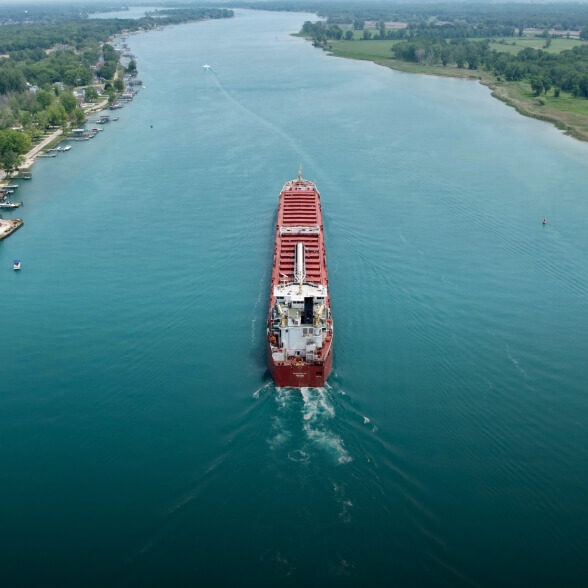
Maritime sector
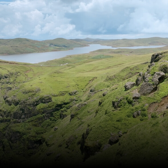
Water saving

Designed for excellence, designed for versatility
DJI Matrice 400
DJI Matrice 400 Combo
* All data on this page were collected using a production model of DJI Dock 3 and DJI Matrice 4D/4TD in a controlled environment. Actual results may vary depending on environment, usage, and firmware version.
**All videos and photos on this page were taken in strict compliance with local laws and regulations. Demonstrations are for reference only. Please observe local laws and regulations and ensure that the aircraft has obtained relevant certifications prior to flight.
*** Before use, DJI Matrice 4D/4TD must be activated via the DJI Pilot 2 app or the DJI Enterprise app.
**** To ensure that the equipment operates stably and continuously, perform regular maintenance.
1. Data acquired with a new battery with at least 95% charge on takeoff and at least 15% charge on landing. Data is provided for reference purposes only. During flight, pay attention to notifications on FlightHub 2 or the DJI Pilot 2 app.
2. DJI Dock 3 has an IP56 rating, while DJI Matrice 4D/4TD has an IP55 rating. Both were tested under controlled laboratory conditions with the dock distribution cabinet door closed and screws tightened. The IP rating is not permanently effective and may decrease due to product wear and tear.
3. Requires use with Android phones for deployment and commissioning.
4. Purchasable separately.
5. You need to upgrade to the latest firmware version.
6. Vehicle support must comply with local regulations. Pay attention to road safety and height restrictions while driving.
7. D indicates the measurement distance.
8. Available only with Matrice 4TD. DO NOT expose the infrared camera lenses to a strong energy source such as sun, lava or laser beams. Failure to do so may burn out the camera sensor and result in permanent damage.
9. Available only with Matrice 4TD. NIR auxiliary light is suitable for telephoto camera lighting needs.
10. Measured with the drone hovering 100 meters above the ground and the telephoto camera effectively capturing images.
11. Compared with Matrice 3D/3TD of DJI Dock 2.
12. Measured at an ambient temperature of about 25 °C, with a safe battery level of 15%, in a windless environment, and a forward and reverse speed of about 15 m/s. This value is for reference only, and actual operating data may vary.
13. Data acquired in a controlled test environment. Specific test conditions are as follows: forward flight at a constant speed of 12 m/s in a windless laboratory environment at 20 meters above sea level, in photo mode (without in-flight shooting operations), with Obstacle Avoidance set to Off, and with battery level at 100% to 0%. Actual results may vary depending on the environment, usage and firmware version.
14. Data acquired with DJI Matrice 4D series drones in stationary flight in a windless environment at 20 meters above sea level and from battery level from 100% down to 0%. Actual results may vary depending on environment, usage and firmware version.
15. An official repair will be provided free of charge in the event of a collision due to a failure to avoid obstacles, resulting in damage to the drone or the Obstacle Detection Module, provided the following conditions are met: the Obstacle Detection Module is installed, the drone flies automatically along a preset path, all equipment is functioning properly, the GNSS signal is strong, weather conditions are favorable, and both millimeter-wave radar and LiDAR are operating properly. Please note that free repair is not provided in the following scenarios:
(1) Presence of fast-moving objects around the flight path (e.g., operating wind turbines, moving tower cranes, flying birds, etc.);
(2) Special weather conditions such as rain, snow, fog or dust;
(3) The radar cannot be certified and activated in some countries and regions due to national policy restrictions. Please contact your local dealer for more details;
(4) The Obstacle Detection Module is out of warranty.
16. Measured under standard lighting conditions from a horizontal position 10 meters away from the subject, with direct line of sight.
17. Shooting with the telephoto camera facing the object directly.
18. Current capabilities are insufficient to meet the mapping needs of urban areas. Future updates will continue to optimize flight paths and mapping solutions for urban areas.
19. There should be no obstacles between the radio control and the repeater plane, and between the repeater plane and the operating plane. Strong electromagnetic interference can affect the video transmission distance.
20. In an outdoor, open environment without interference and in compliance with FCC regulations, the drone can typically complete the transmission of footage to the dock when the distance between the drone and the dock is within 1 kilometer. The transmission speed from the dock to the cloud depends on the user’s network conditions.
21. Purchasable separately. Service is not available in some countries and geographic areas. Consult your local dealer for more details.
22. Consult your dealer first to make sure the payload is compatible with DJI FlightHub 2.
23. Some accessories are to be purchased separately. Installation of accessories may affect the safety performance of obstacle avoidance by the aircraft. Follow the instructions for use.
24. Due to national policy restrictions on radar certification, this function is not supported in some countries and regions. Please contact your local dealer for more details.
25. For reference only, this result obtained at a distance of 100 m from the subject is presented.
26. When installing on the aircraft, tighten the screws and make sure the interface is sealed properly. When using with DJI Dock, use the included Allen wrench to re-tighten the screws.
27. The data were collected in the experimental environment with an ambient temperature of 25 °C and are for reference only. Actual conditions may vary slightly depending on differences in software versions, audio source, specific environment and other factors. The final result depends on actual usage.
28. The current text-to-voice feature supports only English and Mandarin Chinese.
29. DJI Care Enterprise service may vary by country/region. Please consult your local retailer for details; Unlimited free repairs: Free repairs within the scope and amount of coverage; Shared coverage: DJI Enterprise products that activate and bind DJI Care Enterprise Plus within the same period (30 calendar days) can share coverage limits; Free shipping: available for geographic areas covered by DJI Care Enterprise. Additional costs, including logistics and customs, incurred outside the scope of coverage are the responsibility of the user; Official Extended Warranty Coverage: Includes aircraft body, stabilized camera, radio control, and charging hub.
30. Building-side and on-tower deployment capabilities are based on the service area of the satellite positioning system, which currently supports only most regions in Asia Pacific, as detailed in the Installation and Configuration Manual. Specific applicability should be determined based on the results displayed on the DJI Pilot 2 app during docking site evaluation. During deployment on communication tower, dynamic power variation of communication base stations may cause signal interference, which in rare cases may affect drone takeoff. If such problems occur, try restarting the aircraft and reassigning the flight task
Take advantage of industry 4.0 and 5.0
Up to 40% Tax Relief
The goal of Industry 4.0 and 5.0 is to incentivize Italian companies that invest in capital goods to improve, through digitization, their production processes.
This translates into Fiscal benefits on the one hand and Productive benefits on the other especially for:
- Startup
- Freelancers
- SME
- Public Administration
- Law Enforcement.
Rent your drone from 150€/Month
Pay in convenient installments
– Zero down payment, easy and quick to apply
– All-Risk helmet insurance on drone and accessories
– Small and convenient installments from 24 to 60 months
– Lower costs than a loan or lease
– Asset immediately available
– 100% tax-deductible installment by installment
– Possibility of final redemption of asset
– Possibility of early termination of contract
*Available only for vat holders with at least 18months of activity