

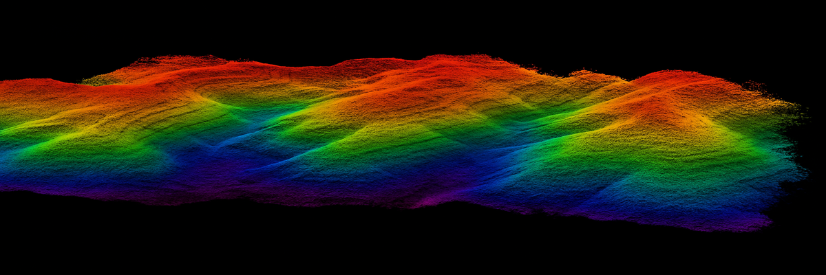
Integrated LiDAR system for UAVs with 32-beam scanner, dual echo and high-frequency GNSS+INS POS. Point density up to 1.28 M points/s with centimetre accuracy at 120 m for professional topographic and infrastructure surveys.
| 1.28 MPoints/second | 32 beamsLiDAR scanner | 120 mMax distance | 26 MPCamera |

The GS-130X represents the all-in-one solution for professionals requiring maximum precision in LiDAR surveys from UAVs.
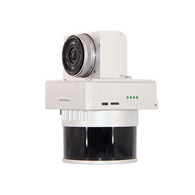
The Laser Scanner GS-130X represents the most advanced LiDAR solution for professional applications on DJI drones. With its 32-beam scanner and dual-echo capability, it guarantees acquisition density up to 1.28 million points per second with centimetre-level precision at distances up to 120 metres. The integrated system combines Hesai XT-32 scanner, high-frequency GNSS+INS POS and optional 26MP camera in a compact design optimised for Matrice 300/350 RTK. DroneBase, DJI Gold 5 Dealer certified ISO 9001:2015, provides specialised technical support and training to maximise the performance of the GS-130X system in professional topography, smart city and infrastructure monitoring applications.
Which drones are compatible with the GS-130X?
What precision can I achieve with the GS-130X?
Is data processing software included?
How long is flight time on Matrice 300?
Is specific training required to use it?
What data format does the system produce?
Pre and post-sales assistance · Express 24h shipping · Certified technical support · On-site demo
★ DJI Gold 5 DealerISO 9001:2015Technical SupportOn-site demo


There are no reviews yet.