

Complete solution for mapping and aerial survey professionals. Redefines industry standards for compact commercial drones with mechanical shutter, 56× zoom and RTK module for centimetre precision. Everything you need for professional photogrammetry, mapping and GIS.
| 45 minFlight time | 56×Hybrid zoom | 20 MPCMOS 4/3″ | 1 cmRTK precision |
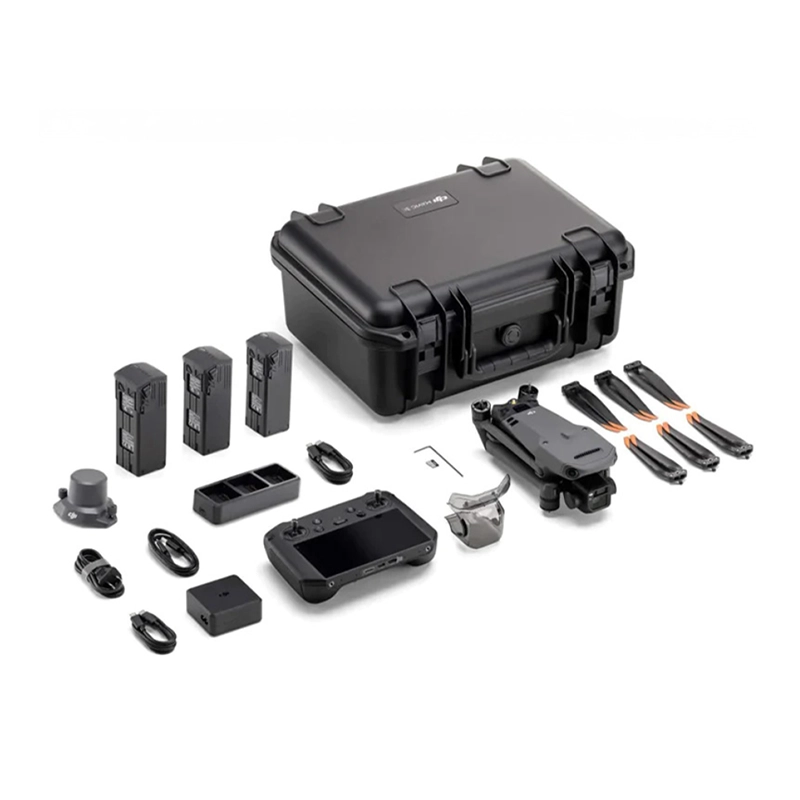
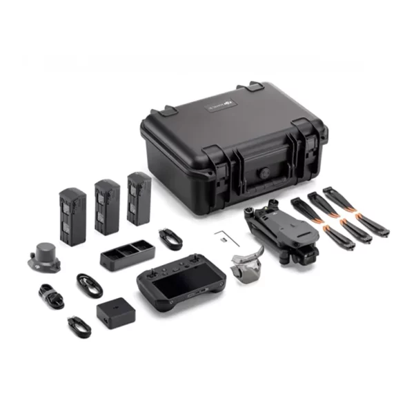
The Photogrammetry Combo includes everything you need for professional mapping and survey operations: drone with Care, additional battery kits and RTK module for centimetre precision.
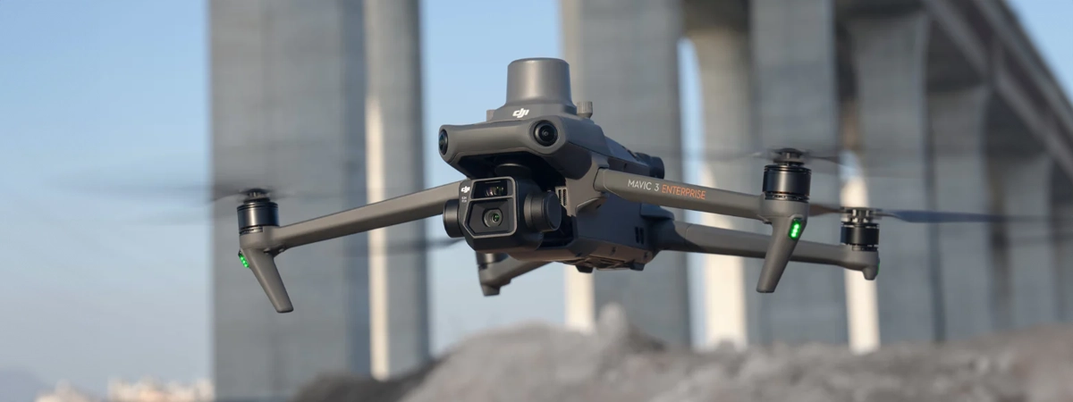
The DJI Mavic 3 Enterprise Photogrammetry Combo is the most complete solution for professionals in aerial mapping and topographic surveying. This all-in-one system includes the Mavic 3 Enterprise drone with 20MP 4/3″ CMOS sensor and mechanical shutter, the RTK module for centimetre precision, additional battery kit and DJI Care protection for 1 year. Capable of surveying up to 2 square kilometres in a single flight, it is the ideal choice for professional photogrammetry, GIS mapping and architectural surveys. DroneBase, a DJI Gold 5 Dealer certified ISO 9001:2015, provides specialised technical support and professional training to maximise your technology investment.
What exactly is included in the Photogrammetry Combo?
What is the precision of the included RTK module?
How much territory can I map in a single flight?
Is it compatible with photogrammetry software?
Can I use it without ground control points?
What training do you provide with the purchase?
Pre and post-sales support · 24h express delivery · Certified technical support · On-site demonstrations
★ DJI Gold 5 DealerISO 9001:2015Technical supportOn-site demonstrations


There are no reviews yet.