3D Lidar
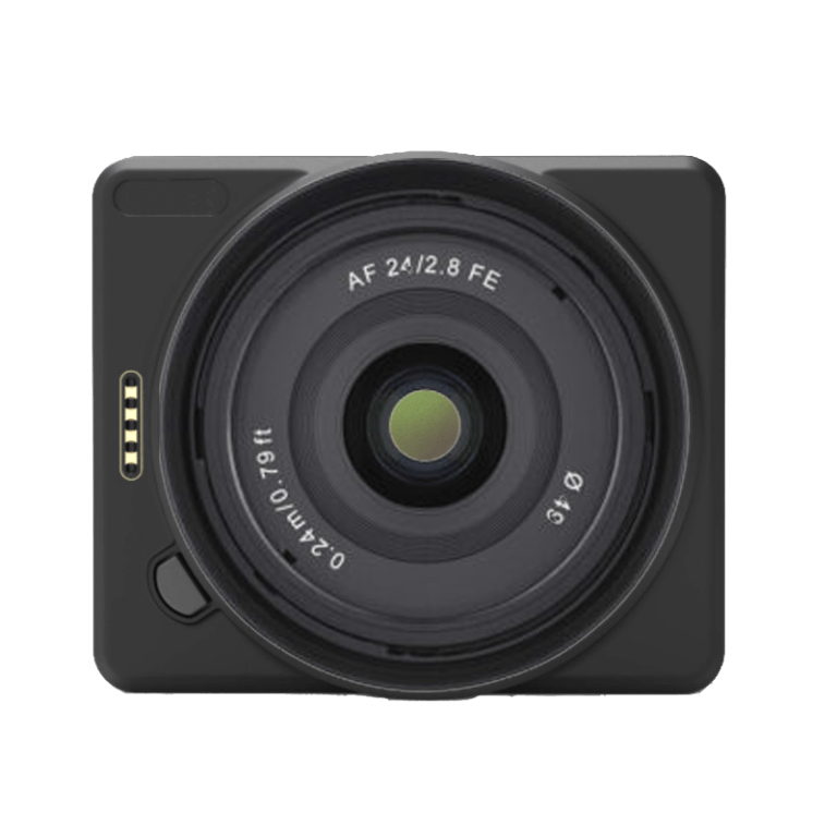
Laser Scanner GS-100C+
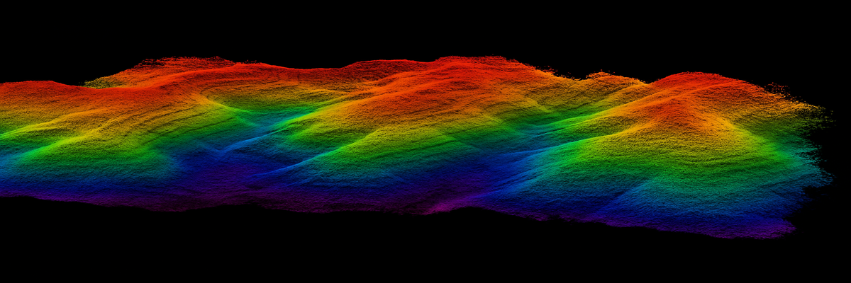
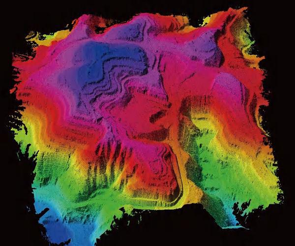
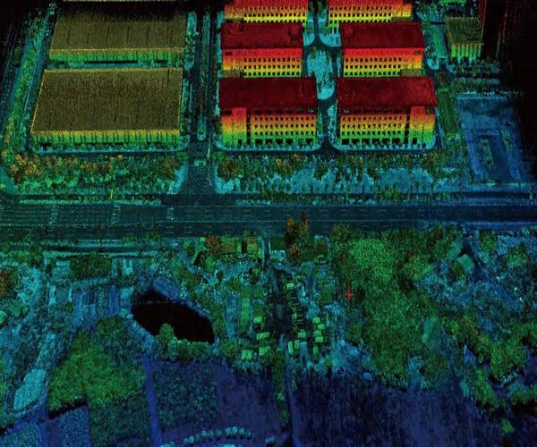
The GS-100C+ Laser Scanner is a compact, high-precision system designed for drone applications. Ideal for 3D surveys, topographic mapping and industrial monitoring, it offers accurate and detailed data even in complex environments.

8.799,00 € TAX Included
Disponibile in pronta consegna
IVA inclusa
Paga a rate | Disponibile pagamento MEPA
Garanzia DJI
Ufficiale 12 mesi
Spedizione 24h
Express in Italia
Supporto Tecnico
Pre e post vendita
Reso 14 Giorni
Senza domande

DJI Gold Dealer Certificato
Prodotto originale · Garanzia ufficiale DJI Italia · ISO 9001:2015
Parla con un esperto
Consulente tecnico dedicato — Lun–Ven 9:00–18:00
Chiama


Perché DroneBase
Il partner che non
ti lascia mai a terra.
01 — Garanzia
Garanzia DJI Ufficiale
12 mesi di garanzia completa su prodotto originale. Acquisto certificato da rivenditore DJI Gold 5.
02 — Logistica
Spedizione 24h Express
Ordini entro le 14:00 spediti il giorno stesso. Tracciabile in tutta Italia. Imballaggio professionale.
03 — Supporto
Supporto Tecnico Dedicato
Consulente certificato assegnato al tuo account. Assistenza pre e post vendita senza limiti di chiamate.
04 — Acquisto
Reso Gratuito 14 Giorni
Soddisfatti o rimborsati entro 14 giorni dalla consegna. Politica senza domande, rimborso completo.


There are no reviews yet.