

Advanced mobile laser scanner with SLAM algorithms for 3D mapping without GNSS. Precision of 3-5 cm, 100 m range and three integrated cameras for point cloud colouration.
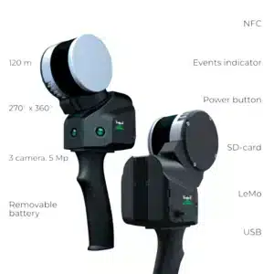
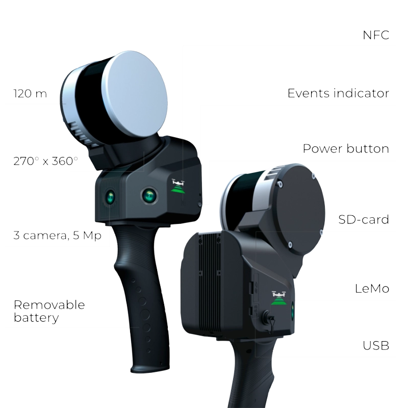
| 100 mWorking range | 320K ppsPoints per second | 3-5 cmXYZ accuracy | 3 camIntegrated cameras |

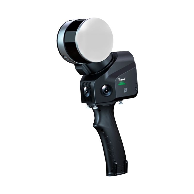
The TOPODRONE LiDAR SLAM 100 revolutionises mobile scanning through the combination of advanced technologies and operational versatility.
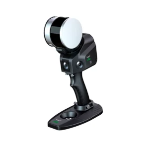
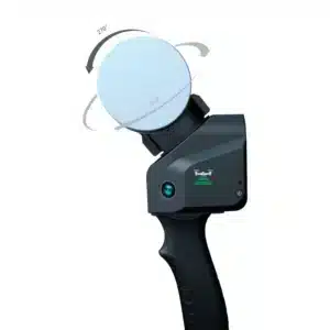
The TOPODRONE LiDAR SLAM 100 represents the evolution of mobile laser scanning, combining advanced SLAM technologies with the precision of the Hesai XT16 sensor. This professional laser scanner offers a complete solution for 3D mapping without GNSS, ideal for indoor environments, tunnels, mines and complex urban spaces. With a 100-metre range and the capability to acquire up to 320,000 points per second, it guarantees 3-5 cm precision for surveying and mapping applications. The three integrated 5 Mpx cameras enable automatic point cloud colouration, whilst mounting versatility makes it suitable for backpack, vehicle or handheld use. DroneBase, a DJI Gold 5 Dealer certified ISO 9001:2015, provides specialised technical support and advanced training to maximise the potential of this professional tool in the geomatics and three-dimensional surveying sector.
Can the TOPODRONE LiDAR SLAM 100 operate without GPS?
What mounting modes are available?
Is the RTK module necessary for operation?
What software is included in the package?
What is the battery autonomy?
Is it compatible with other processing software?
Pre and post-sale assistance · Express 24-hour shipping · Certified technical support · On-site demo
★ DJI Gold 5 DealerISO 9001:2015Technical SupportOn-site demo


There are no reviews yet.