3D Lidar
Showing all 8 results
-
3D Lidar
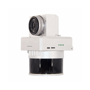
Laser Scanner GS-130X
The GS-130X is an integrated LiDAR system for UAVs that combines 32-beam scanner, dual echo, high-frequency GNSS+INS POS and 26 MP camera (optional). With density up to 1.28 M points/s and centimeter accuracy over 120 m, it enables fast and reliable surveys for smart cities, precision agriculture, infrastructure monitoring, and environmental surveys with the “one-key” Shuttle and gAirHawk software.
SKU: n/a -
3D Lidar
Laser Scanner GS-260H
The GS-260H is a compact LiDAR for drones and light vehicles, with triple return and density up to 1.92 M pt/s over 300 m. The integrated POS (GNSS+INS 200 Hz) and 26 MP camera ensure centimeter accuracy and perfect synchronization between point cloud and imagery. Ideal for topographic surveys, infrastructure inspections and smart cities with “one-key” workflow.
SKU: n/a -
3D Lidar
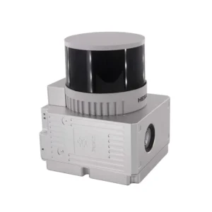
Laser Scanner GS-260X
The GS-260X is an ultra-compact 1.1 kg LiDAR for drones, VTOLs and vehicles, capable of generating up to 1.92 M points/s with triple return at 300 m distance. With built-in POS (gSpin 310 at 200 Hz) and synchronized 26 MP camera, it ensures centimeter accuracy and georeferenced photo textures. Ideal for terrain mapping, infrastructure inspections, and smart city projects with “one-key” workflows.
SKU: n/a -
-
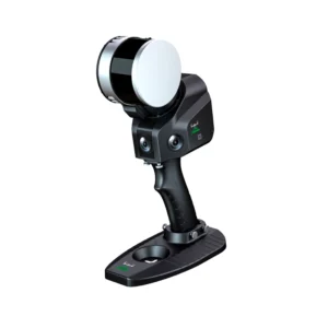
3D Lidar
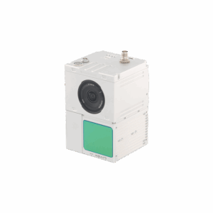
Laser Scanner Slam GS-100G Series
The SLAM GS-100G Series Laser Scanner is the plug-and-play solution for precision laser scanning in industrial and automation environments. With advanced SLAM technology, multi-protocol support, and robust galvanic isolation, it provides reliable and secure 3D acquisitions, cross-platform configuration, and modular DIN-rail mounting.
SKU: n/a -
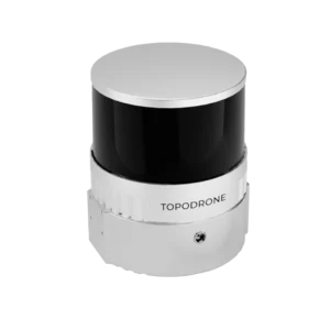
3D Lidar
TOPODRONE LiDAR 100+
The TOPODRONE LiDAR 100+ is an advanced system for high-precision 3D mapping. With a range of 100 m and 320,000 points per second, it offers accurate data with an XYZ accuracy of 3-5 cm. It includes integrated cameras and SLAM technology for operations in complex environments.
SKU: n/a -