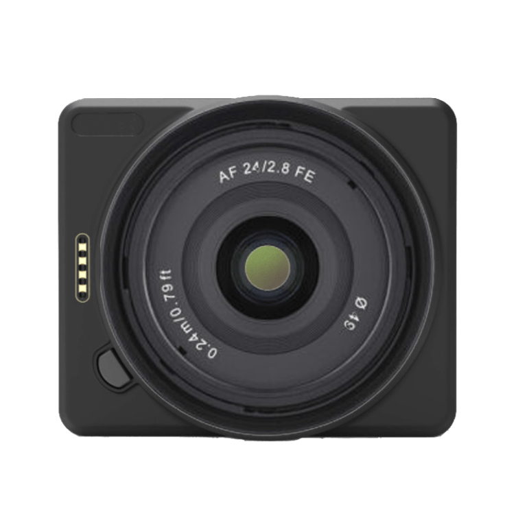
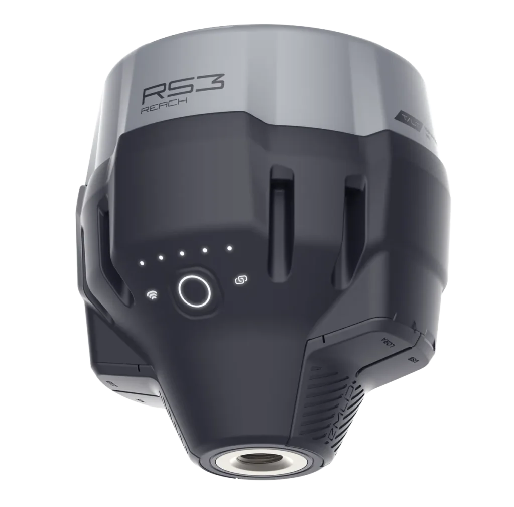
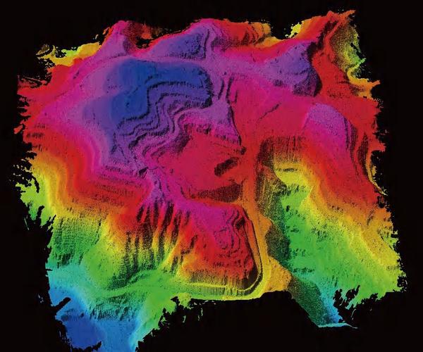
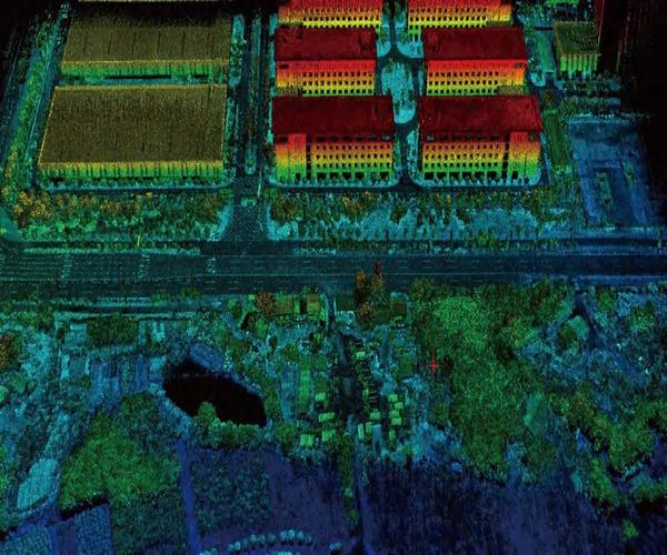
LiDAR GS-130X Solution for UAVs
The high-efficiency “one-key” system for topographic and infrastructure surveys
The GS-130X integrates a 32
beam LiDAR scannerwith dual echoes, a high-performance POS (GNSS + INS), and-in option-a 26 MP camera into a single compact body.
With its “one-key” workflow and included Shuttle and gAirHawk software,
it is possible to conduct centimeter surveys up to 120 m away at a density of 1 280 000 points/s.
Ideal for smart cities, precision agriculture, infrastructure monitoring, mining surveys, and forestry.
1280k
point/sec
dual-echo
point rate
120
mt
max
range
1.0
cm
range
precision
26
MP
integrated
camera
360°
fov
circular
view
200
hz
imu
sensor
Main features:
32-beam LiDAR scanner with dual echoes to capture multiple surfaces separately
Density of points: up to 1 280 000 points/s
Useful range: up to 120 m (10 % reflectivity)
Measurement accuracy: ± 1 cm
High-frequency POS: update GNSS + INS at 200 Hz, positioning accuracy ≤ 0.05 m
Adjustment: Roll/Pitch 0.005° – Heading 0.017°
Compact and lightweight: 1.26 kg; dimensions 11.5 × 11 × 12 cm
Rugged: operation from -20 °C to +55 °C; compatible with multi-rotor and VTOL
Built-in camera (optional): 26 MP, FOV 83°, focal length 16 mm
Main Advantages and Benefits
“One-key” quick start: planning and acquisition in a few clicks, with automatic pre-processing
Centimeter accuracy: reliability for critical applications such as urban mapping and infrastructure inspections
High productivity: wide coverage per flight, superior point density and automated workflow
Application versatility: from mining survey to terrain modeling, from power grid control to smart city projects
Complete software ecosystem: Shuttle for POS trajectories, gAirHawk for classification and point-cloud post-processing
RGB coloring of the point cloud
All 3D LiDAR systems can be equipped, via plug-&-play “EXT” interface, with external or integrated cameras.Photographic acquisition and centimeter georeferencing of images are handled automatically by the on-board GNSS, ensuring perfect synchronization between LiDAR and RGB data.
By connecting one or more cameras to the LiDAR sensor, the corresponding color information can be applied to individual points, enriching the point cloud with high-resolution visual details. The coloring step is also performed fully automatically within the same post-processing software provided with the system.
PPK technology for centimeter georeferencing
Thanks to Post-Processing Kinematic (PPK), no more ground targets are needed: point cloud and RGB images directly achieve centimeter accuracy during processing. The included Shuttle software automatically handles all correction and georeferencing steps, ensuring a fast and reliable workflow.
Fully automatic GPS correction
Immediate extraction and export of RINEX logs
Accuracy up to 2 cm RMS**
Compatible with any GNSS base station (real-time VRS or CORS networks)
** Values measured in PPK mode
Terrain Mapping
Inspection of Power Lines
Mining Survey
Implementation of Smart City
Technical Specifications
Voce | Specifiche |
---|---|
Modello | GS-130X |
Scanner LiDAR | 32 fasci, doppio eco |
Punti per secondo | 1 280 000 pt/s |
Lunghezza d’onda | 905 nm, Classe 1 (IEC 60825-1:2014) |
Portata massima | 120 m @10 % riflettività |
Campo visivo | 360° regolabile |
Accuratezza misura | ± 1 cm |
Update rate POS | 200 Hz |
Accuratezza posizionamento | ≤ 0,05 m |
Accuratezza assetto | Roll/Pitch 0,005° – Heading 0,017° |
GNSS | GPS L1/L2/L5; GLONASS L1/L2; BDS B1/B2/B3; Galileo E1/E5a/E5b |
Fotocamera (opzionale) | 26 MP; FOV 83°; focale 16 mm |
Storage | 64 GB (espandibile a 128 GB via TF card) |
Peso | 1,26 kg |
Dimensioni | 11,5 × 11 × 12 cm |
Temperatura operativa | –20 °C…+55 °C |
Piattaforma supportata | Multi-rotor / VTOL |
Software incluso | Shuttle (POS trajectory) • gAirHawk (point-cloud processing) • WayPoint Master |
Call Us Now
for a free consultation on Hardware,
Software, and ENAC.
Book Now
your free phone consultation with our Experts.
There are no reviews yet.