
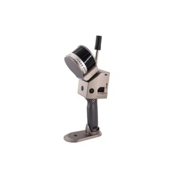
Plug-and-play solution for high-precision 3D laser scanning with advanced SLAM technology.
Compact design, robust galvanic isolation and multi-protocol support for critical industrial environments.
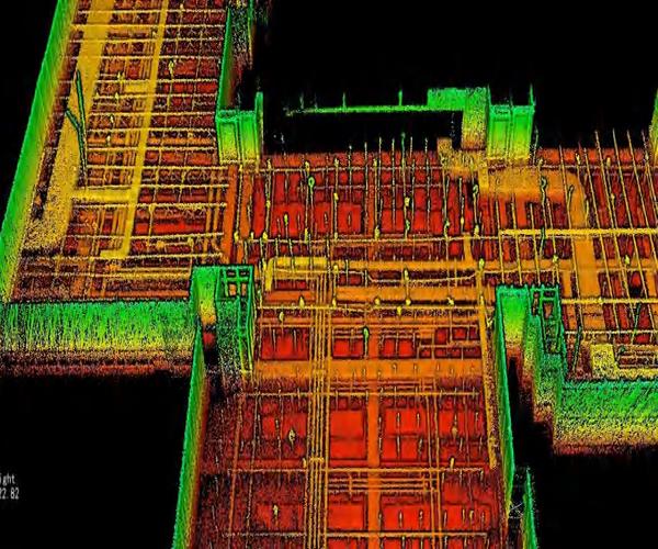
Reliable acquisitions up to 320,000 points/second with millimetre accuracy.
| 320K pts/sScanning speed | 120 mLaser range | 1.5 cmRelative accuracy | 40 minBattery life |


The Laser Scanner SLAM GS-100G Series represents the most advanced solution for 3D data acquisition in industrial environments, guaranteeing exceptional performance and absolute reliability in every operating condition.
The Laser Scanner SLAM GS-100G Series represents excellence in industrial 3D laser scanning, developed with latest-generation SLAM technology for high-precision mapping. This plug-and-play system guarantees reliable acquisitions up to 320,000 points per second with relative accuracy of ±1.5 cm, ideal for industrial automation applications and critical environments. The modular design with robust galvanic isolation and multi-protocol support ensures seamless integration into existing systems. DroneBase, DJI Gold 5 Dealer certified ISO 9001:2015, provides specialised technical support, customised training and post-sale assistance to guarantee maximum ROI from your investment in professional LiDAR technologies.
Can the GS-100G operate completely without GPS?
What is the difference between absolute and relative accuracy?
Does the system support integration with CAD/BIM software?
Is it possible to extend battery life beyond 40 minutes?
Is the system resistant to dust and moisture?
What type of training is included in the purchase?
Pre and post-sale support · 24h express shipping · Certified technical support · On-site demo
★ DJI Gold 5 DealerISO 9001:2015Technical SupportOn-site demo


There are no reviews yet.