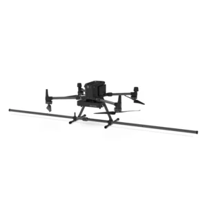
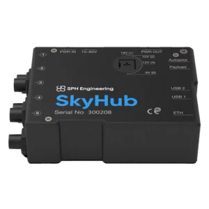
Discover our range of DJI drone-compatible magnetometers designed to perform aerial magnetic surveys with high accuracy and efficiency. These advanced instruments are ideal for applications in geophysics, archaeology, and detection of buried metal objects, offering accurate and detailed data.
Key features:
- DJI drone compatibility: Designed to integrate seamlessly with models such as DJI M300 and M350 RTK, facilitating implementation in aerial operations.
- Portable design: Lightweight and compact structure, ideal for operations in hard-to-reach environments.
- Integrated GPS: Ensures precise geotagging of collected data, improving the accuracy of surveys.
- Geophysical surveys: Mapping of magnetic anomalies for geological and mining studies.
- Archaeological surveys: Identification of buried structures and artifacts without invasive excavation.
- Metal object detection: Locating pipes, cables and other underground metal objects.
Magnetometer
Showing all 3 results
-
✓ Pronta consegnaGeoradar & Magnetometer Combo, Magnetometer
Drone magnetometer – Sensys MagDrone R3
Ultra-portable magnetometer with integrated GPS for DJI M300/M350 RTK drones, perfect for surveys across vast inaccessible areas. Ideal for mining exploration, archaeology and security. Available at DroneBase, DJI Gold 5 Dealer.
SKU: n/a -
✓ Pronta consegnaGeoradar & Magnetometer Combo, Magnetometer
Drone magnetometer – Sensys MagDrone R4
Ultra-portable magnetometer for DJI M300/M350 RTK drones with integrated GPS for surveying large inaccessible areas. Ideal for mineral exploration, archaeology and security applications. Available at DroneBase, DJI Gold 5 Dealer.
SKU: n/a -
✓ Pronta consegna