
- Advanced multispectral imaging: Acquisition of data in different spectral bands for detailed analysis.
- Integration with DJI drones: Full compatibility with DJI platforms, ensuring easy installation and smooth operation.
- High spatial resolution: Precise details for applications requiring high accuracy.
- Precision agriculture: Monitoring crop health, irrigation management and optimizing fertilizer use.
- Environmental monitoring: Analysis of vegetation, water quality and detection of environmental changes.
- Scientific research: Ecological studies, biodiversity monitoring and other research applications.
Featured products
RedEdge-P Dual
Dual multispectral sensor with 10 spectral bands for advanced vegetation analysis and precision agriculture. Resolution exceeding Landsat an

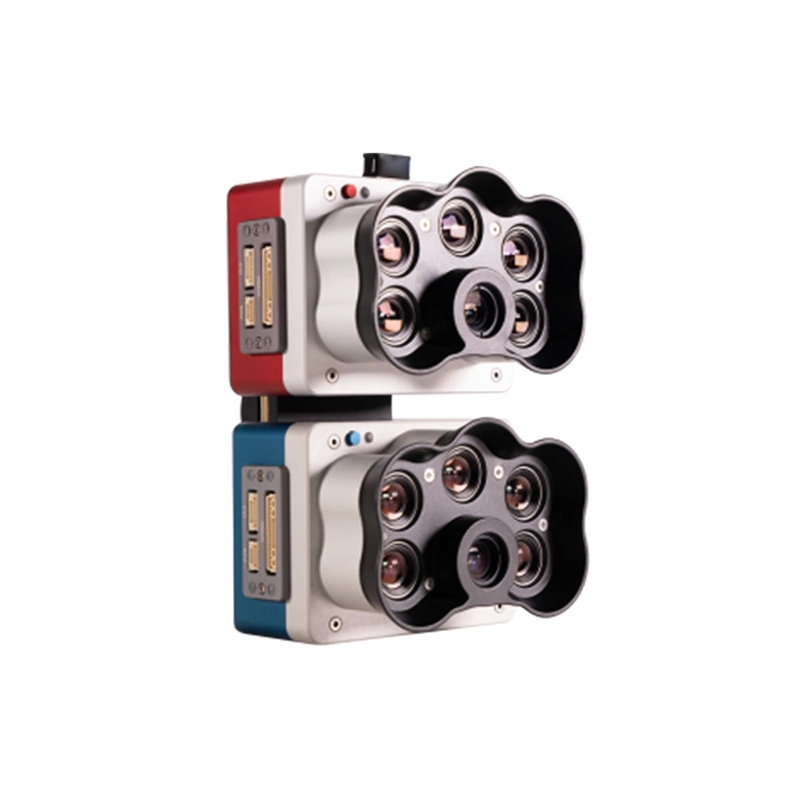
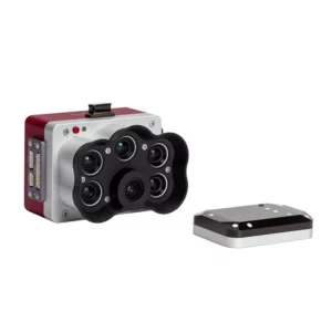
Micasense Altum-Pt.
Multispectral and thermal camera with ultra-high resolution panchromatic imaging for precision agriculture. Dual spatial resolution and CFex
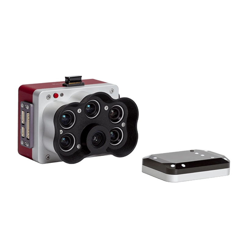
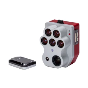
Micasense RedEdge-P
Multispectral camera with 6 simultaneous bands and CFexpress memory for high-speed acquisition. Double resolution and advanced analysis for
Multispectral
Showing all 4 results
-
✓ Pronta consegnaMultispectral, Sensors for agriculture, Thermography with Drones
Micasense Altum-Pt.
Multispectral and thermal camera with ultra-high resolution panchromatic imaging for precision agriculture. Dual spatial resolution and CFexpress storage for rapid acquisition and efficient data management. Available at DroneBase, DJI Gold 5 Dealer.
SKU: n/a -
✓ Pronta consegna
-
✓ Pronta consegna

Precision Agriculture with Multispectral Technology
Multispectral drone cameras revolutionize modern agriculture by capturing invisible light spectra that reveal crop health, stress patterns, and nutrient deficiencies invisible to the human eye. Our MicaSense sensor systems provide farmers and agronomists with actionable data through advanced vegetation indices like NDVI, NDRE, and GNDVI.
These professional imaging solutions enable early detection of plant diseases, optimization of irrigation systems, and precise application of fertilizers and pesticides. With centimeter-level accuracy and repeatable measurements, multispectral mapping supports data-driven decisions that increase yields while reducing environmental impact.
Advanced Spectral Bands for Comprehensive Analysis
Professional multispectral cameras capture data across multiple electromagnetic spectrum bands, typically including blue (475nm), green (560nm), red (668nm), red edge (717nm), and near-infrared (840nm) wavelengths. The red edge band is particularly valuable for detecting subtle changes in chlorophyll content before visible stress symptoms appear.
Each spectral band provides unique insights into plant physiology, soil conditions, and environmental factors. Combined with thermal imaging capabilities in systems like the Altum-PT, operators can simultaneously monitor crop health, water stress, and temperature variations across entire fields with unprecedented detail and accuracy.
Professional Data Processing and Analysis
Raw multispectral data requires specialized processing software to generate meaningful agricultural insights. Our recommended workflow includes radiometric calibration using integrated downwelling light sensors (DLS), geometric correction through precise GPS coordinates, and vegetation index calculations.
Professional software platforms like Pix4Dmapper, DroneDeploy, and ATLAS enable automated processing of multispectral imagery into actionable maps, prescription files for variable rate applications, and temporal analysis for monitoring crop development throughout growing seasons.
DJI Integration and Flight Performance
All multispectral systems in our portfolio integrate seamlessly with DJI Matrice enterprise platforms, ensuring reliable flight performance and professional-grade stability. The standardized DJI SkyPort and X-Port mounting systems provide secure payload attachment and real-time data transmission capabilities.
Flight planning software supports automated missions with precise overlap settings, altitude control for optimal ground sampling distance, and waypoint navigation for consistent data collection. Battery life typically supports 15-25 minutes of flight time depending on drone platform and environmental conditions.
Why buy from DroneBase
DJI Gold Partner Excellence
Certified expertise with ISO 9001:2015 quality standards ensuring professional service and support.
Technical Integration Support
Complete system configuration and training for optimal multispectral data collection workflows.
Enterprise-Grade Solutions
Professional-only product focus with advanced payloads for commercial and research applications.
Italian Market Leadership
Established presence in Rimini serving agricultural and surveying professionals across Italy.
Frequently asked questions
Professional multispectral systems typically range from €15,000 to €35,000 depending on specifications and capabilities. Contact our Rimini office for detailed quotations including DJI drone platform, sensor, and software licensing packages.
Yes, commercial multispectral drone operations require ENAC certification for professional pilots and operational authorization. We provide guidance on Italian drone regulations and can recommend certified training providers for commercial licensing requirements.
Multispectral imaging provides significant value for wheat, corn, soybeans, vineyards, olive groves, and specialty crops. High-value agricultural applications include precision viticulture, orchard management, and large-scale arable farming where early stress detection delivers measurable ROI.
At typical agricultural survey altitudes of 80-120 meters, multispectral cameras deliver 3-8cm ground sampling distance. This resolution enables plant-level analysis while maintaining efficient area coverage for commercial farming operations.
Optimal survey frequency depends on crop type and growing conditions. Generally, monthly surveys during growing season provide sufficient temporal resolution for trend analysis, with additional flights during critical periods like flowering or stress events.
Basic capture and calibration software is typically included with multispectral cameras. Advanced processing software like Pix4Dmapper Agriculture or specialized agricultural platforms require separate licensing. We can recommend optimal software packages based on your specific applications.
Want a consultation or a demo?
Our DJI Enterprise certified technicians help you choose the right configuration. No commitment.
+39 0541 1790411


